
MyTopo
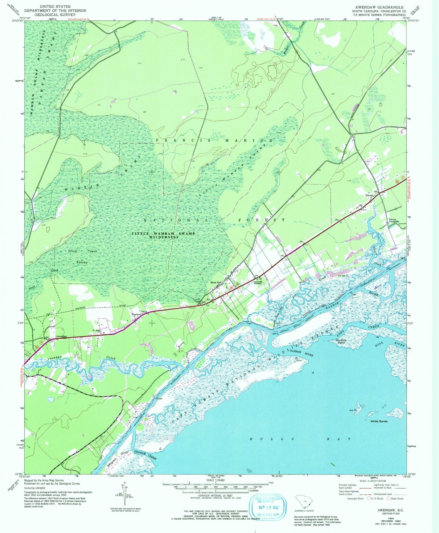
Classic USGS Awendaw South Carolina 7.5'x7.5' Topo Map
Couldn't load pickup availability
Historical USGS topographic quad map of Awendaw in the state of South Carolina. Typical map scale is 1:24,000, but may vary for certain years, if available. Print size: 24" x 27"
This quadrangle is in the following counties: Charleston.
The map contains contour lines, roads, rivers, towns, and lakes. Printed on high-quality waterproof paper with UV fade-resistant inks, and shipped rolled.
Contains the following named places: Doe Hall Creek, Graham Creek, Harbor River, Laurel Hill Plantation, Little Wambaw Swamp, Morants Point, Pineland, Saint James School, Sandy Point Creek, Steed Creek Swamp, Tibwin, Tibwin Creek, Tibwin Plantation, White Banks, Cape Romain National Wildlife Refuge, Awendaw, Awendaw Creek, Long Creek, Walnut Grove Ranger Station, Buck Hall Recreation Area, Buck Hall, Awendaw Chapel (historical), Buck Hall School (historical), Our Chapel, Saint James Church, Tibwin Church, McClellanville Division, Saint James Santee Elementary School, Little Wambaw Swamp Wilderness, Awendaw Fire District Station 3, Laurel Hill Farms Airport


