MyTopo
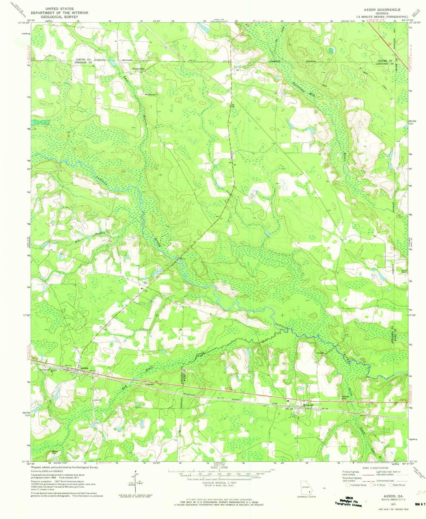
Classic USGS Axson Georgia 7.5'x7.5' Topo Map
Couldn't load pickup availability
Historical USGS topographic quad map of Axson in the state of Georgia. Map scale may vary for some years, but is generally around 1:24,000. Print size is approximately 24" x 27"
This quadrangle is in the following counties: Atkinson, Coffee, Ware.
The map contains contour lines, roads, rivers, towns, and lakes. Printed on high-quality waterproof paper with UV fade-resistant inks, and shipped rolled.
Contains the following named places: Atkinson County Volunteer Fire Department Station 1, Axson, Axson Cemetery, Axson Census Designated Place, Axson Church, Axson Community Cemetery, Axson Division, Axson Post Office, Bennett Cemetery, Big Branch, Cat Creek, Coon Branch, First Born Church, Little Red Bluff Creek, Little Utah Cemetery, Millwood, Millwood Census Designated Place, Millwood Church, Millwood Village Post Office, Mount Zion Church, Perch Creek, Red Bluff Creek, Smut Branch, Stokesville, Stokesville Church, Stokesville Church Cemetery, Utah Church, Ware County Fire Rescue Station 7 Millwood, White Cemetery, ZIP Code: 31624