MyTopo
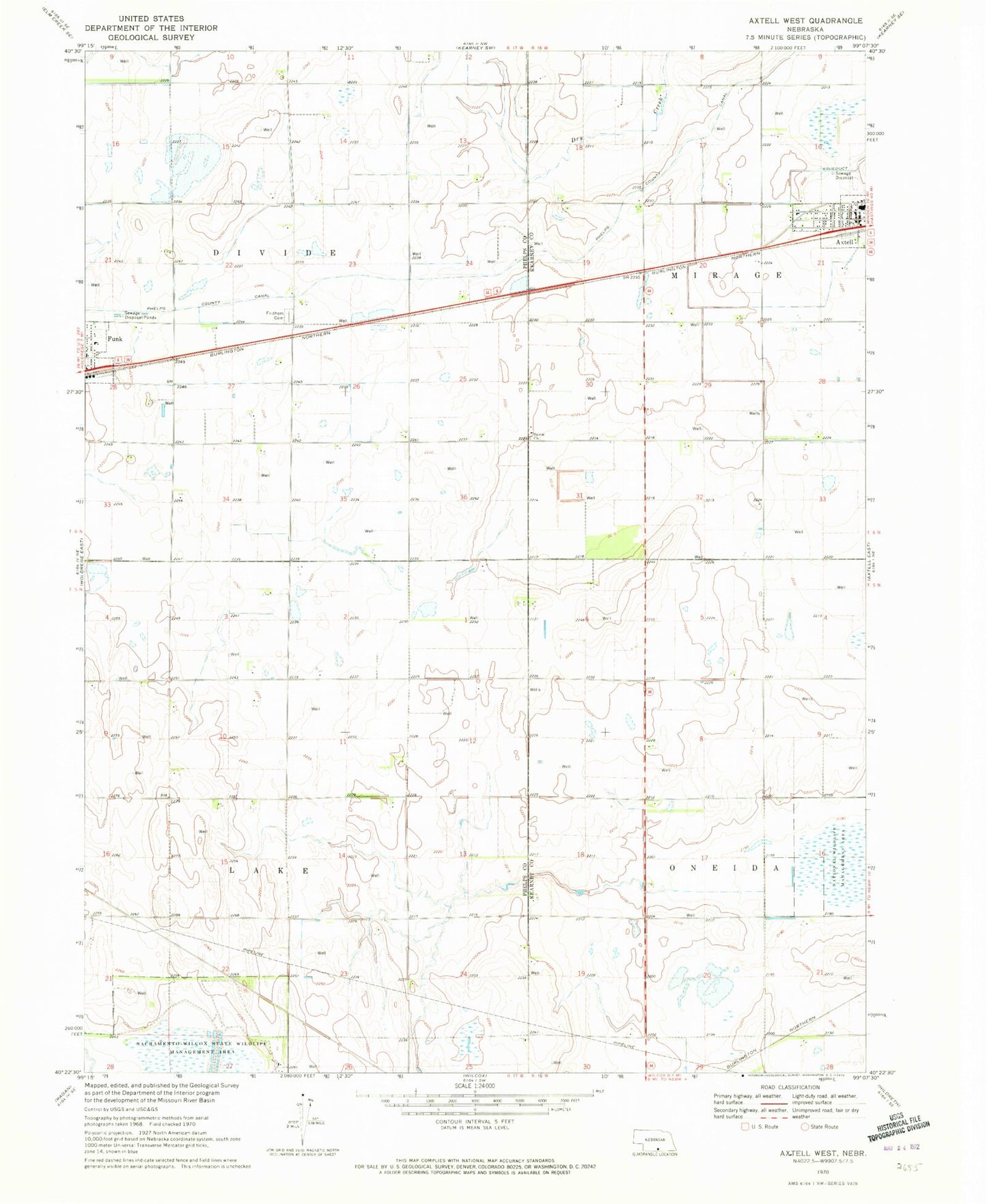
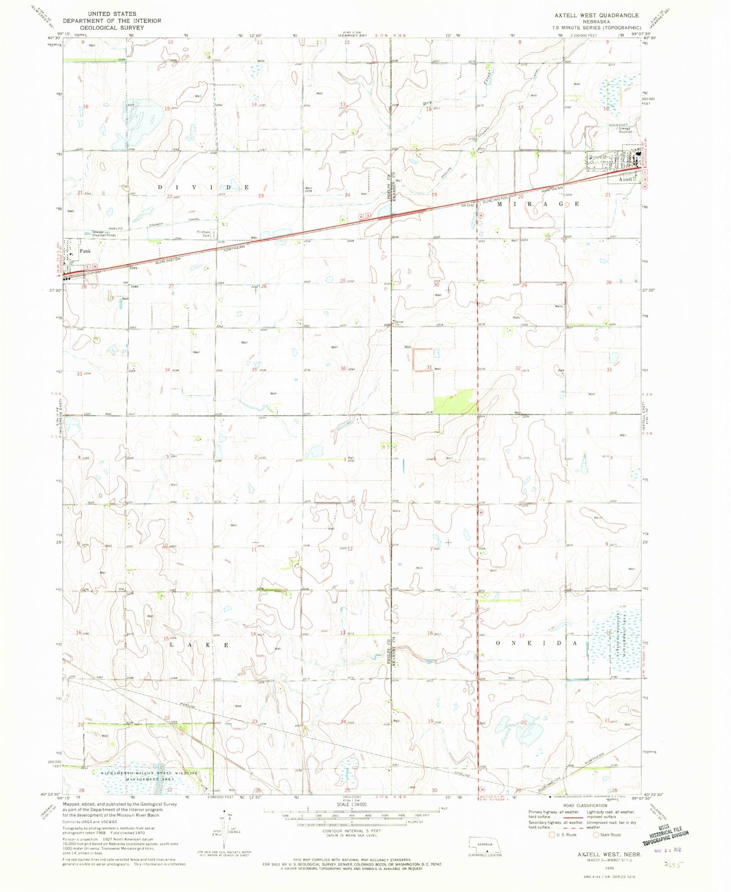
Classic USGS Axtell West Nebraska 7.5'x7.5' Topo Map
Couldn't load pickup availability
Historical USGS topographic quad map of Axtell West in the state of Nebraska. Map scale may vary for some years, but is generally around 1:24,000. Print size is approximately 24" x 27"
This quadrangle is in the following counties: Kearney, Phelps.
The map contains contour lines, roads, rivers, towns, and lakes. Printed on high-quality waterproof paper with UV fade-resistant inks, and shipped rolled.
Contains the following named places: Axtell, Axtell City Park, Axtell Community Schools, Axtell Medical Clinic, Axtell Nebraska Historical Marker, Axtell Post Office, Axtell Public Library, Election Precinct 5, First Presbyterian Church, Fridhem Cemetery, Fridhem Lutheran Church, Funk, Funk Federal Waterfowl Production Area, Funk First Response Team, Funk Nebraska Historical Marker, Funk Public School, Funk Rural Fire Department, Harmony Park, Kearney County Waterfowl Production Area, Midland Co-op Elevator, Salem Church, Township of Divide, Township of Lake, Village of Axtell