MyTopo
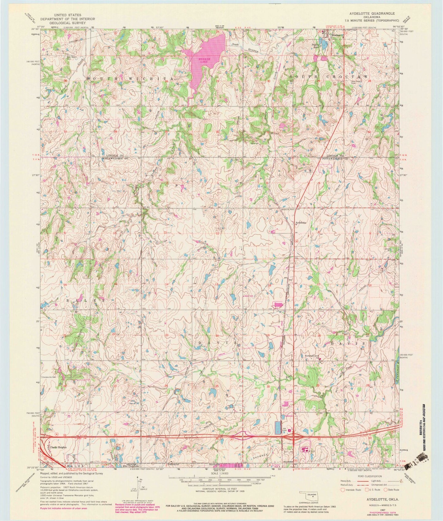
Classic USGS Aydelotte Oklahoma 7.5'x7.5' Topo Map
Couldn't load pickup availability
Historical USGS topographic quad map of Aydelotte in the state of Oklahoma. Map scale may vary for some years, but is generally around 1:24,000. Print size is approximately 24" x 27"
This quadrangle is in the following counties: Lincoln, Pottawatomie.
The map contains contour lines, roads, rivers, towns, and lakes. Printed on high-quality waterproof paper with UV fade-resistant inks, and shipped rolled.
Contains the following named places: Aydelotte, Bob White Dam, Bob White Reservoir, Family of Faith Christian School, Gordon Cooper Technology Center, Green Creek, Meeker Elementary School, Meeker Lake, New Hope Cemetery, New Salem Cemetery, North Rock Creek Elementary School, Oknoname 111050 Dam, Oknoname 111050 Reservoir, Oknoname 111055 Dam, Oknoname 111055 Reservoir, Poplin Dam, Poplin Lake, Quapaw Creek Site 13 Dam, Quapaw Creek Site 13 Reservoir, Quapaw Creek Site 15 Dam, Quapaw Creek Site 15 Reservoir, Quapaw Creek Site 18 Dam, Quapaw Creek Site 18 Reservoir, Shawnee Mall, Shawnee Oil Field, Town of Meeker, Township of Davis, West Red Hill Oil and Gas Field, ZIP Code: 74804