MyTopo
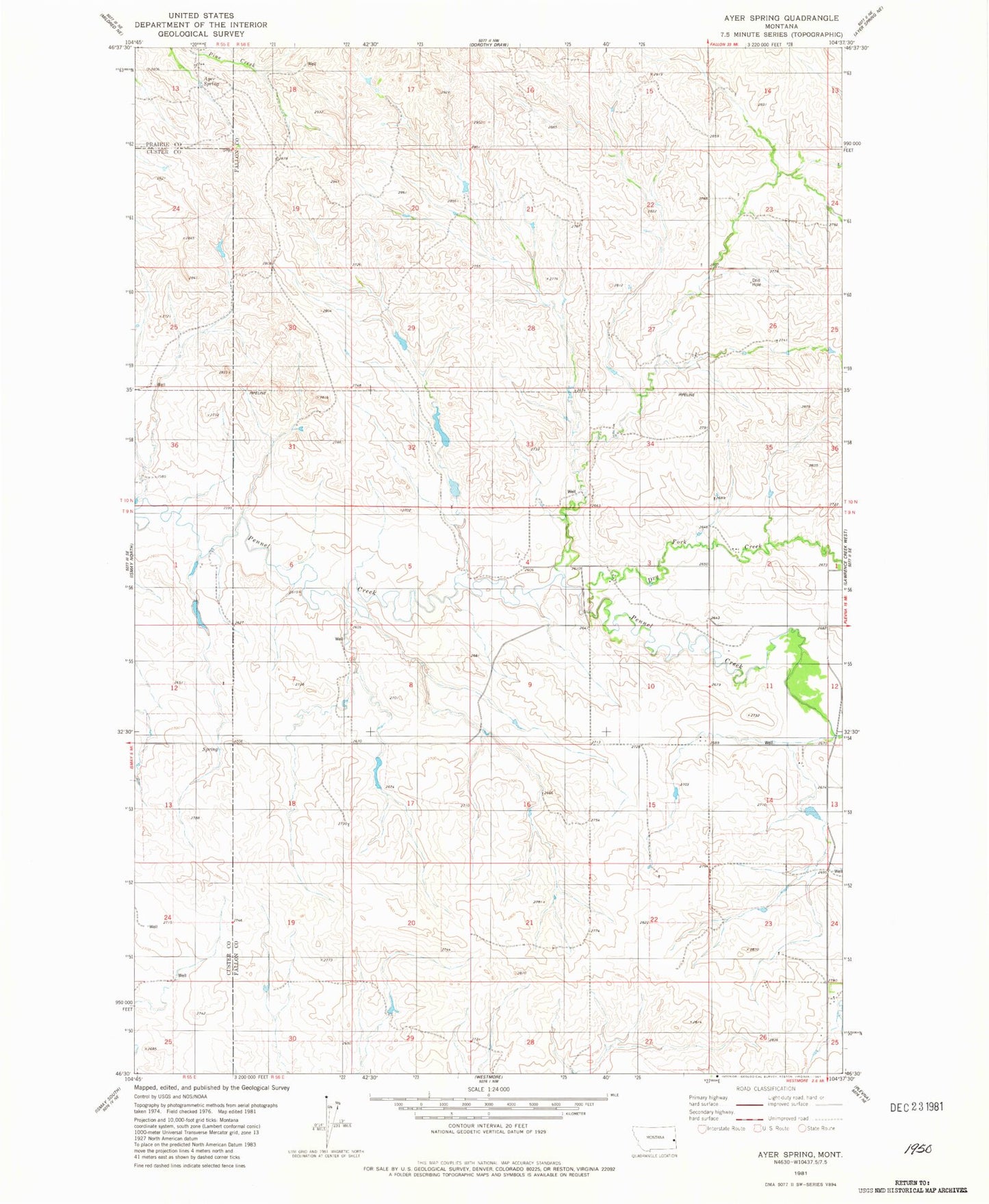
Classic USGS Ayer Spring Montana 7.5'x7.5' Topo Map
Regular price
$16.95
Regular price
Sale price
$16.95
Unit price
per
Couldn't load pickup availability
Historical USGS topographic quad map of Ayer Spring in the state of Montana. Map scale may vary for some years, but is generally around 1:24,000. Print size is approximately 24" x 27"
This quadrangle is in the following counties: Custer, Fallon, Prairie.
The map contains contour lines, roads, rivers, towns, and lakes. Printed on high-quality waterproof paper with UV fade-resistant inks, and shipped rolled.
Contains the following named places: 09N56E01CBAB01 Well, 09N56E03CBAC01 Well, 09N56E05AABA01 Well, 09N56E07AAAD01 Well, 09N56E11BBCD01 Well, 09N56E14AACB01 Well, 10N56E18BC__01 Well, 10N56E20DA__01 Well, 10N56E26BA__01 Well, Dry Fork Creek