MyTopo
Classic USGS Ayers Hill Pennsylvania 7.5'x7.5' Topo Map
Couldn't load pickup availability
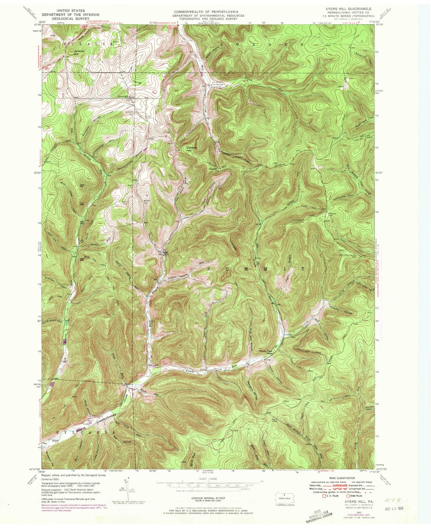
Historical USGS topographic quad map of Ayers Hill in the state of Pennsylvania. Typical map scale is 1:24,000, but may vary for certain years, if available. Print size: 24" x 27"
This quadrangle is in the following counties: Potter.
The map contains contour lines, roads, rivers, towns, and lakes. Printed on high-quality waterproof paper with UV fade-resistant inks, and shipped rolled.
Contains the following named places: Ianson Cemetery, Arts Trail, Ayers Hill Cemetery, Ayers Shanty Run, Bates Hollow, Bear Lodge Trail, Bear Pen Trail, Beaver Trail, Beech Run, Berger Trail, Big Hollow, Borie Branch, Burleson Hollow, Burt Hollow, Butternut Hollow, Card Hollow, Cochran Hill, Croutslot Hollow, Deering Run, Elk Lick Run, Fanton Hollow, Ford Hollow, Fox Fire Trail, Gibbs Trail, Halsey Trail, Hardwood Trail, Harts Trail, Heath Hollow, Hockney Hollow, Indian Shanty Run, Summit Cemetery, Jenkins Hill, Kaple Hill, Klesa Trail, Knickerbocker Hollow, Little Cherry Springs Park, Little Hollow, Mud Lick Hollow, Patterson State Park, Pine Run, Pole Lick Trail, Prout Lick Trail, Prouty Run, Reed Cemetery, Ridge Trail, Rock Ridge Trail, Ross Hollow, Schoolhouse Trail, Teed Hollow, The Black Hole, Tom Fee Trail, Tower Trail, Prouty Place State Park, Nelson Run, Gillon Trail, Ayers Hill, Borie, Pine Run Trail, Prouty Place Camp, Coudersport Country Club, Potter County, Township of Summit