MyTopo
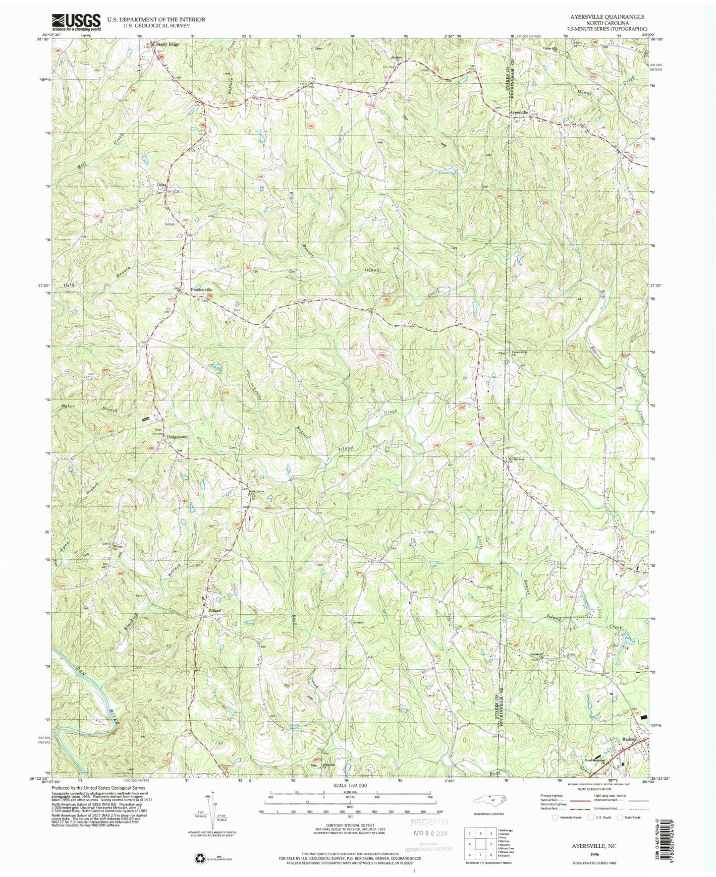
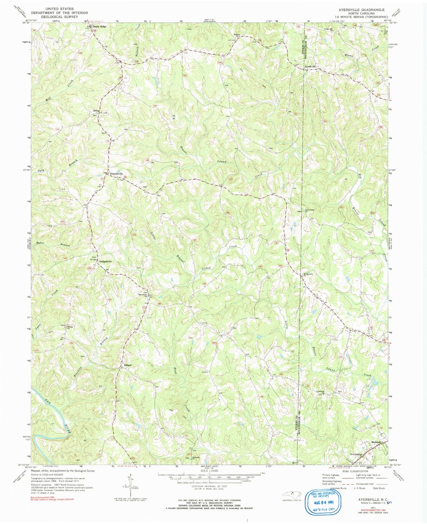
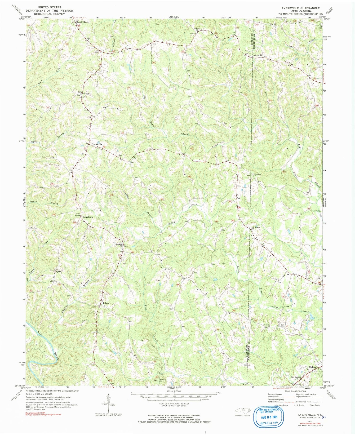
Classic USGS Ayersville North Carolina 7.5'x7.5' Topo Map
Couldn't load pickup availability
Historical USGS topographic quad map of Ayersville in the state of North Carolina. Map scale is 1:24000. Print size is approximately 24" x 27"
This quadrangle is in the following counties: Rockingham, Stokes.
The map contains contour lines, roads, rivers, towns, and lakes. Printed on high-quality waterproof paper with UV fade-resistant inks, and shipped rolled.
Contains the following named places: Ayersville, Ayersville Baptist Church, Ayersville Baptist Church Cemetery, Bethesda Cemetery, Bethesda United Methodist Church, Blackies Branch, Buffalo, Buffalo Cemetery, Buffalo Primitive Baptist Church, Byrd Memorial Church, Case School (historical), Community Baptist Church, Delta, Delta United Methodist Church, Dillard, Dodgetown, Good Will School (historical), Goodwill Baptist Church, Hemlock Golf Course Site, Martin School (historical), Mount Herman Cemetery, Mount Herman United Methodist Church, Northeast Stokes Volunteer Fire and Rescue, Oak Grove Cemetery, Oak Grove Missionary Baptist Church, Prestonville, Sandy Ridge, Sandy Ridge Post Office, Stokes - Rockingham Volunteer Fire and Rescue Station 2, Township of Beaver Island, Township of Snow Creek, Victor Hill Pentecostal Holiness Church, Wilson Primitive Baptist Church