MyTopo
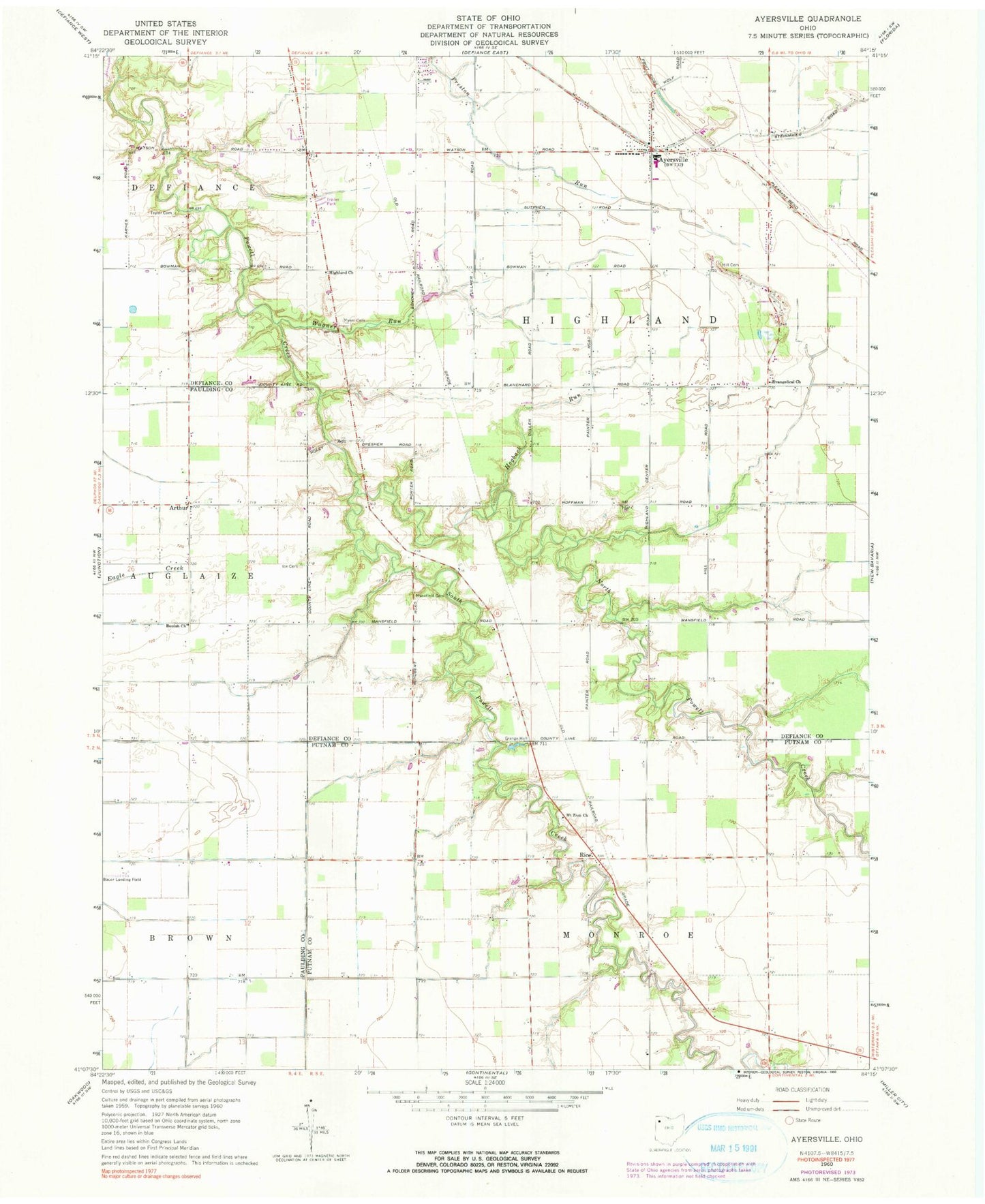
Classic USGS Ayersville Ohio 7.5'x7.5' Topo Map
Couldn't load pickup availability
Historical USGS topographic quad map of Ayersville in the state of Ohio. Map scale may vary for some years, but is generally around 1:24,000. Print size is approximately 24" x 27"
This quadrangle is in the following counties: Defiance, Paulding, Putnam.
The map contains contour lines, roads, rivers, towns, and lakes. Printed on high-quality waterproof paper with UV fade-resistant inks, and shipped rolled.
Contains the following named places: Andrews Farms, Arthur, Arthur Post Office, Ayersville, Ayersville Elementary School, Ayersville High School, Ayersville Post Office, Ayersville United Methodist Church, Bauer Landing Strip, Beulah Church, Blevins Airport, Countryside Estates, Don Mar Farms, Evangelical Church, Highland Church, Highland Township Volunteer Fire Department Station 100, Hill Cemetery, Hogback Run, Ice Cemetery, Mansfield Cemetery, Mount Zion Cemetery, Mount Zion Church, Myers Cemetery, North Powell Creek, Rice, Rice Post Office, South Powell Creek, Southerton, Steffel Ditch, Taylor Cemetery, Township of Highland, Trimed Emergency Medical Services, Wagner Run