MyTopo
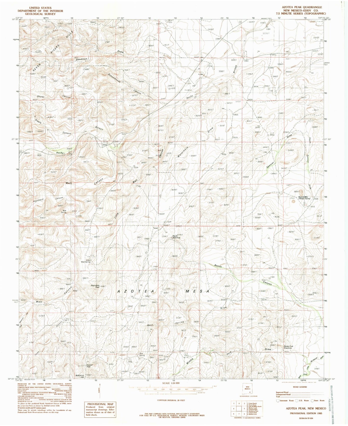
Classic USGS Azotea Peak New Mexico 7.5'x7.5' Topo Map
Couldn't load pickup availability
Historical USGS topographic quad map of Azotea Peak in the state of New Mexico. Map scale may vary for some years, but is generally around 1:24,000. Print size is approximately 24" x 27"
This quadrangle is in the following counties: Eddy.
The map contains contour lines, roads, rivers, towns, and lakes. Printed on high-quality waterproof paper with UV fade-resistant inks, and shipped rolled.
Contains the following named places: 06731 Water Well, 06732 Water Well, 06733 Water Well, 06734 Water Well, 06735 Water Well, 06736 Water Well, 06740 Water Well, 06741 Water Well, 06742 Water Well, 06743 Water Well, 06744 Water Well, 06745 Water Well, 06746 Water Well, 06748 Water Well, 20028 Water Well, 20031 Water Well, 20033 Water Well, 20034 Water Well, 20143 Water Well, 20150 Water Well, 20151 Water Well, 20153 Water Well, 20154 Water Well, Azotea Peak, Barber Crossing, Boy D S Waterhole, Boyds Canyon, Catclaw Draw, Deadman Draw, Denny Ranch, Indian Big Spring, J Staple Canyon, Lepee Claims, Little Walt Canyon, Little Walt Spring, McKittrick Hill, Middle Fork Little McKittrick Draw, Middle Fork Waterhole, Miller Ranch, Nagooltee Peak, Old Jones Ranch, Rain Spring Draw, Rain Spring Ranch, Righthand Canyon, Rock Waterhole Canyon, Rocky Arroyo, Rocky Arroyo Cemetery, Rocky Arroyo School, Round Mountain, Rounds Waterhole, Schoolhouse Canyon, Seven Rivers Hills, Shafer Canyon, South Spencer Draw, Spencer Dam, Toms Canyon, Walt Canyon, Walt Canyon Hills, Walt Spring, Waterhole Draw