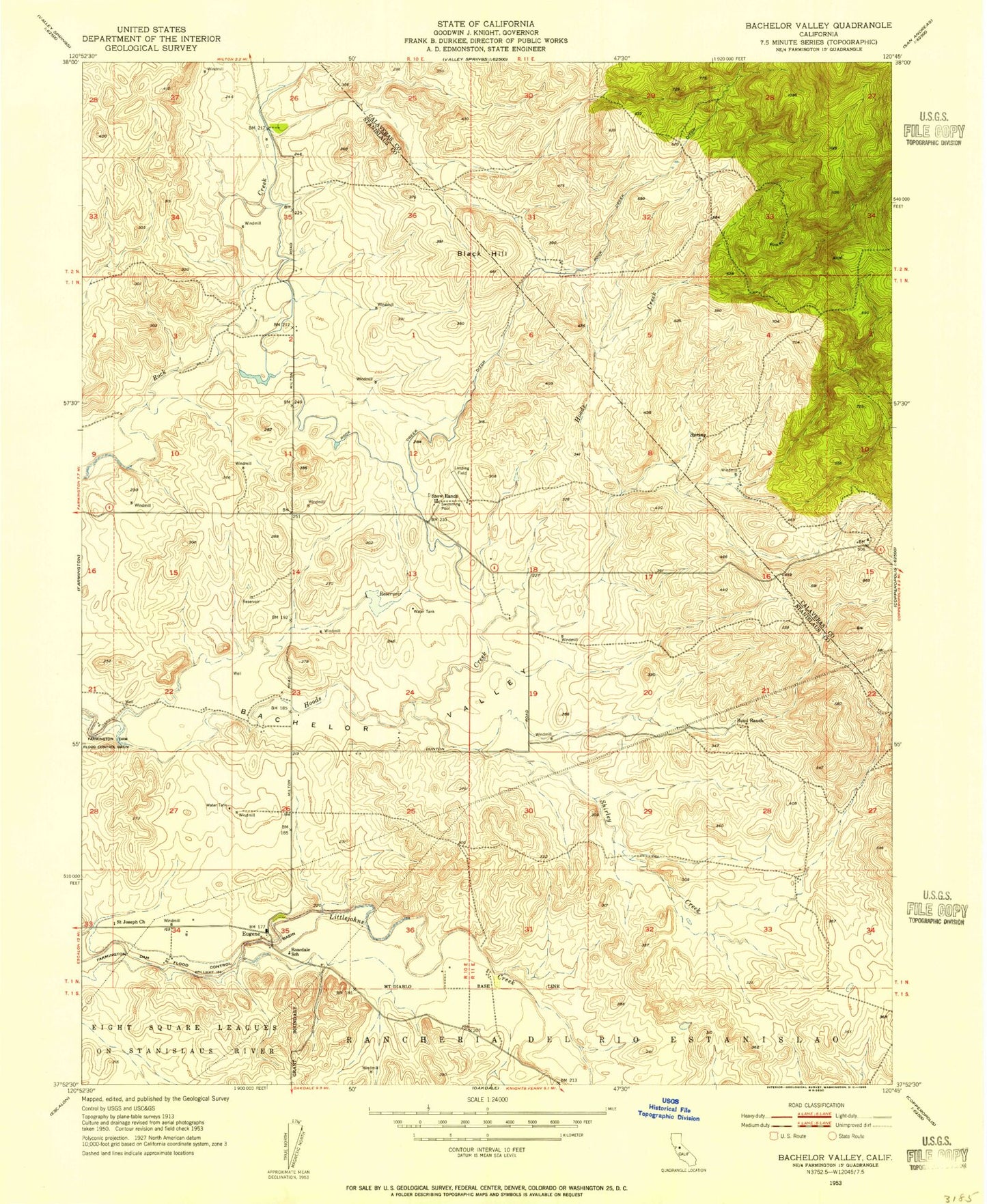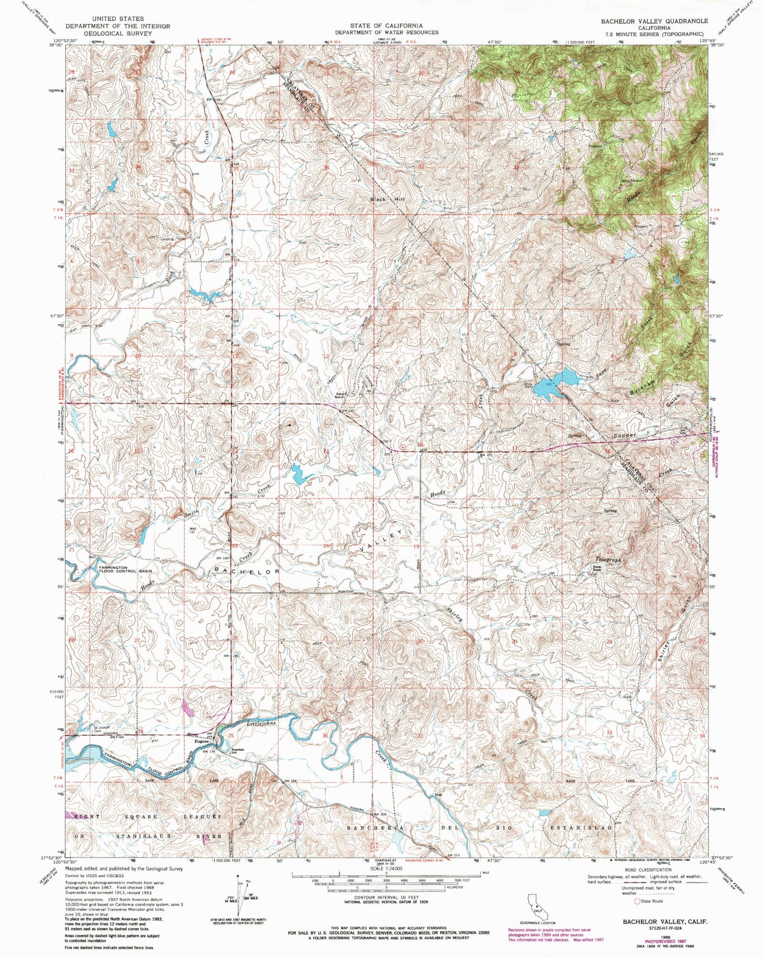

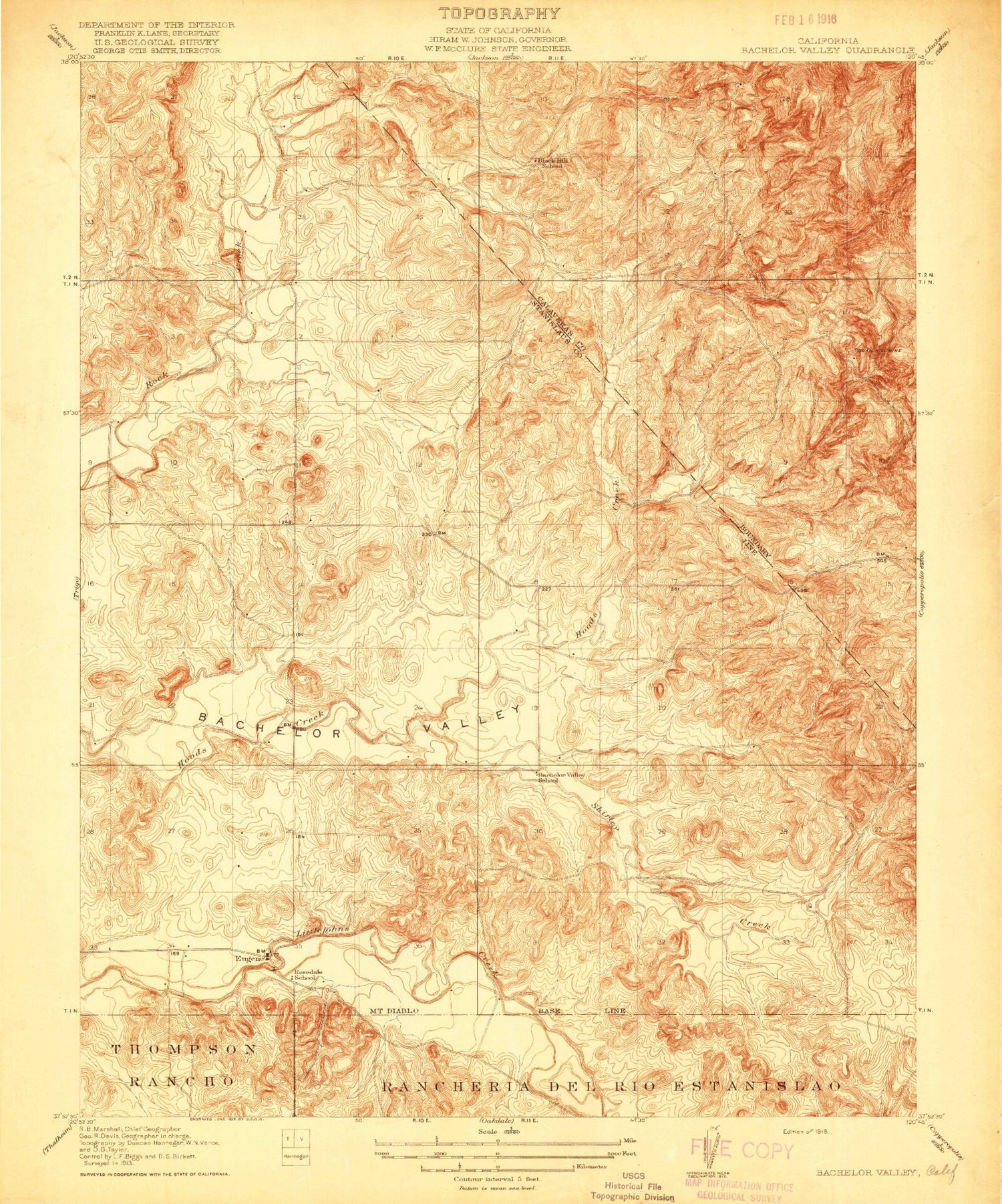
MyTopo
Classic USGS Bachelor Valley California 7.5'x7.5' Topo Map
Couldn't load pickup availability
Historical USGS topographic quad map of Bachelor Valley in the state of California. Map scale may vary for some years, but is generally around 1:24,000. Print size is approximately 24" x 27"
This quadrangle is in the following counties: Calaveras, Stanislaus.
The map contains contour lines, roads, rivers, towns, and lakes. Printed on high-quality waterproof paper with UV fade-resistant inks, and shipped rolled.
Contains the following named places: Bachelor Valley, Bachelor Valley School, Black Hill, Black Hill School, Buckham Gulch, Bund Ranch, Copper Gulch, Eugene, Orvis 560 Dam, Orvis Dam, Quail Hill Mine, Rock Creek Ditch, Rosedale School, Saint Joseph Catholic Cemetery, Shirley Creek, Shirley Gulch, Smith Creek, Snow Creek, Snow Ranch, Telegraph Creek