MyTopo
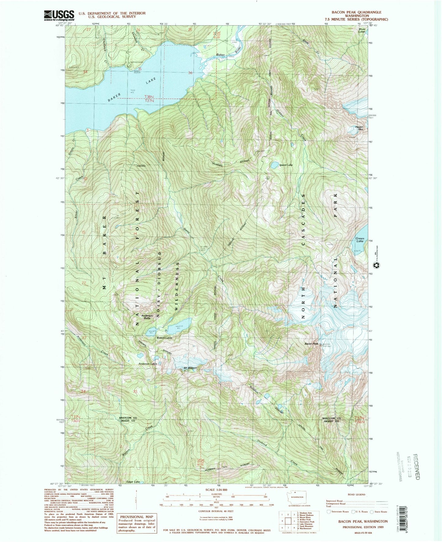
Classic USGS Bacon Peak Washington 7.5'x7.5' Topo Map
Couldn't load pickup availability
Historical USGS topographic quad map of Bacon Peak in the state of Washington. Typical map scale is 1:24,000, but may vary for certain years, if available. Print size: 24" x 27"
This quadrangle is in the following counties: Skagit, Whatcom.
The map contains contour lines, roads, rivers, towns, and lakes. Printed on high-quality waterproof paper with UV fade-resistant inks, and shipped rolled.
Contains the following named places: Anderson Butte, Anderson Lakes, Bacon Peak, Baker Lake Guard Station, Baker Lake Lookout (historical), Chadwick Creek, Ermine Creek, Green Lake, Hidden Creek, Ipsoot Lake, Noisy Creek, Shannon Creek, Silver Creek, Watson Lakes, Mount Watson, Noisy-Diobsud Wilderness, Shannon Creek Campground, Anderson Butte Lookout