
MyTopo
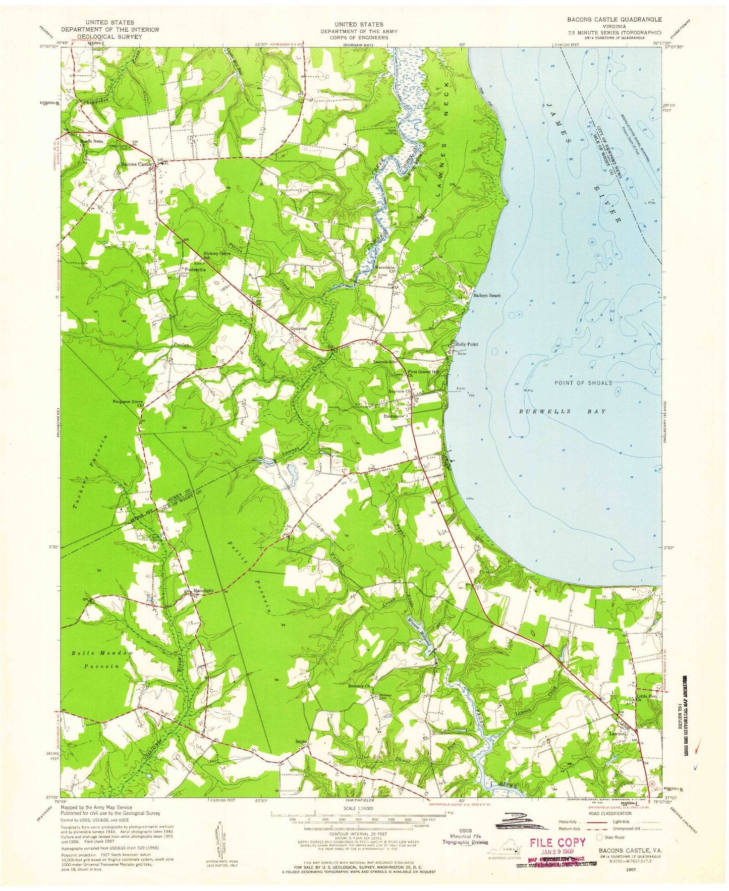
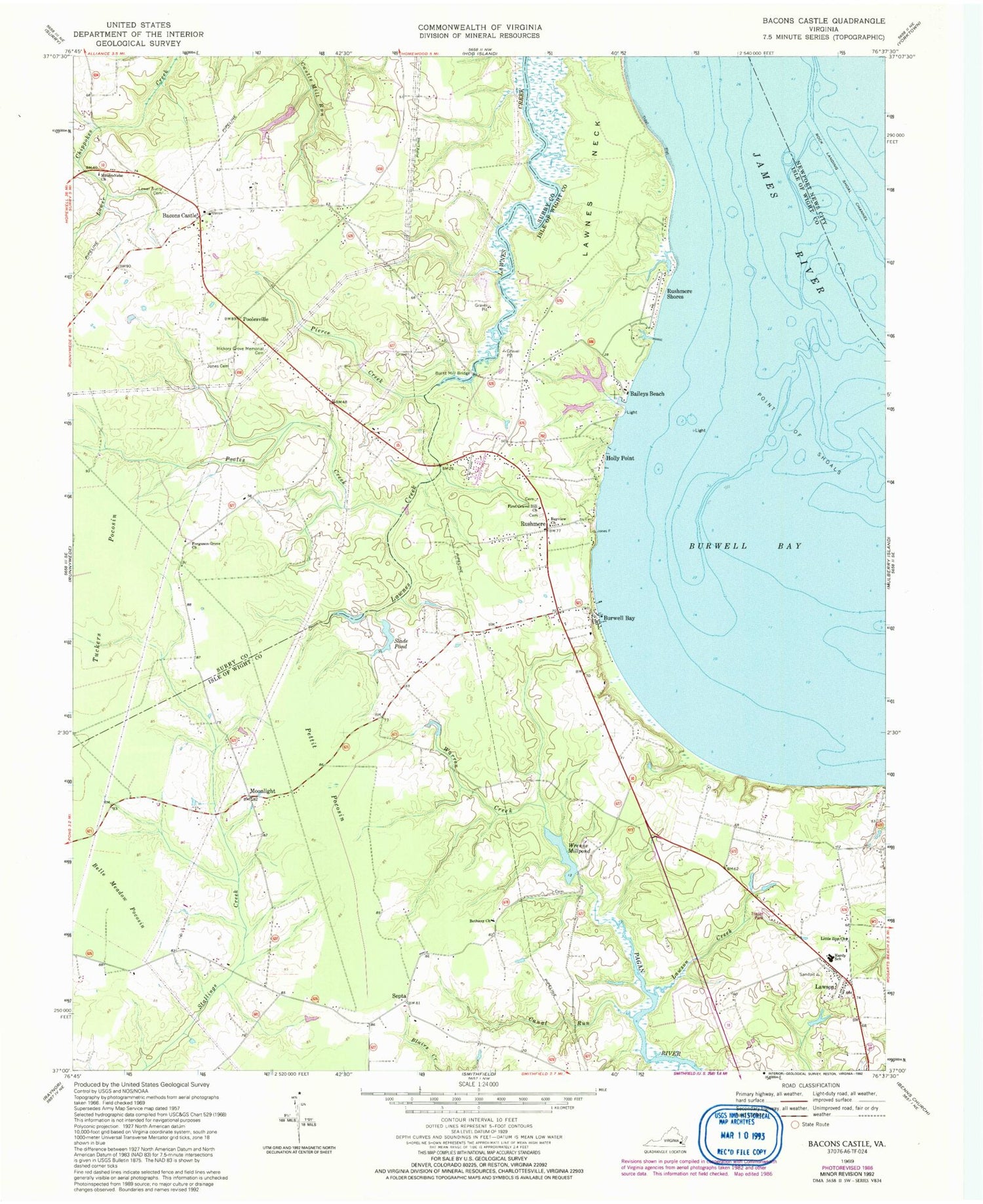
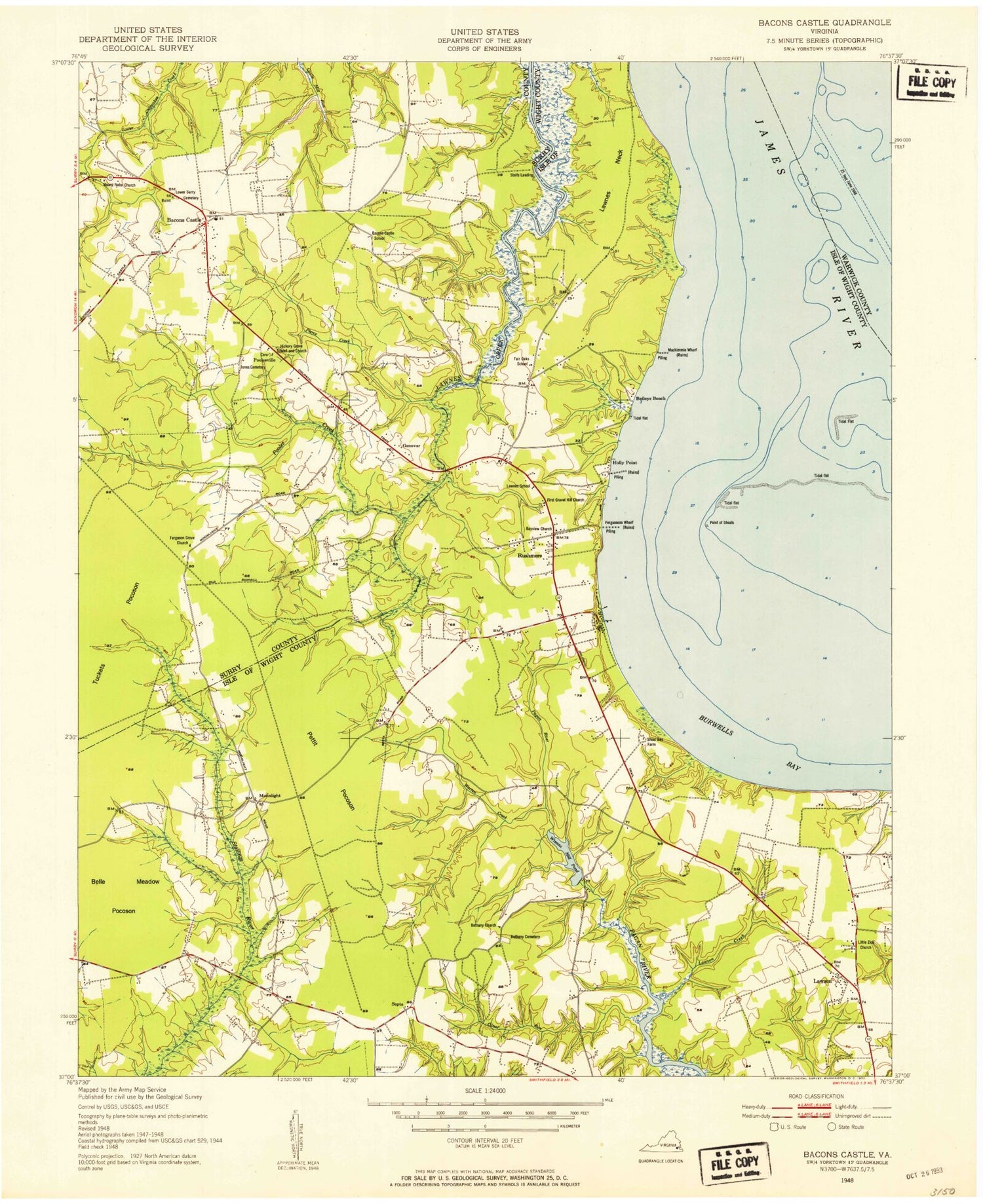
Classic USGS Bacons Castle Virginia 7.5'x7.5' Topo Map
Couldn't load pickup availability
Historical USGS topographic quad map of Bacons Castle in the state of Virginia. Map scale may vary for some years, but is generally around 1:24,000. Print size is approximately 24" x 27"
This quadrangle is in the following counties: Isle of Wight, Newport News (city), Surry.
The map contains contour lines, roads, rivers, towns, and lakes. Printed on high-quality waterproof paper with UV fade-resistant inks, and shipped rolled.
Contains the following named places: Bacons Castle, Bacons Castle District, Baileys Beach, Bayview Church, Belle Meadow Pocosin, Bethany Cemetery, Bethany Church, Burnt Mill Bridge, Burwell Bay, Canal Run, Ferguson Grove Church, First Gravel Hill Church, Gail Dam, Genovar, Hardy District, Hardy Elementary School, Hickory Grove Memorial Cemetery, Holly Point, Jones Cemetery, Lawnes Neck, Lawson, Lawson Creek, Little Zion Church, Lower Surry Cemetery, Macedonia Church, Moonlight, Mount Nebo Church, Old Brick Church, Pettit Pocosin, Pierce Creek, Point Shoals, Pooles Creek, Pooles Mobile Home Park, Poolesville, Rock Landing Shoal Channel, Rushmere, Rushmere Census Designated Place, Rushmere Shores, Rushmere Volunteer Fire Department, Septa, Slade Pond, Tylers Beach, Warren Creek, WKGM-AM (Smithfield), WNIS-AM (Norfolk), Wrenns Dam, Wrenns Mill, Wrenns Millpond, ZIP Code: 23430