MyTopo
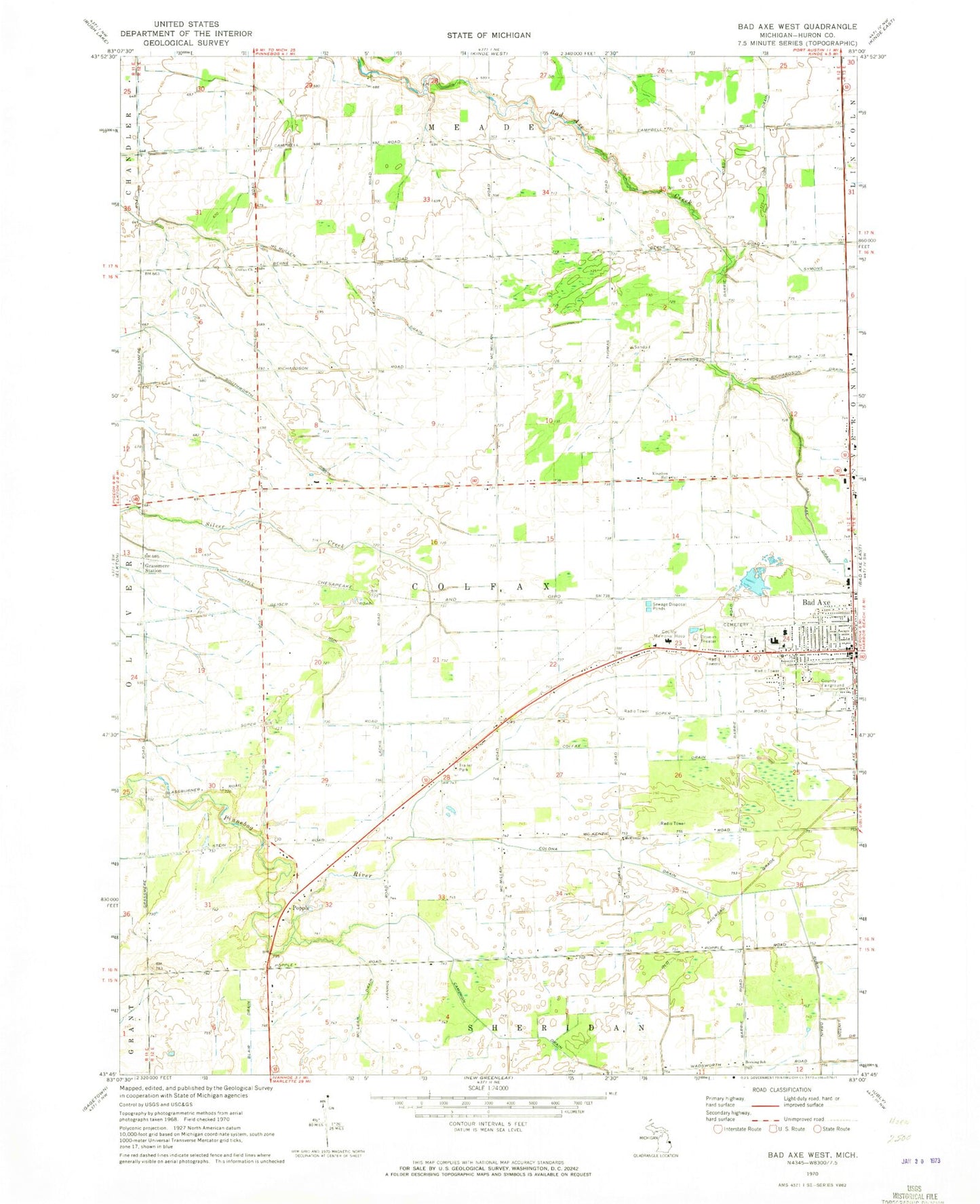
Classic USGS Bad Axe West Michigan 7.5'x7.5' Topo Map
Couldn't load pickup availability
Historical USGS topographic quad map of Bad Axe West in the state of Michigan. Map scale may vary for some years, but is generally around 1:24,000. Print size is approximately 24" x 27"
This quadrangle is in the following counties: Huron.
The map contains contour lines, roads, rivers, towns, and lakes. Printed on high-quality waterproof paper with UV fade-resistant inks, and shipped rolled.
Contains the following named places: Aquila Farms, Assembly of God Church, Bad Axe, Bad Axe Drain, Bad Axe High School, Bad Axe Intermediate School, Bad Axe Junior High School, Becking School, Big Burning Public School, Cameron Drain, Church of Jesus Christ of Latter Day Saints, Colfax Drain, Colfax School, Colfax Township Cemetery, Colfax Township Hall, Colona Drain, Engler Field, Errer Farms, First Baptist Church, Free Methodist Church, Grassmere Post Office, Grassmere Station, Greene Elementary School, Huron Community Fairgrounds, Huron County Medical Care Facility, Kingdom Hall, Lyndon Mobile Home Court, McKenzie School, Mclaren Thumb Region Hospital, McLean Drain, McMullen Drain, Michigan State Police Department, Miller Farms, Misty Meadows Mobile Home Park, Mount Forest Fire Station, Our Savior Lutheran Church, Pines Mobile Home Village, Popple, Popple Post Office, Ritter Farms, Sacred Heart Roman Catholic Cemetery, Saint Paul's Episcopal Church, Scott Farms, Seventh Day Adventist Church, Southworth Drain, Steciak Farms, Sunny Acres Nursing Center, Toner Farms, Township of Colfax, Victory in Christ Community Church, WLEW-AM (Bad Axe)