MyTopo
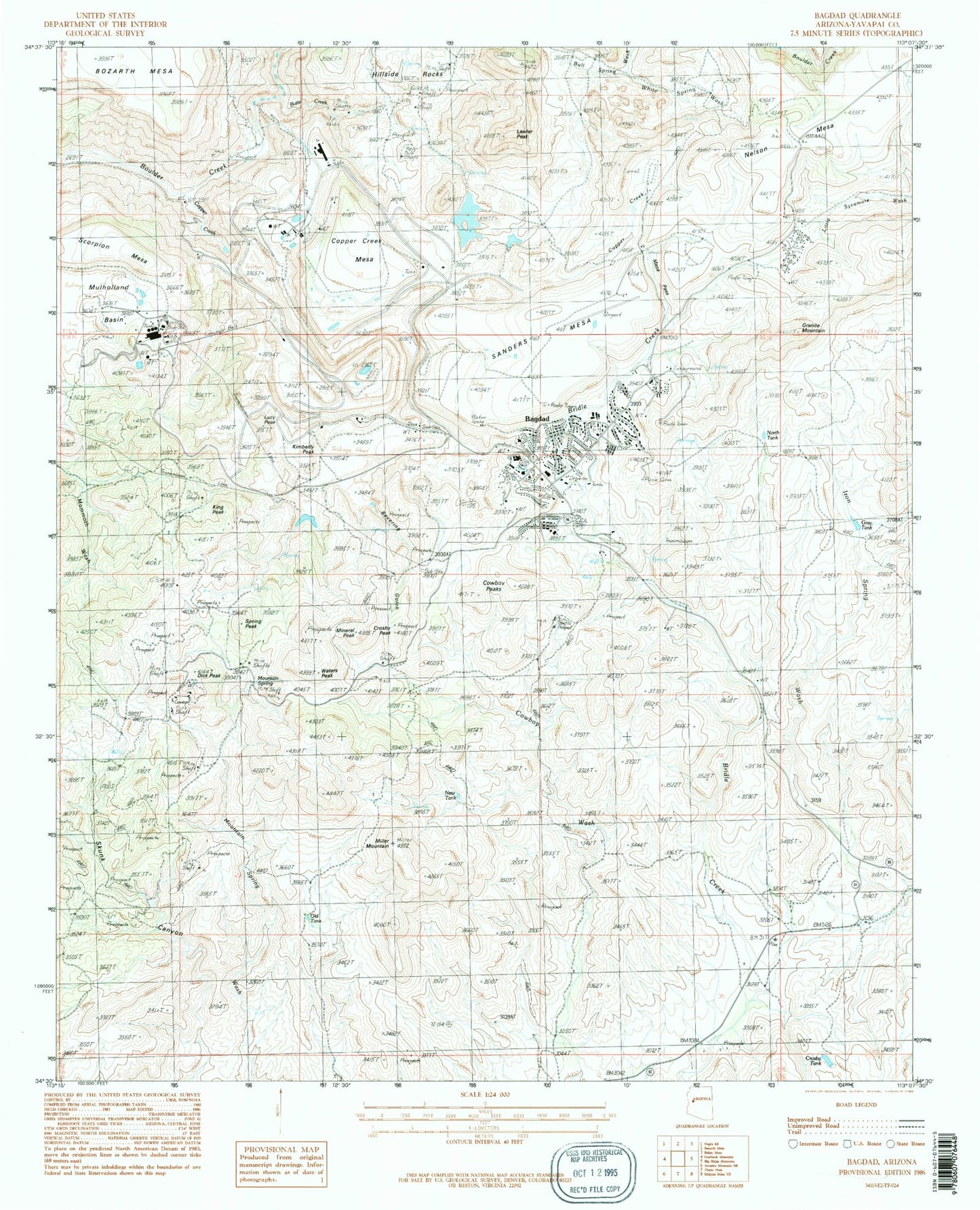
Classic USGS Bagdad Arizona 7.5'x7.5' Topo Map
Couldn't load pickup availability
Historical USGS topographic quad map of Bagdad in the state of Arizona. Map scale may vary for some years, but is generally around 1:24,000. Print size is approximately 24" x 27"
This quadrangle is in the following counties: Yavapai.
The map contains contour lines, roads, rivers, towns, and lakes. Printed on high-quality waterproof paper with UV fade-resistant inks, and shipped rolled.
Contains the following named places: Alum Creek, Bagdad, Bagdad Airport, Bagdad Census Designated Place, Bagdad Community Health Center, Bagdad Elementary School, Bagdad Middle / High School, Bagdad Open Pit Mine, Bagdad Post Office, Bagdad Tailings Dam, Bevering Gulch, Black Mesa, Butte Creek, Centipede Mesa, Comstock-Dexter Mine, Copper Creek, Copper Creek Mesa, Copper King Mine, Cowboy Mine, Cowboy Peaks, Crosby Peak, Crosby Tank, Daniel C Lincoln Elementary School, Dick Peak, First Baptist Church, Granite Mountain, Hillside Rocks, Hilltop Community Church, Kimberly Peak, King Peak, Kyeke Mine, Lawler Peak, Lucy Peak, Maroney Gulch, Mesa Pass, Mesa View Golf Course, Miller Mountain, Mineral Creek, Mineral Peak, Mountain Spring, Mulholland Basin, Nelson Mesa, Niagara Creek, Old Dick Mine, Saint Francis Catholic Church, Sanders Mesa, Spring Creek, Spring Peak, Sycamore Mobile Home Park, Waters Peak, White Spring, White Spring Wash, Yavapai County Sheriff's Office Substation