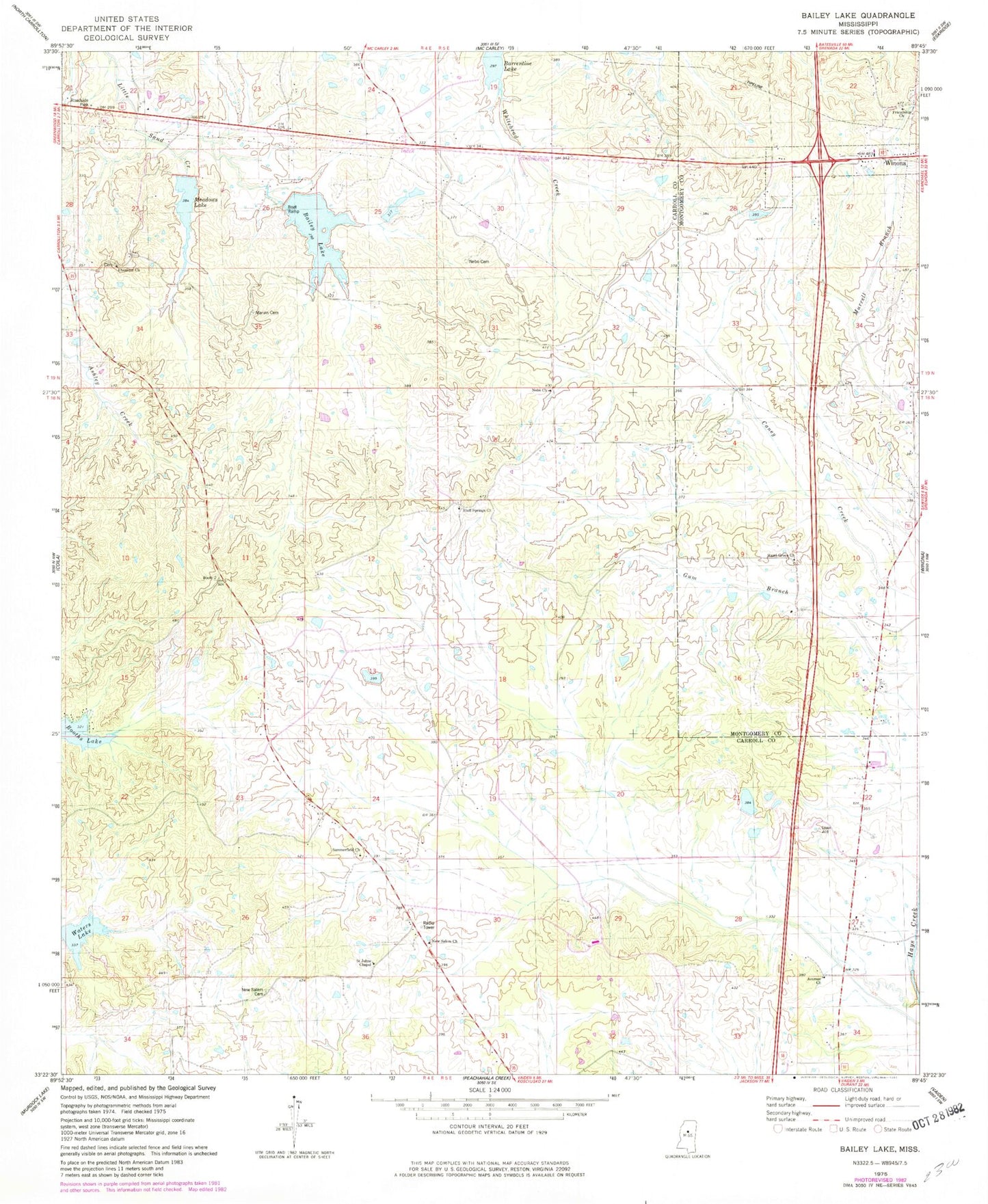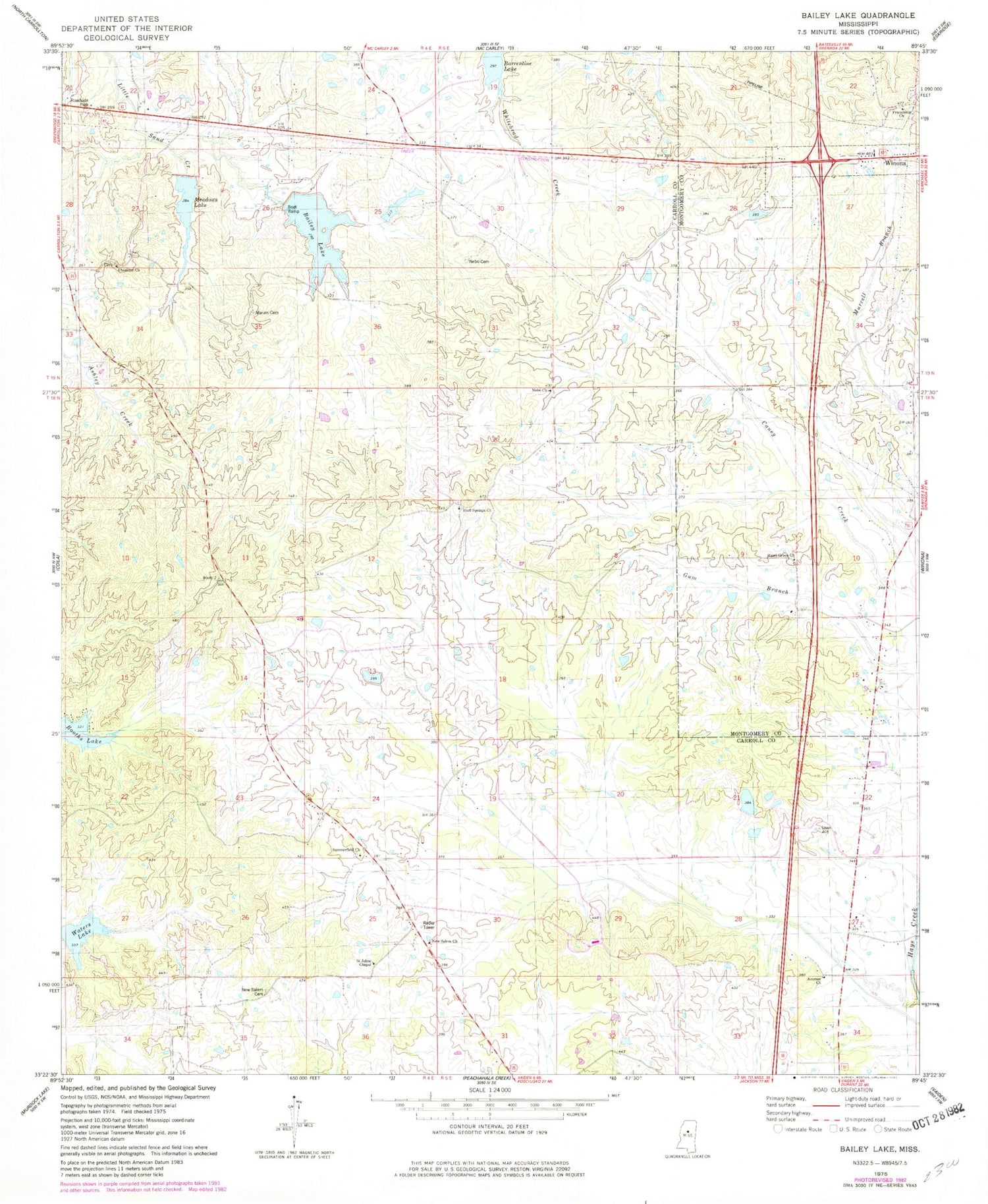
MyTopo
Classic USGS Bailey Lake Mississippi 7.5'x7.5' Topo Map
Couldn't load pickup availability
Historical USGS topographic quad map of Bailey Lake in the state of Mississippi. Map scale may vary for some years, but is generally around 1:24,000. Print size is approximately 24" x 27"
This quadrangle is in the following counties: Carroll, Montgomery.
The map contains contour lines, roads, rivers, towns, and lakes. Printed on high-quality waterproof paper with UV fade-resistant inks, and shipped rolled.
Contains the following named places: Acorner Church, Bailey Lake, Big Sand Creek Watershed Y-32-9b Dam, Big Sand Watershed Y-32-9a Dam, Bluff Springs Cemetery, Bluff Springs Methodist Church, Booths Lake, Bryantville, Ebenezer Church, Friendship Church, G H Curtis Lake Dam, Hazel Green Church, Marvin Cemetery, Meadows Lake, Middleton, Nebo Cemetery, Nebo Church, New Salem Cemetery, New Salem Church, Pelucia Watershed Y-33a-5 Dam, Powells Creek, Saint Johns Chapel, Summerfield Cemetery, Summerfield Church, Supervisor District 4, Waters Lake