
MyTopo
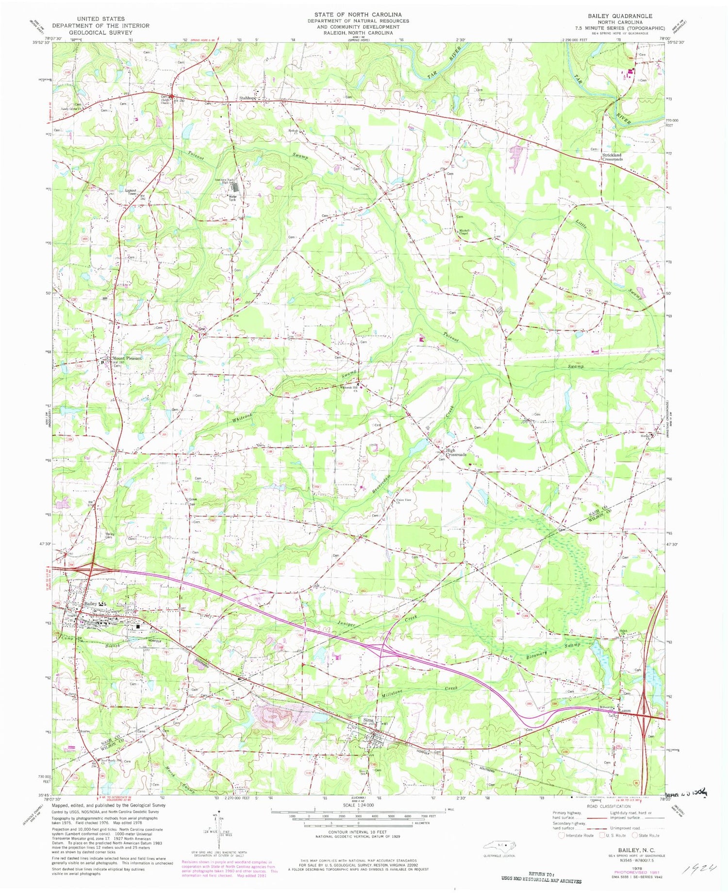
Classic USGS Bailey North Carolina 7.5'x7.5' Topo Map
Couldn't load pickup availability
Historical USGS topographic quad map of Bailey in the state of North Carolina. Map scale may vary for some years, but is generally around 1:24,000. Print size is approximately 24" x 27"
This quadrangle is in the following counties: Nash, Wilson.
The map contains contour lines, roads, rivers, towns, and lakes. Printed on high-quality waterproof paper with UV fade-resistant inks, and shipped rolled.
Contains the following named places: Bailey, Bailey Cemetery, Bailey Elementary School, Bailey Fire Department, Bailey Police Department, Bailey Post Office, Beaverdam Creek, Bissett Mill, Coopers Volunteer Fire Department and Rescue Squad Substation, Floods Chapel, High Crossroads, Hornes Church, Juniper Creek, Lamm, Little Swamp, Milbournie Church, Millstone Creek, Mitchells Chapel, Morgans Pond, Morgans Pond Dam, Mount Pleasant, Mount Pleasant Methodist Church, Mount Pleasant School, Nash County Emergency Medical Services Station 400, Neverson Quarry, New Sandy Hill Church, Perry Crossroads, Perrys Pond, Redoak Church, Reed Marsh, Sandy Grove Church, Sandy Level Church, Shiloh Church, Sims, Sims Community Rural Volunteer Fire Department, Sims Post Office, Sims School, Southern Nash High School, Stanciels Pond, Stanciels Pond Dam, Stanhope, Stanhope Community Volunteer Fire Department, Strickland Church, Strickland Crossroads, Strickland School, Stricklands Bridge, Stricklands Mill, Town of Bailey, Town of Sims, Township of Bailey, Township of Jackson, Union View Church, Whiteoak Hill Church, Whiteoak Swamp, Wilhams School, Wilson County Sheriff's Office, ZIP Code: 27807


