MyTopo
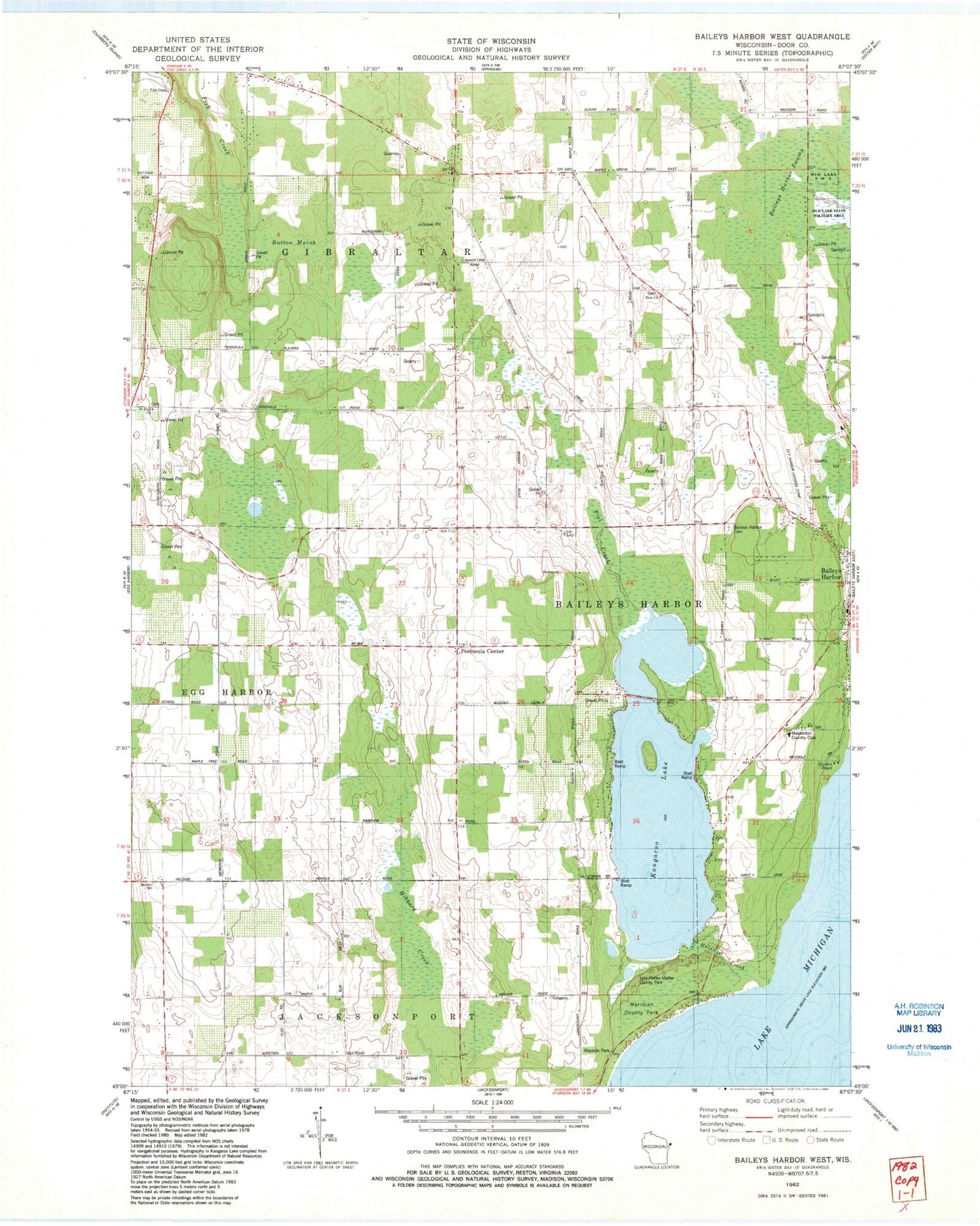
Classic USGS Baileys Harbor West Wisconsin 7.5'x7.5' Topo Map
Couldn't load pickup availability
Historical USGS topographic quad map of Baileys Harbor West in the state of Wisconsin. Map scale is 1:24000. Print size is approximately 24" x 27"
This quadrangle is in the following counties: Door.
The map contains contour lines, roads, rivers, towns, and lakes. Printed on high-quality waterproof paper with UV fade-resistant inks, and shipped rolled.
Contains the following named places: Baileys Harbor Census Designated Place, Baileys Harbor Fire Department, Baileys Harbor Swamp, Baileys Harbor Town Cemetery, Bley Farms, Boynton Chapel, Button Marsh, Door County Quarries, Gibraltar Fire and Rescue Department, Gray Air Dairy Farm, Haberli Farms, Heins Creek, Jarman Quarry, Kangaroo Lake, Kangaroo Lake State Natural Area, Lighting Strikes Orchard, Lyle-Harter-Matter County Park, Maxwelton Country Club, Meridian County Park, Peil Creek, Peninsula Center, Saint Mary's of the Lake Cemetery, Saint Paul's Lutheran Church, Sky Harbor Landing Strip (historical), Thorp Pond, Thorp Pond State Natural Area, Zion Church