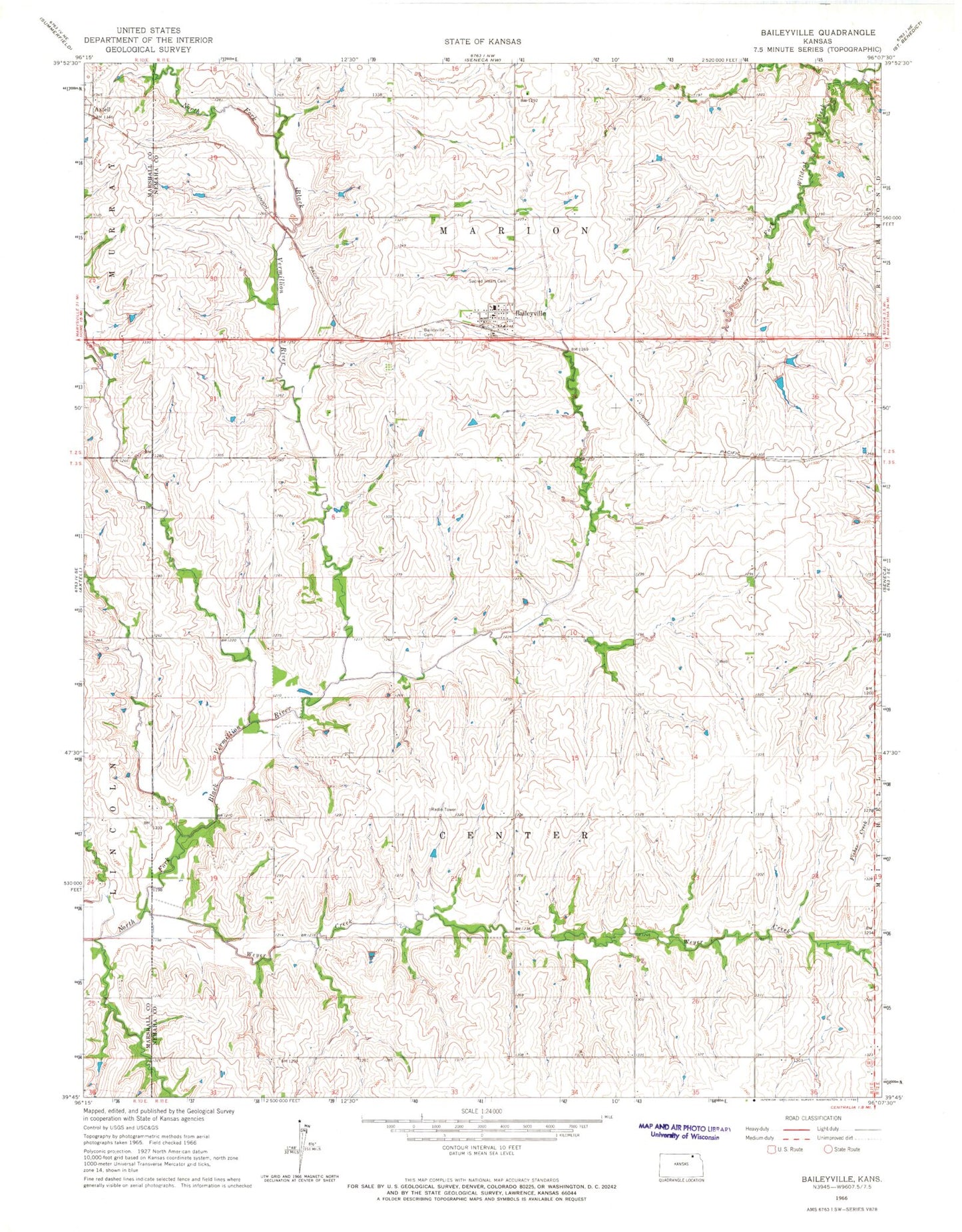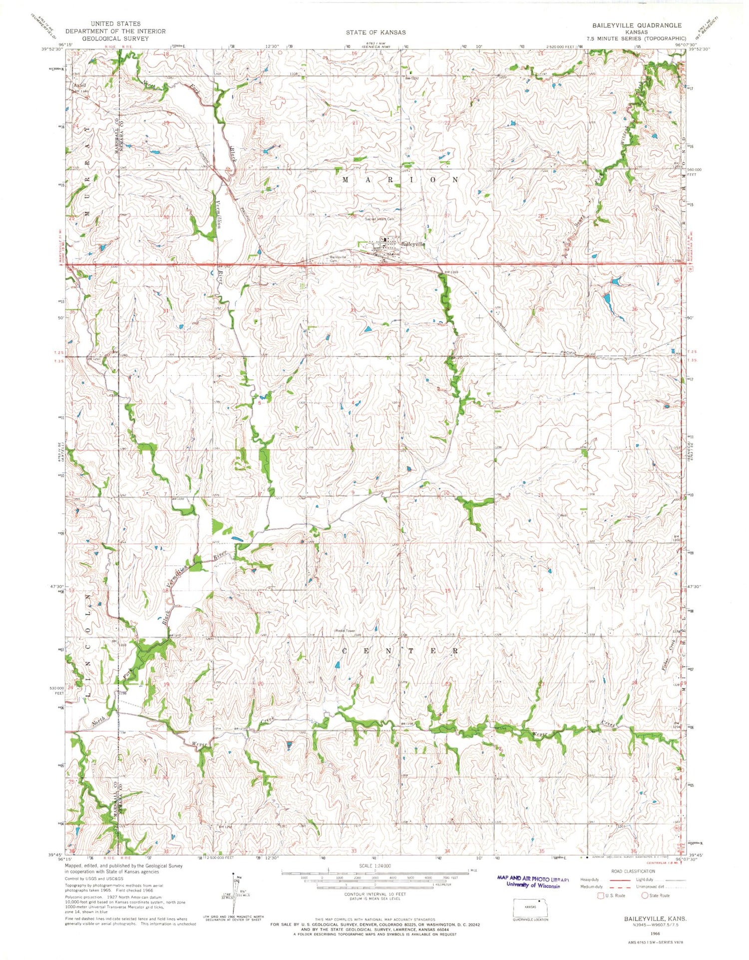
MyTopo
Classic USGS Baileyville Kansas 7.5'x7.5' Topo Map
Couldn't load pickup availability
Historical USGS topographic quad map of Baileyville in the state of Kansas. Map scale may vary for some years, but is generally around 1:24,000. Print size is approximately 24" x 27"
This quadrangle is in the following counties: Marshall, Nemaha.
The map contains contour lines, roads, rivers, towns, and lakes. Printed on high-quality waterproof paper with UV fade-resistant inks, and shipped rolled.
Contains the following named places: B and B Junior / Senior High School, B and B Unified School District Office, Baileyville, Baileyville Cemetery, Baileyville Census Designated Place, Baileyville Post Office, Sacred Heart Catholic Church, Sacred Heart Cemetery, Township of Center, Township of Marion, Weyer Creek