MyTopo
Classic USGS Baker Mountain Oklahoma 7.5'x7.5' Topo Map
Regular price
$16.95
Regular price
Sale price
$16.95
Unit price
per
Couldn't load pickup availability
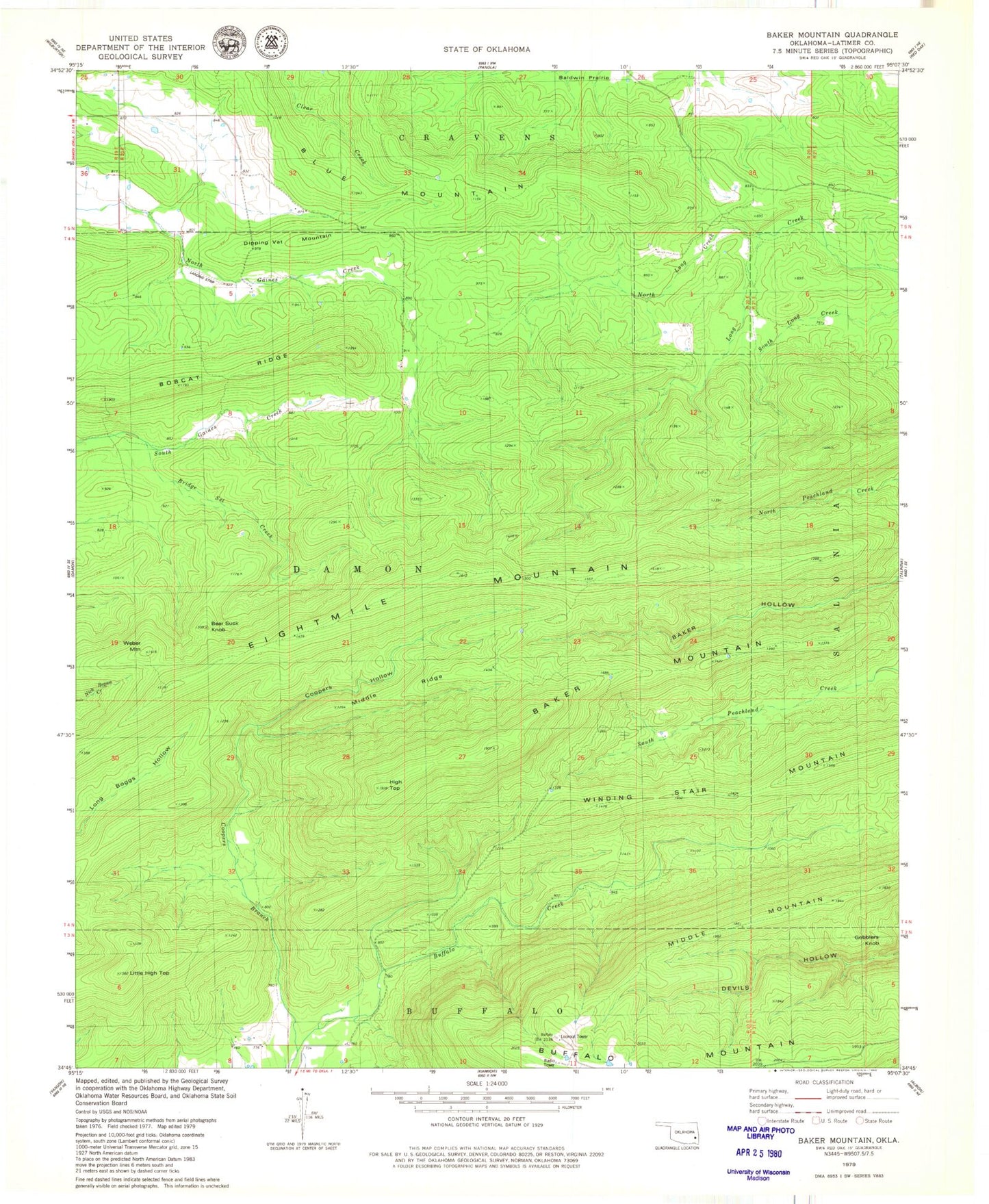
Historical USGS topographic quad map of Baker Mountain in the state of Oklahoma. Map scale is 1:24000. Print size is approximately 24" x 27"
This quadrangle is in the following counties: Latimer.
The map contains contour lines, roads, rivers, towns, and lakes. Printed on high-quality waterproof paper with UV fade-resistant inks, and shipped rolled.
Contains the following named places: Baker Mountain, Bear Suck Knob, Bobcat Ridge, Bridge Set Creek, Buffalo Mountain, Coopers Branch, Coopers Hollow, Dripping Vat Mountain, Eightmile Mountain, Gobblers Knob, High Top, Little High Top, Middle Mountain, Middle Ridge, North Long Creek, Weber Mountain