
MyTopo
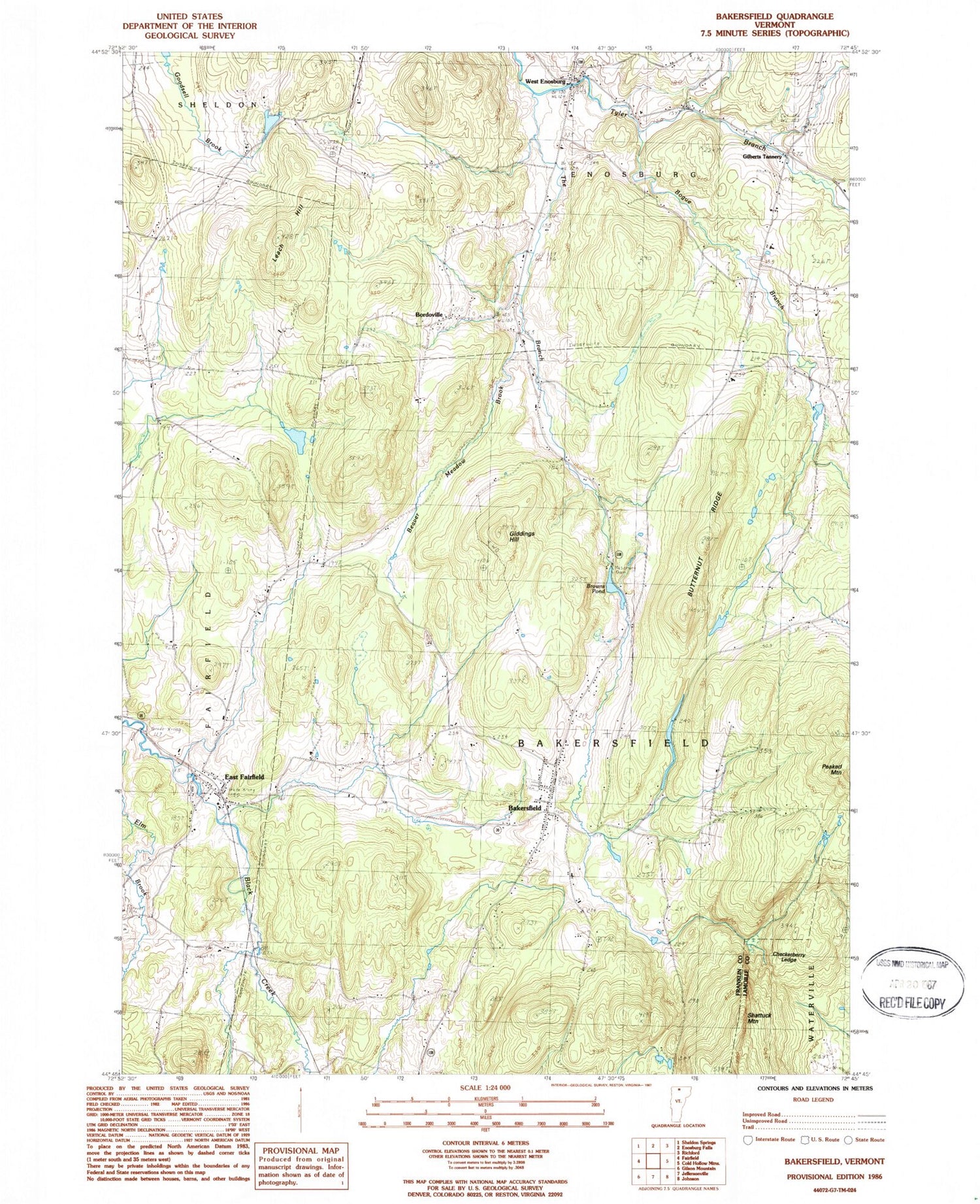
Classic USGS Bakersfield Vermont 7.5'x7.5' Topo Map
Couldn't load pickup availability
Historical USGS topographic quad map of Bakersfield in the state of Vermont. Map scale may vary for some years, but is generally around 1:24,000. Print size is approximately 24" x 27"
This quadrangle is in the following counties: Franklin, Lamoille.
The map contains contour lines, roads, rivers, towns, and lakes. Printed on high-quality waterproof paper with UV fade-resistant inks, and shipped rolled.
Contains the following named places: Advent Christian Church, Bakersfield, Bakersfield Census Designated Place, Bakersfield Elementary School, Bakersfield Fire Department, Bakersfield Post Office, Basswood School, Beaver Meadow Brook, Bogue Branch, Bordoville, Bordoville Advent Cemetery, Branch School, Browns Pond, Browns Pond Dam, Buckley School, Burnt Mountain, Butternut Ridge, Checkerberry Ledge, Chester Arthur Church, Cooks Brook, Duffy Hill School, East Fairfield, East Fairfield Covered Bridge, East Fairfield Fire Department, East Fairfield Post Office, Egypt School, Enosburg Center Cemetery, F H Brigham Memorial Free Library, Giddings Hill, Gilberts Tannery, Herrick School, Lapland School, Leach Hill, Maple Grove Cemetery, North Fairfield - Herrick Cemetery, North School, President Arthur Birthplace Museum, Ross Brook, Saddle Pond, Saint Georges Cemetery, School Number 11, Shattuck Mountain, The Branch, Town of Bakersfield, Tri-Church Parish Church, West Enosburg, West Enosburg Cemetery, West School, Wolf Run Country Club, Wolf Run Cross Country Ski Center


