MyTopo
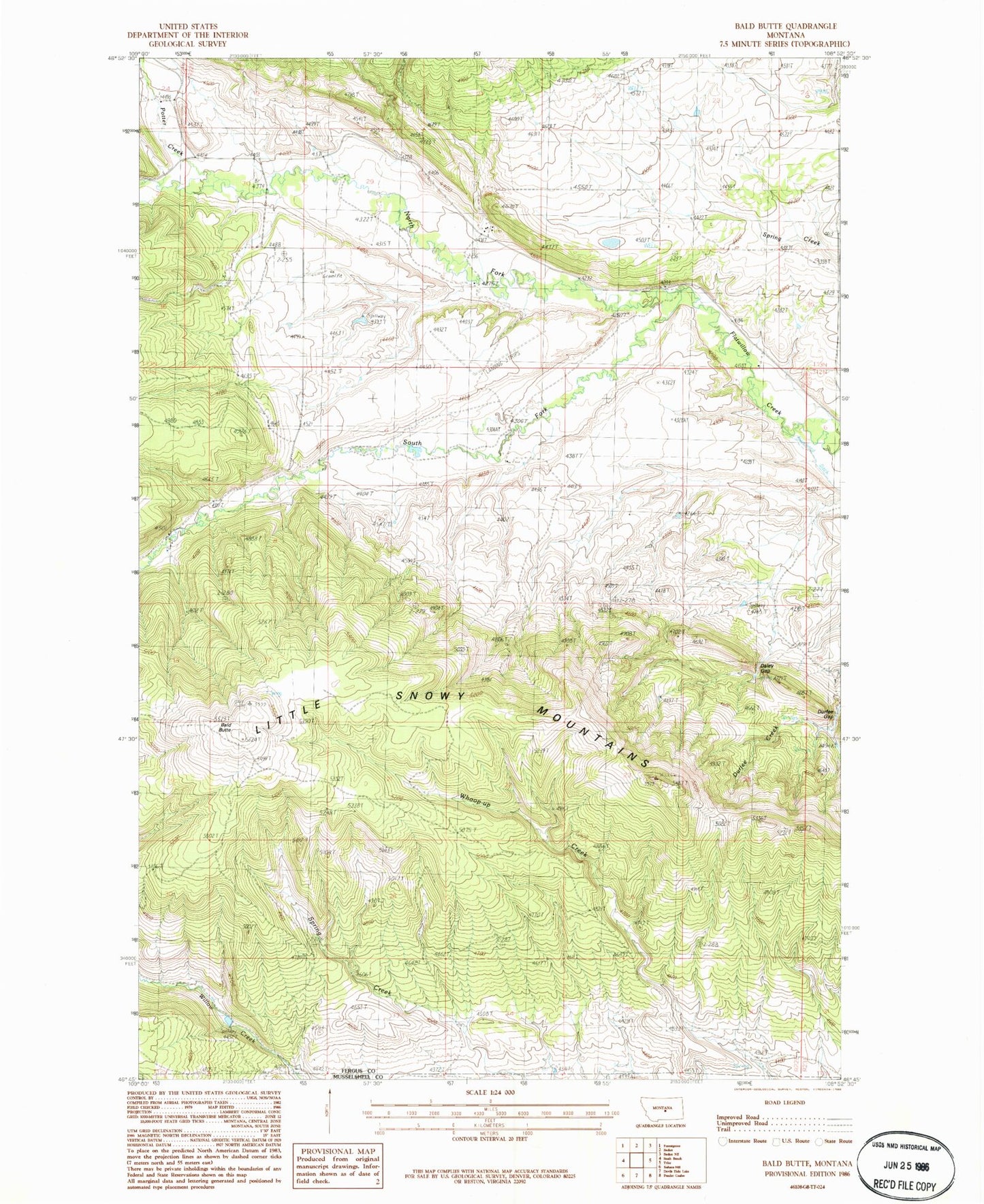
Classic USGS Bald Butte Montana 7.5'x7.5' Topo Map
Regular price
$16.95
Regular price
Sale price
$16.95
Unit price
per
Couldn't load pickup availability
Historical USGS topographic quad map of Bald Butte in the state of Montana. Map scale is 1:24000. Print size is approximately 24" x 27"
This quadrangle is in the following counties: Fergus, Musselshell.
The map contains contour lines, roads, rivers, towns, and lakes. Printed on high-quality waterproof paper with UV fade-resistant inks, and shipped rolled.
Contains the following named places: 12N22E13DDDD01 Spring, Bald Butte, Daley Gap, Durfee Gap, N Bar Ranch, N Bar Ranch Airport, N-Bar School (historical), North Fork Flatwillow Creek, Potter Creek, Ryan School (historical), South Fork Flatwillow Creek, Tyler School (historical)