MyTopo
Classic USGS Bald Hill Washington 7.5'x7.5' Topo Map
Couldn't load pickup availability
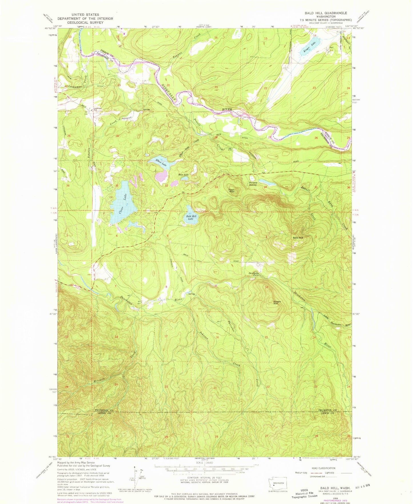
Historical USGS topographic quad map of Bald Hill in the state of Washington. Map scale may vary for some years, but is generally around 1:24,000. Print size is approximately 24" x 27"
This quadrangle is in the following counties: Lewis, Pierce, Thurston.
The map contains contour lines, roads, rivers, towns, and lakes. Printed on high-quality waterproof paper with UV fade-resistant inks, and shipped rolled.
Contains the following named places: Bald Hill, Bald Hill Lake, Bass Lake, Beaver Dam, Clear Lake, Deschutes Falls, Edna Creek, Elbow Lake, Elbow Lake Creek, Fossil Rock, Green Hill, Johnson Creek, Kreger Lake, Lackamas Creek, Lackamas Elementary School, Little Deschutes River, Mitchell Creek, Muskrat Dam, Parsnip Swamp, Powell Creek, Tanwax Creek, Thurston County Fire District 17 Bald Hills Fire Department, Thurston Creek, Tobolton Creek, ZIP Code: 98597