MyTopo
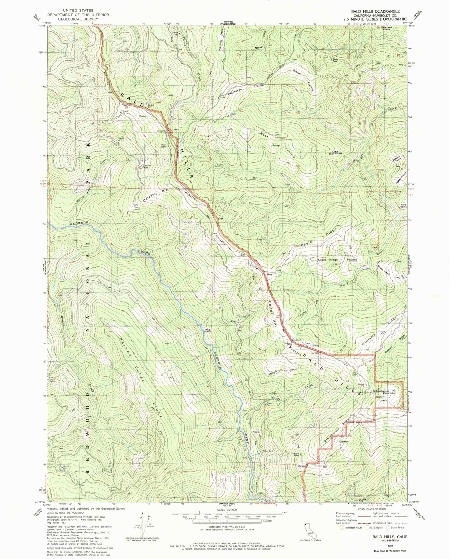
Classic USGS Bald Hills California 7.5'x7.5' Topo Map
Couldn't load pickup availability
Historical USGS topographic quad map of Bald Hills in the state of California. Map scale is 1:24000. Print size is approximately 24" x 27"
This quadrangle is in the following counties: Humboldt.
The map contains contour lines, roads, rivers, towns, and lakes. Printed on high-quality waterproof paper with UV fade-resistant inks, and shipped rolled.
Contains the following named places: Anton Lyons Ranch, Bald Hills, Bald Hills School, Bear Prairie, Bridge Creek, Bridge Creek Ridge, Cagle Ridge, Cagle Ridge Prairie, Childs Hill Prairie, Copper Creek, Counts Hill Prairie, Cuddy Cabin, Cuddy Prairie, Devils Creek, Doiason Hill Prairie, Elk Camp, Graham and McCombs Ranch, Griffith Place (historical), Harry Weir Creek, Hog Prairie, Little Bear Prairie, Pitt Place Prairie, Roach Creek Hole, Schoolhouse Pasture, Schoolhouse Pasture Rock, Schoolhouse Peak, Schoolhouse Peak Lookout, Sidehill Prairie, Smith Prairie, Thompson Prairie, Tick Prairie, Tomlinson Brothers Ranch