MyTopo
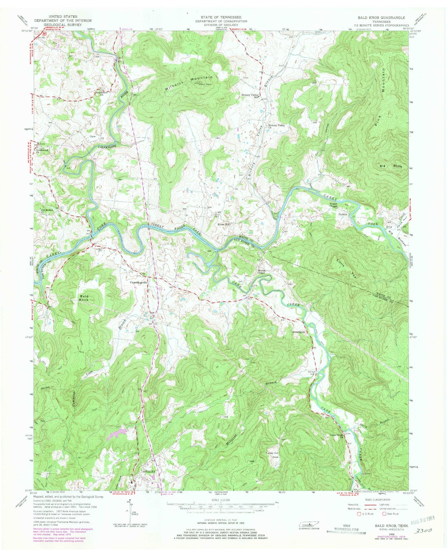
Classic USGS Bald Knob Tennessee 7.5'x7.5' Topo Map
Couldn't load pickup availability
Historical USGS topographic quad map of Bald Knob in the state of Tennessee. Map scale may vary for some years, but is generally around 1:24,000. Print size is approximately 24" x 27"
This quadrangle is in the following counties: Van Buren, White.
The map contains contour lines, roads, rivers, towns, and lakes. Printed on high-quality waterproof paper with UV fade-resistant inks, and shipped rolled.
Contains the following named places: Bald Knob, Bethlehem Cemetery, Bethlehem Church, Big Butte, Calfkiller River, Camps Gulf Branch, Cane Creek, Cane Creek Church, Cane Hollow, Cave, Commissioner District 1, Cummings Cove Branch, Cummingsville, Cummingsville School, Cummingsville United Methodist Church Cemetery, Double Bridges, Dry Creek, Fox Hollow, Frasers Chapel United Methodist Church Cemetery, Frazer Chapel, Gravel Hill Cemetery, Greenwood, Greenwood Cemetery, Greenwood Church, Haston Chapel, Hickory Valley, Hickory Valley Branch, Hickory Valley Church, Hickory Valley Fire and Rescue, Hickory Valley School, Hodge Ferry, Hodges Cemetery, Little Top, Meade, Milksick Mountain, Millstone Branch, Old Bethel Church, Old Union Cemetery, Old Union Cumberland Presbyterian Church, Perry Branch, Pine Mountain, Plumlees Ford, River Hill, River Hill Ferry, River Hill Ford, Skurlock Cemetery, Sparkman Cemetery, Spencer Water Supply Dam, Spencer Water Supply Lake, Spring Branch School, Sweetgum, Turkey Cot Cove, Van Buren County Ambulance Service, Van Buren County High School, Waterfall Hollow, Yates Cemetery, Young