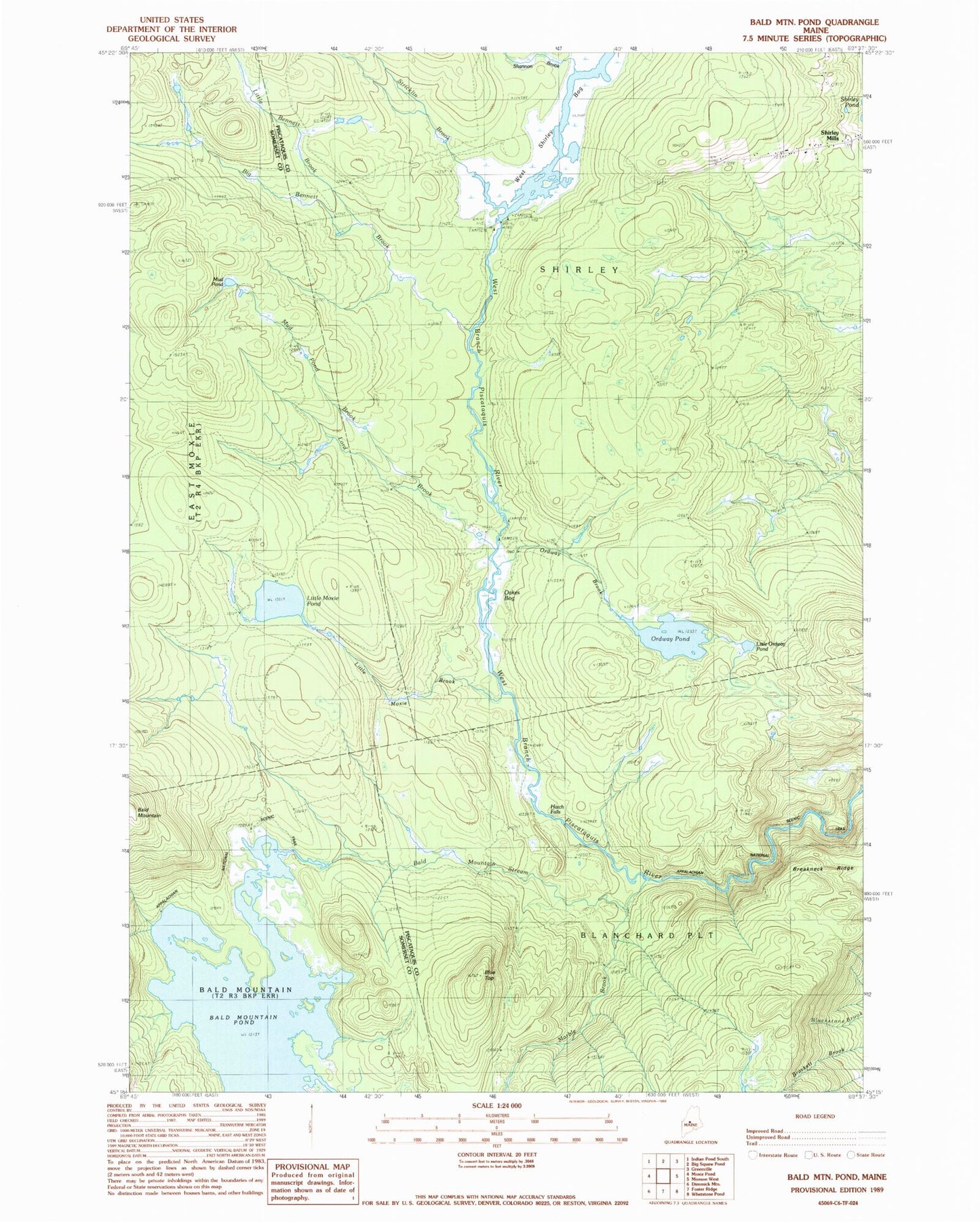
MyTopo
Classic USGS Bald Mountain Pond Maine 7.5'x7.5' Topo Map
Couldn't load pickup availability
Historical USGS topographic quad map of Bald Mountain Pond in the state of Maine. Typical map scale is 1:24,000, but may vary for certain years, if available. Print size: 24" x 27"
This quadrangle is in the following counties: Piscataquis, Somerset.
The map contains contour lines, roads, rivers, towns, and lakes. Printed on high-quality waterproof paper with UV fade-resistant inks, and shipped rolled.
Contains the following named places: Bald Mountain Pond, Bald Mountain Stream, Big Bennett Brook, Blue Top, Breakneck Ridge, East Inlet Bald Mountain Pond, Hatch Falls, Little Bennett Brook, Little Moxie Brook, Little Moxie Pond, Little Ordway Pond, Lord Brook, Marble Brook, Mud Pond, Mud Pond Brook, Oakes Bog, Ordway Brook, Ordway Pond, Shannon Brook, Stricklin Brook, West Shirley Bog, Town of Shirley, Shirley Elementary School (historical), Shirley Mills Cemetery, Shirley United Methodist Church, Unorganized Territory of Blanchard