
MyTopo
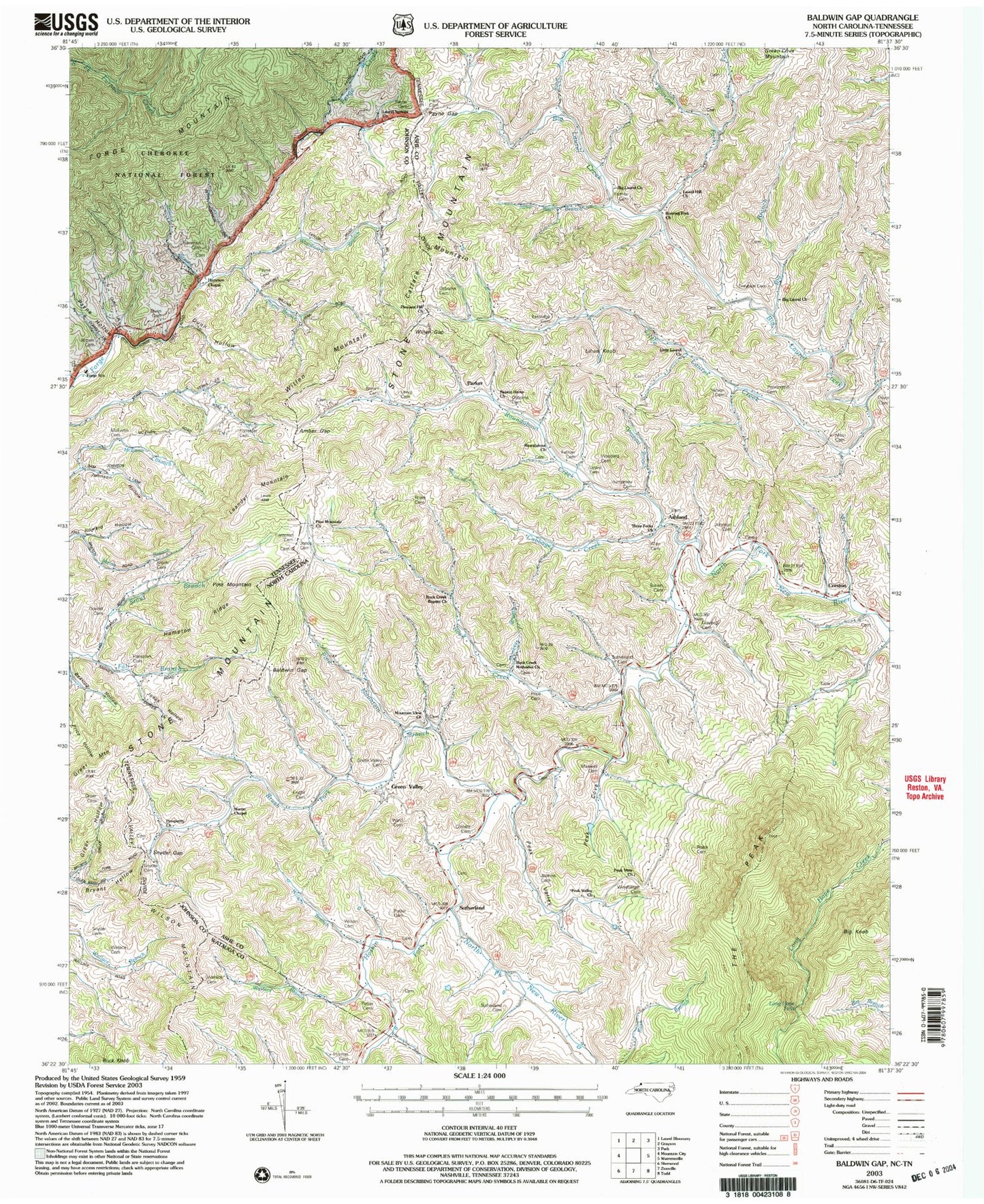
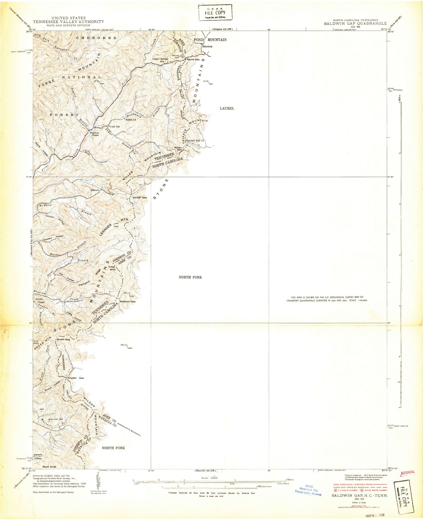
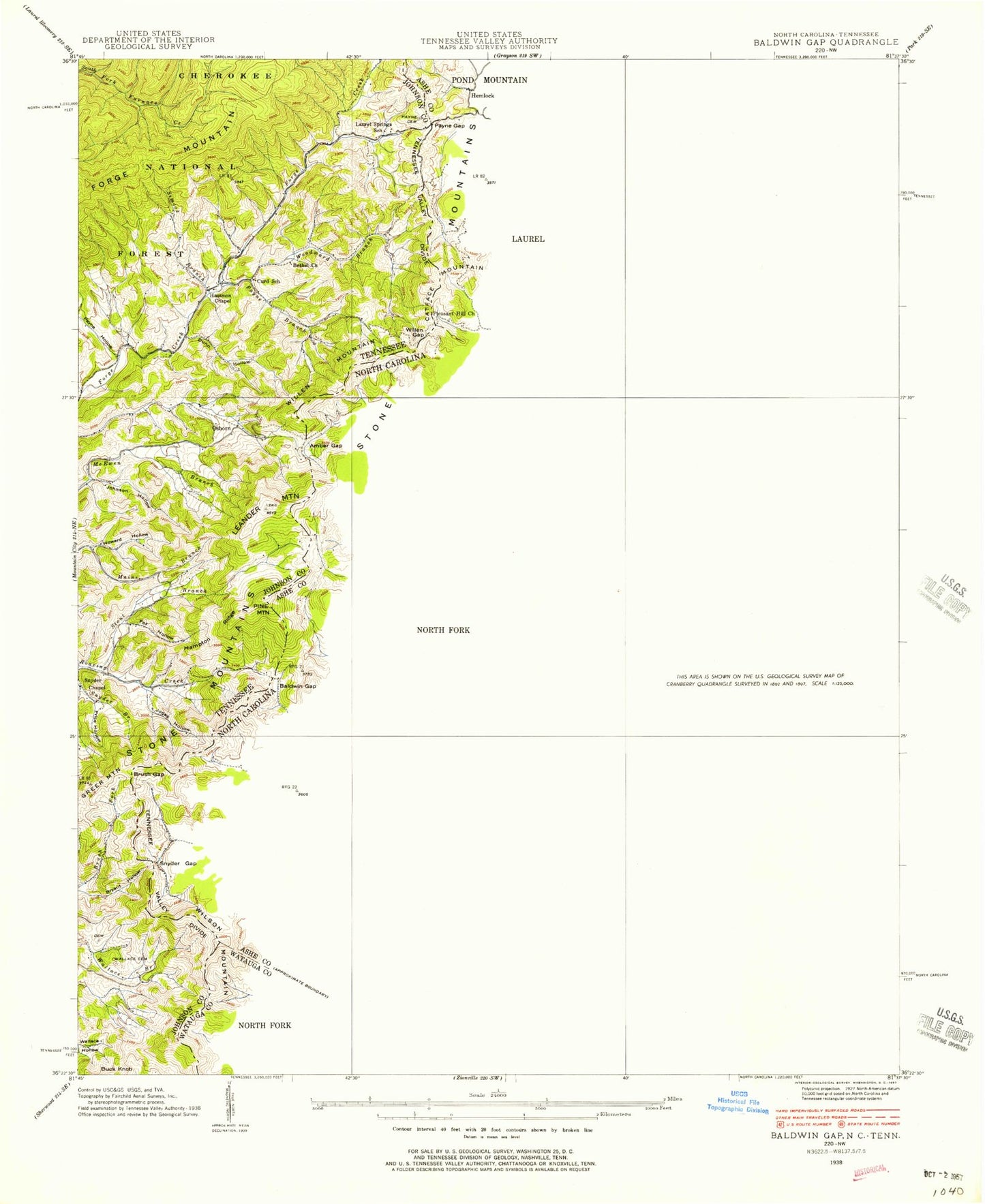
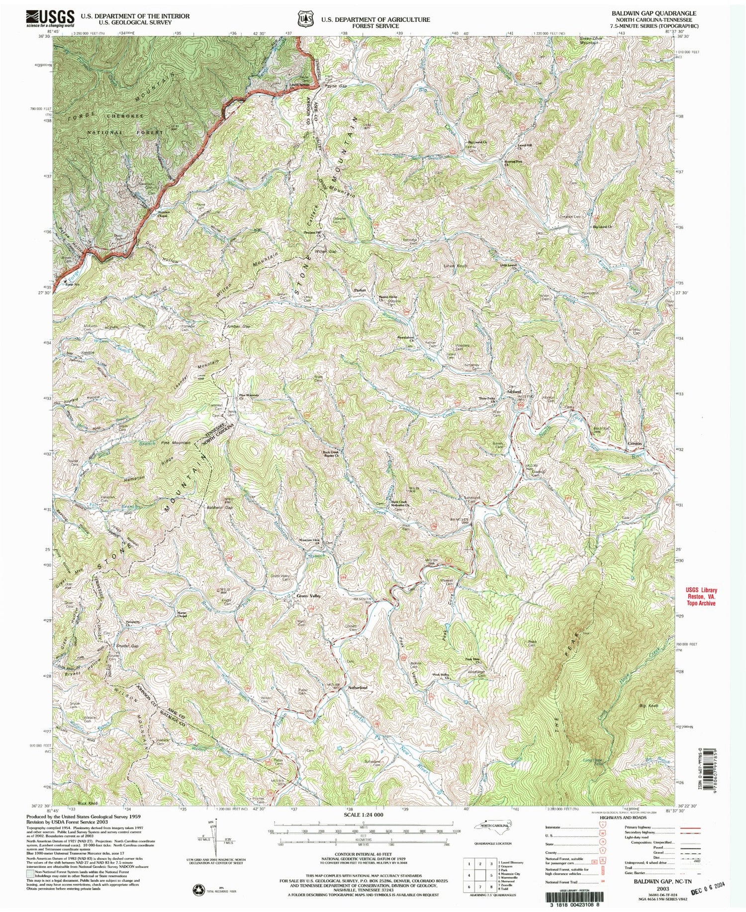
Classic USGS Baldwin Gap North Carolina 7.5'x7.5' Topo Map
Couldn't load pickup availability
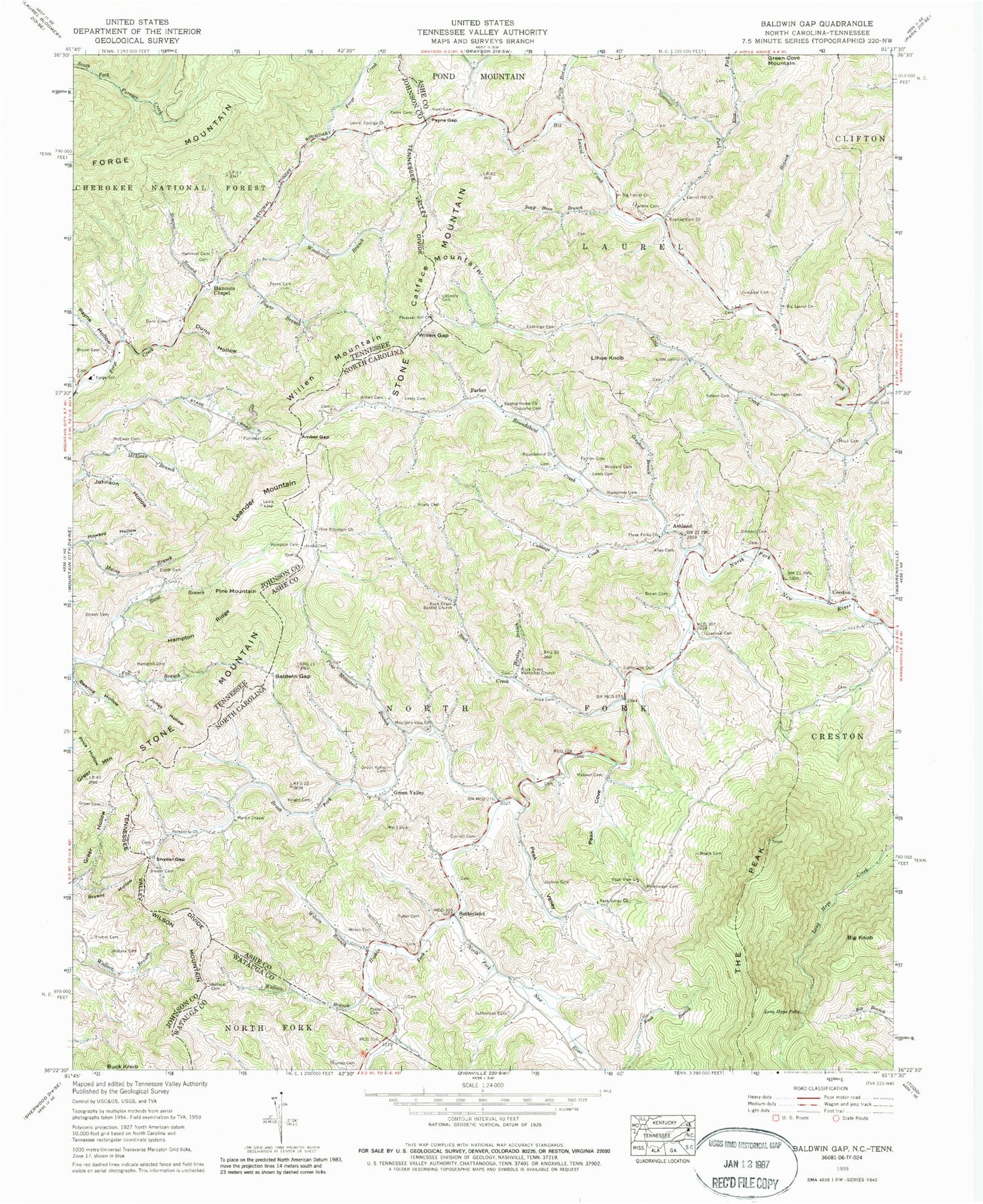
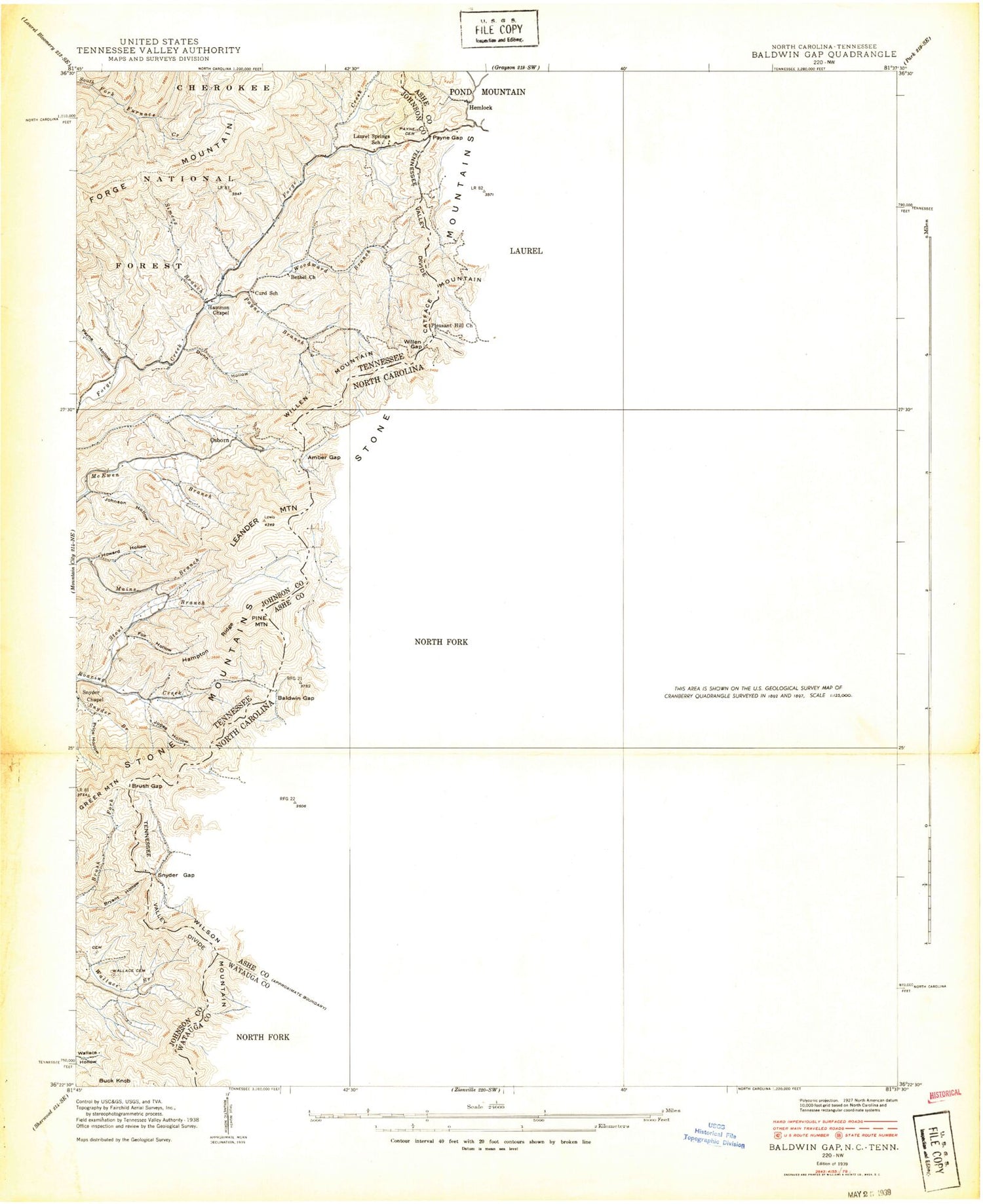
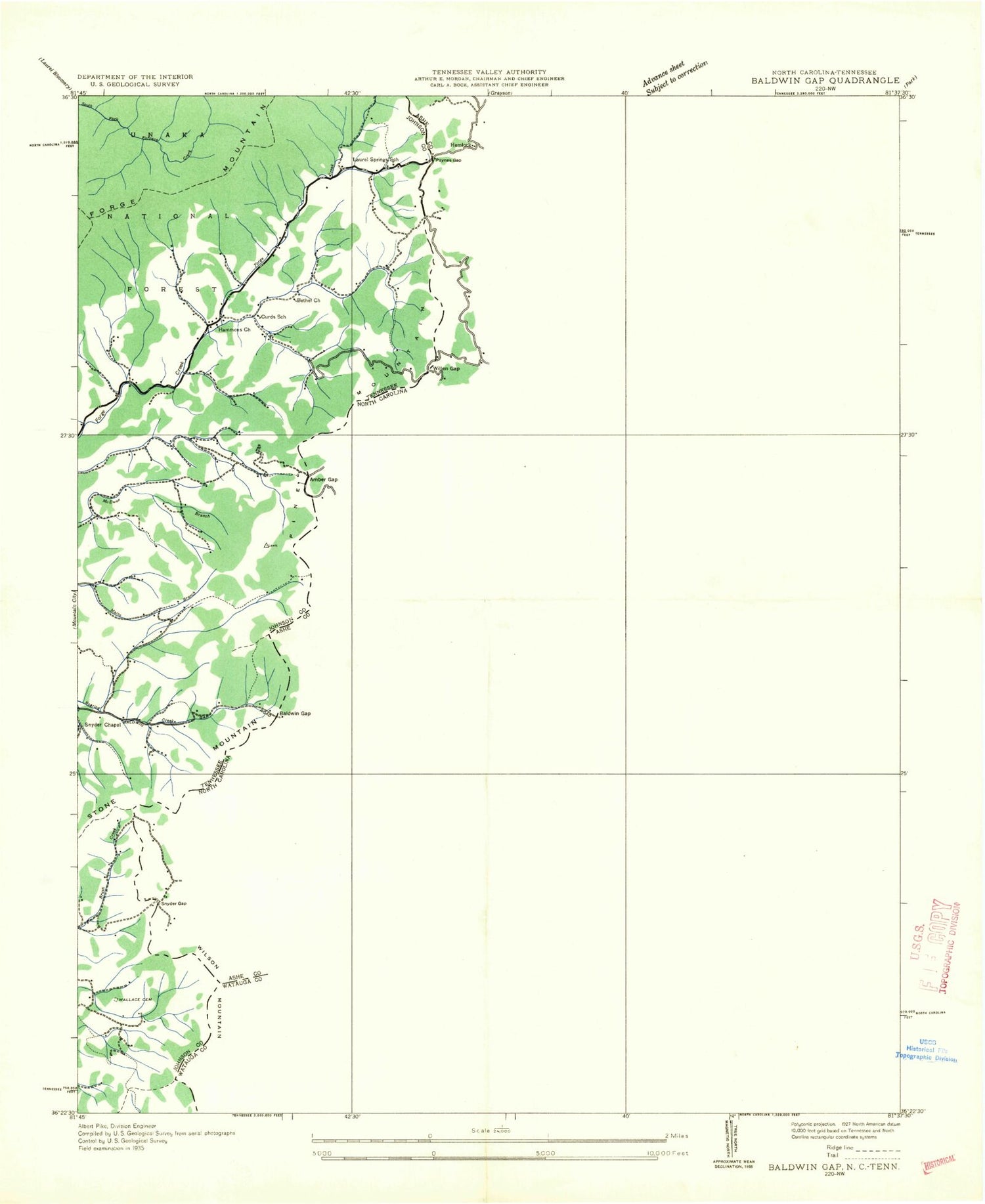
Historical USGS topographic quad map of Baldwin Gap in the states of North Carolina, Tennessee. Map scale may vary for some years, but is generally around 1:24,000. Print size is approximately 24" x 27"
This quadrangle is in the following counties: Ashe, Johnson, Watauga.
The map contains contour lines, roads, rivers, towns, and lakes. Printed on high-quality waterproof paper with UV fade-resistant inks, and shipped rolled.
Contains the following named places: Allen Cemetery, Amber Gap, Ashland, Baldwin Gap, Baptist Home Church, Bearlog Hollow, Big Branch, Big Knob, Big Laurel Church, Brown Cemetery, Brush Fork, Cabbage Creek, Catface Mountain, Commissioner District 2, Cornett Cemetery, Curd School, Cut Laurel Creek, Dowell, Dowell Cemetery, Dunn Hollow, Dunn Memorial Park, East Fork Roaring Fork, Eastridge Cemetery, Fall Branch, Farmer Cemetery, Forge School, Fox Hollow, Graybeal, Graybeal Branch, Graybeal Cemetery, Green Valley, Green Valley Cemetery, Greer Cemetery, Greer Hollow, Ham Cemetery, Hammon Chapel, Hammons Cemetery, Hampton Cemetery, Hampton Ridge, Hemlock, Hoskin Fork, Humphrey Cemetery, Jenkins Cemetery, John D Arnold Cemetery, Johnson Cemetery, Jones Cemetery, Jones Hollow, Knight Cemetery, Laurel Hill Church, Laurel Springs Church, Laurel Springs School, Leander Mountain, Lewis - Forrester Cemetery, Lewis Cemetery, Lihue Knob, Little Laurel Church, Little Laurel Creek, Long Hope Falls, Martin Chapel, Maxwell, Maxwell Cemetery, McEwen Cemetery, Mock Cemetery, Monkey Branch, Mountain View Church, Nelson Cemetery, Oliver Cemetery, Osborn, Osborne Cemetery, Parker, Parmer Cemetery, Payne Branch, Payne Cemetery, Payne Gap, Payne Hollow, Peak Cove, Peak Valley, Peak Valley Church, Peak View Church, Pennington Cemetery, Pine Mountain, Pine Mountain Branch, Pine Mountain Church, Pleasant Hill Church, Pond Mountain, Potter Cemetery, Price Cemetery, Price Hollow, Prosperity Church, Roaring Fork, Roaring Fork Church, Roark Cemetery, Rock Creek, Rock Creek Baptist Church, Rock Creek Methodist Church, Roundabout Church, Roundabout Creek, Simcox Branch, Snyder Branch, Snyder Cemetery, Snyder Chapel, Snyder Gap, Soup Bean Branch, Stout Branch, Sutherland, Sutherland Cemetery, Swift Branch, The Peak, Thomas Cemetery, Thomas Worth Family Cemetery, Three Forks Church, Township of Laurel, Township of North Fork, Wallace Branch, Wallace Cemetery, Ward Cemetery, Willen Gap, Willen Mountain, Wilson Branch, Wilson Cemetery, Wilson Mountain, Winebarger Cemetery, Woodard Cemetery, Woodward Branch, ZIP Code: 28615