MyTopo
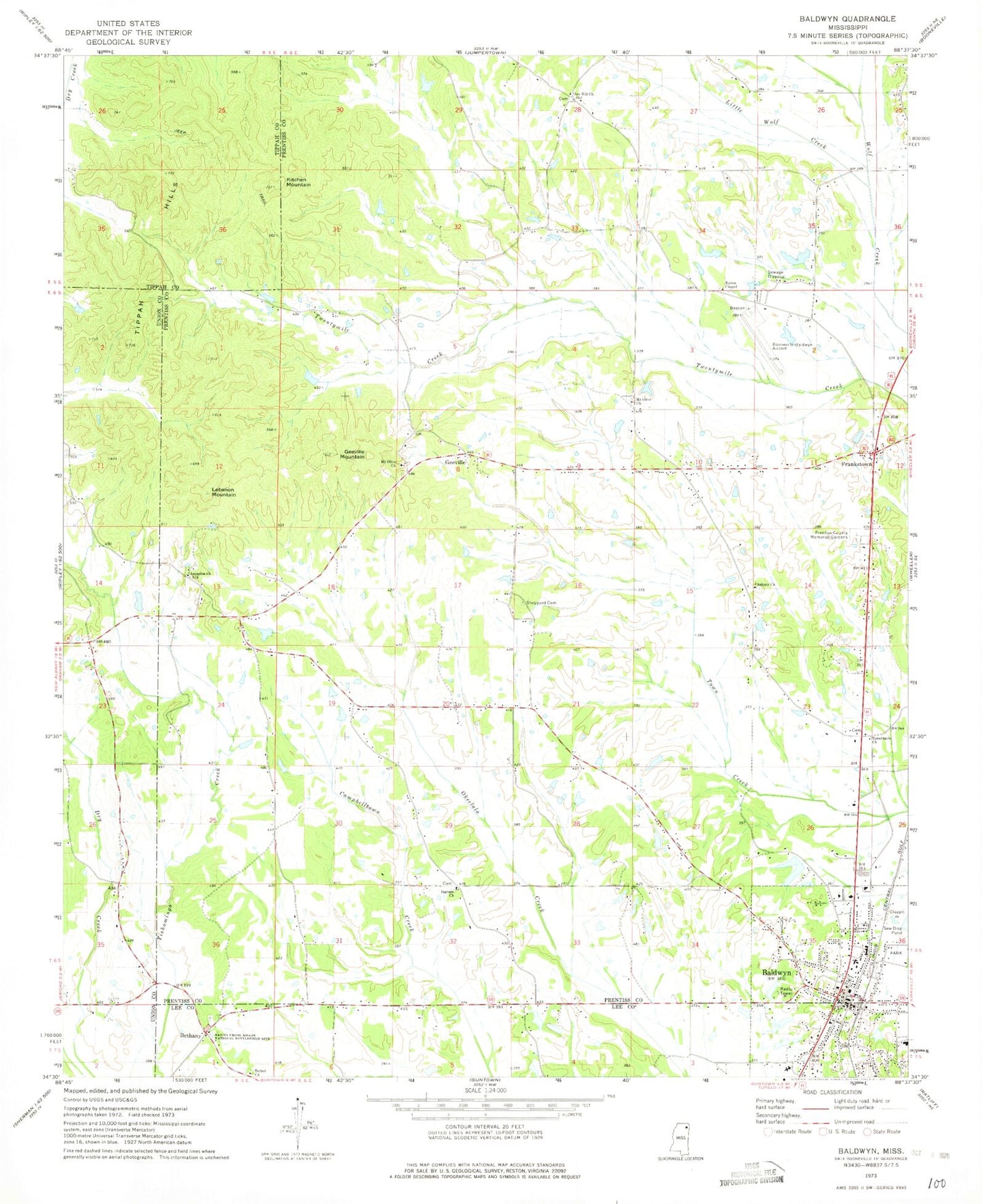
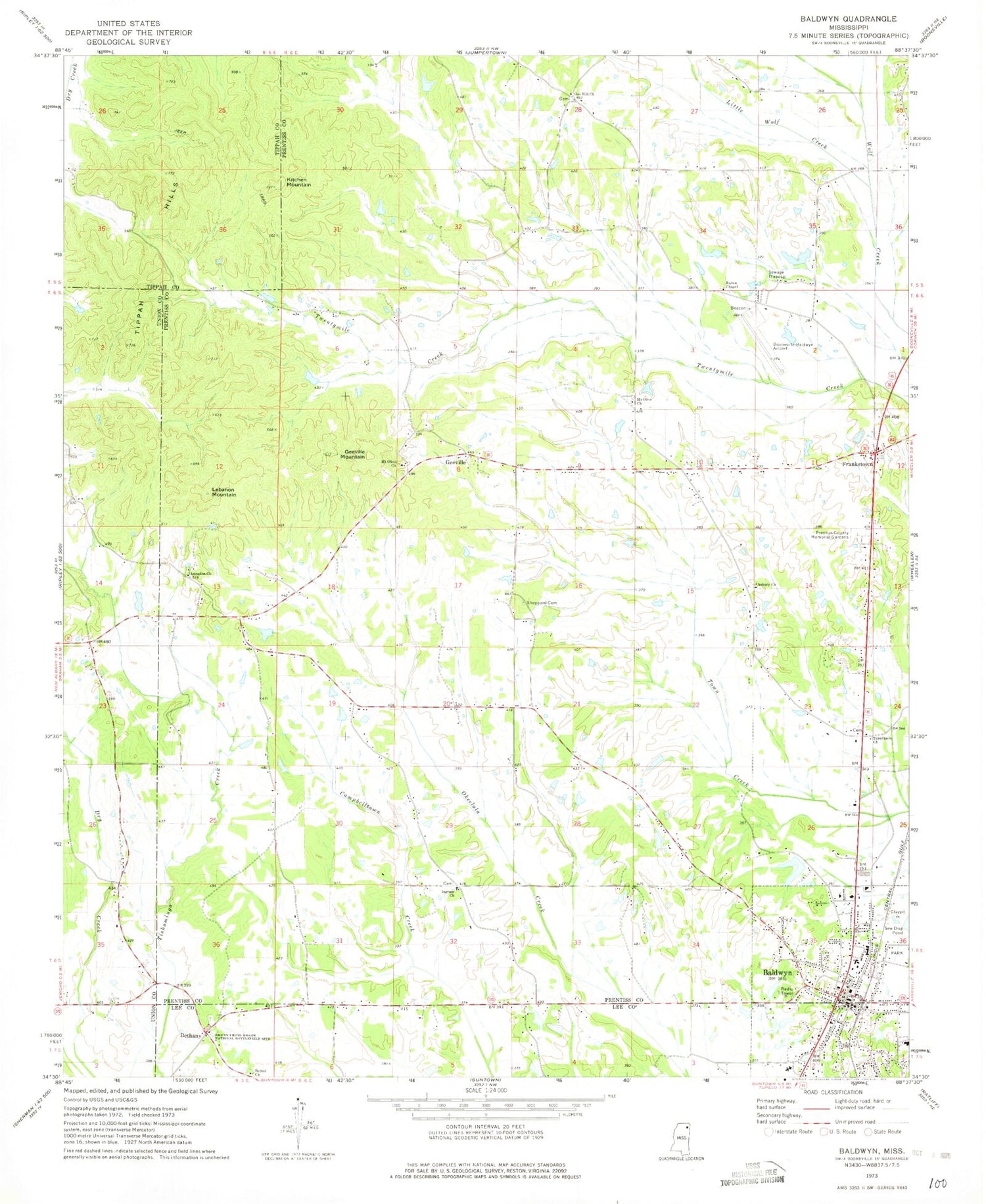
Classic USGS Baldwyn Mississippi 7.5'x7.5' Topo Map
Couldn't load pickup availability
Historical USGS topographic quad map of Baldwyn in the state of Mississippi. Map scale may vary for some years, but is generally around 1:24,000. Print size is approximately 24" x 27"
This quadrangle is in the following counties: Lee, Prentiss, Tippah, Union.
The map contains contour lines, roads, rivers, towns, and lakes. Printed on high-quality waterproof paper with UV fade-resistant inks, and shipped rolled.
Contains the following named places: Asbury Cemetery, Asbury Church, Baldwyn, Baldwyn Church of Christ, Baldwyn Elementary School, Baldwyn Fire Department, Baldwyn High School, Baldwyn Hospital, Baldwyn Middle School, Baldwyn Police Department, Baldwyn Post Office, Baldwyn Presbyterian Church, Bethany, Bethany Cemetery, Bethany Presbyterian Church, Bethel Church, Booneville/Baldwyn Airport, Brices Cross Roads National Battlefield Site, Brices Crossroads National Battlefield Cemetery, Carrollville, Carrollville Cemetery, City of Baldwyn, First Baptist Church, First United Methodist Church, Frankstown, Geeville, Geeville Mountain, Geeville School, Ingram Cemetery, Ingram Church, Ingram Volunteer Fire Department, Kitchen Mountain, Lebanon, Lebanon Cemetery, Lebanon Church, Lebanon Mountain, Little Wolf Creek, Maiden School, Mount Nebo Christian Methodist Episcopal Church, Mount Olive Cemetery, Mount Olive Church, Oak Hill Cemetery, Oak Hill Church, Oak Hill School, Old Calvary Cemetery, Osborne Creek Church, Osborne School, Prentiss County Memorial Gardens, Prentiss School, Ruben Chapel, Rubens Chapel Cemetery, Sheppard Cemetery, Stevenson School, Tabernacle Church, Tabernacle School, Tippah Hills, Yanco, ZIP Code: 38824