MyTopo
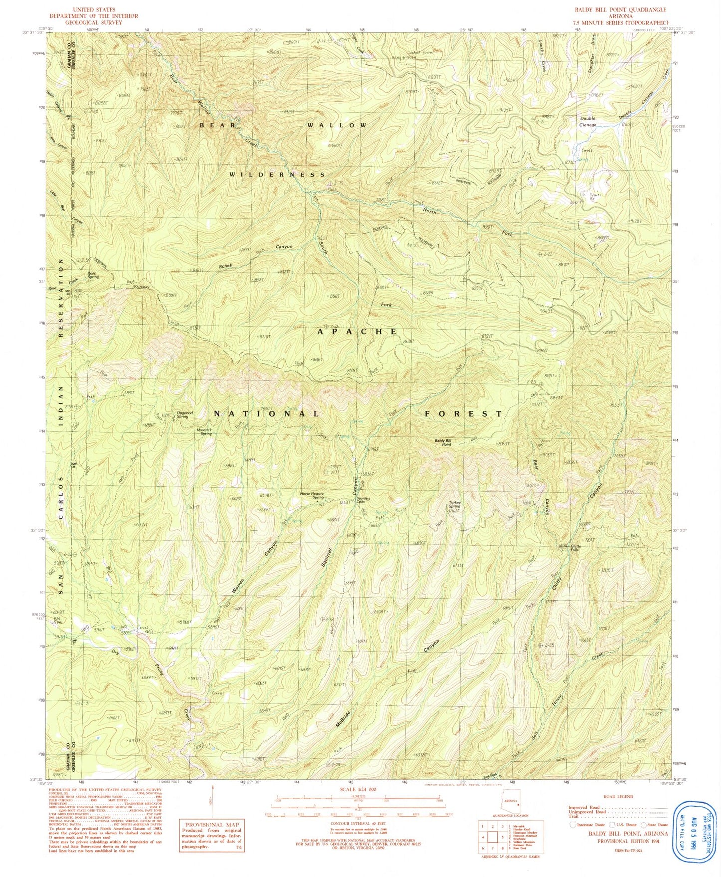
Classic USGS Baldy Bill Point Arizona 7.5'x7.5' Topo Map
Couldn't load pickup availability
Historical USGS topographic quad map of Baldy Bill Point in the state of Arizona. Typical map scale is 1:24,000, but may vary for certain years, if available. Print size: 24" x 27"
This quadrangle is in the following counties: Graham, Greenlee.
The map contains contour lines, roads, rivers, towns, and lakes. Printed on high-quality waterproof paper with UV fade-resistant inks, and shipped rolled.
Contains the following named places: Reno Lookout, Chitty Falls, Baldy Bill Point, Bear Canyon, Chitty Canyon, Double Cienega, McBridge Canyon, North Fork Bear Wallow Creek, Rose Spring, Salt House Creek, Schell Canyon, South Fork Bear Wallow Creek, Squirrel Canyon, Warren Canyon, Chitty Canyon Trail Thirty Four, Conklin Creek Campgrounds, Cottonwood Tank, Cowhead Tank, Dogwood Spring, Dry Prong Trail Forty-five, Horse Pasture Spring, Long Canyon Tank, Malay Tank, Maverick Spring, Miller Spring, Red Tail Tank, Reno Spring, South Squirrel Spring, Squirrel Tank, Steer Pasture Tank, Turkey Spring, Upper Bear Spring, Upper McBride Spring, Bear Wallow Wilderness, Squirrel Canyon Tank, Sanders Corral, Squirrel Spring, Reno Lookout, Upper Malay Tank, Malay Corral, Bear Spring, Turkey Trap Tank, McBride Corral, Chitty Trap Corral, Chitty Creek Spring, Horse Pasture Spring, Maverick Spring, Saunders Cabin, Warren Tank, Yellowjacket Spring, Eagle Tank, Yellowjacket Corral