MyTopo
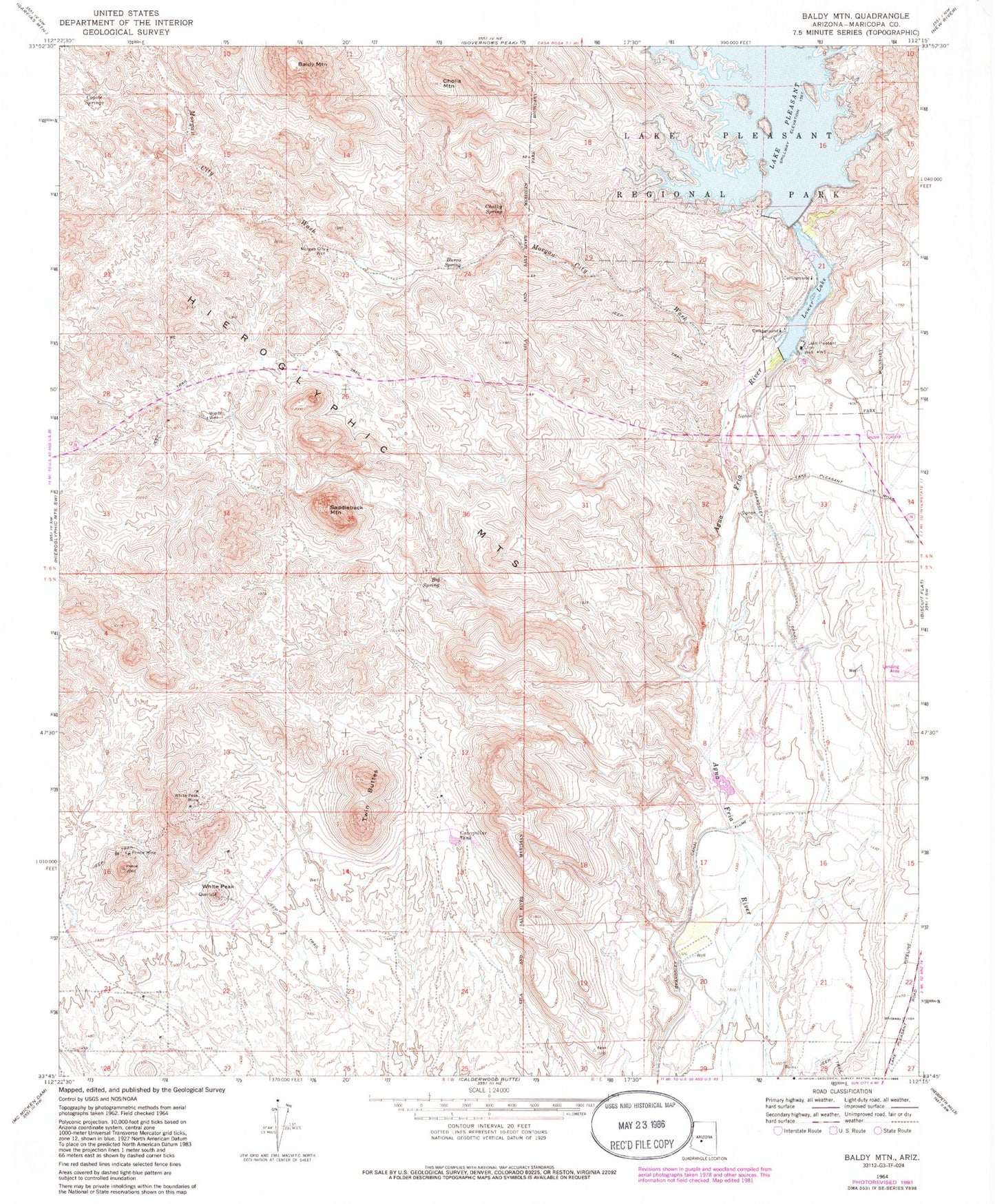
Classic USGS Baldy Mountain Arizona 7.5'x7.5' Topo Map
Couldn't load pickup availability
Historical USGS topographic quad map of Baldy Mountain in the state of Arizona. Typical map scale is 1:24,000, but may vary for certain years, if available. Print size: 24" x 27"
This quadrangle is in the following counties: Maricopa.
The map contains contour lines, roads, rivers, towns, and lakes. Printed on high-quality waterproof paper with UV fade-resistant inks, and shipped rolled.
Contains the following named places: Baldy Mountain, Big Spring, Burro Spring, Caterpillar Tank, Chalky Spring, Cholla Mountain, Coyote Springs, Lake Pleasant Inn, Lower Lake, Morgan City Wash, Morgan City Well, Prince Mine, Saddleback Mountain, Twin Buttes, White Peak, White Peak Mine, Windy Well, Camp Dyer Diversion Dam, Lake Pleasant Landing Field (historical), Carl Pleasant Dam, Lake Carl Pleasant, Lake Pleasant (historical), West Fork White Peak Wash, West Garambullo Wash, Garambullo Wash, East Garambullo Wash, New Waddell Dam Heliport, Clementine Mine Airport (historical), City of Peoria, Vistancia Elementary School, Pleasant Harbor Marina, Blackstone Country Club, Pleasant Harbor Recreational Vehicle Resort, Peoria Fire Department Station 199 Pleasant Harbor Marina, Vistancia