MyTopo
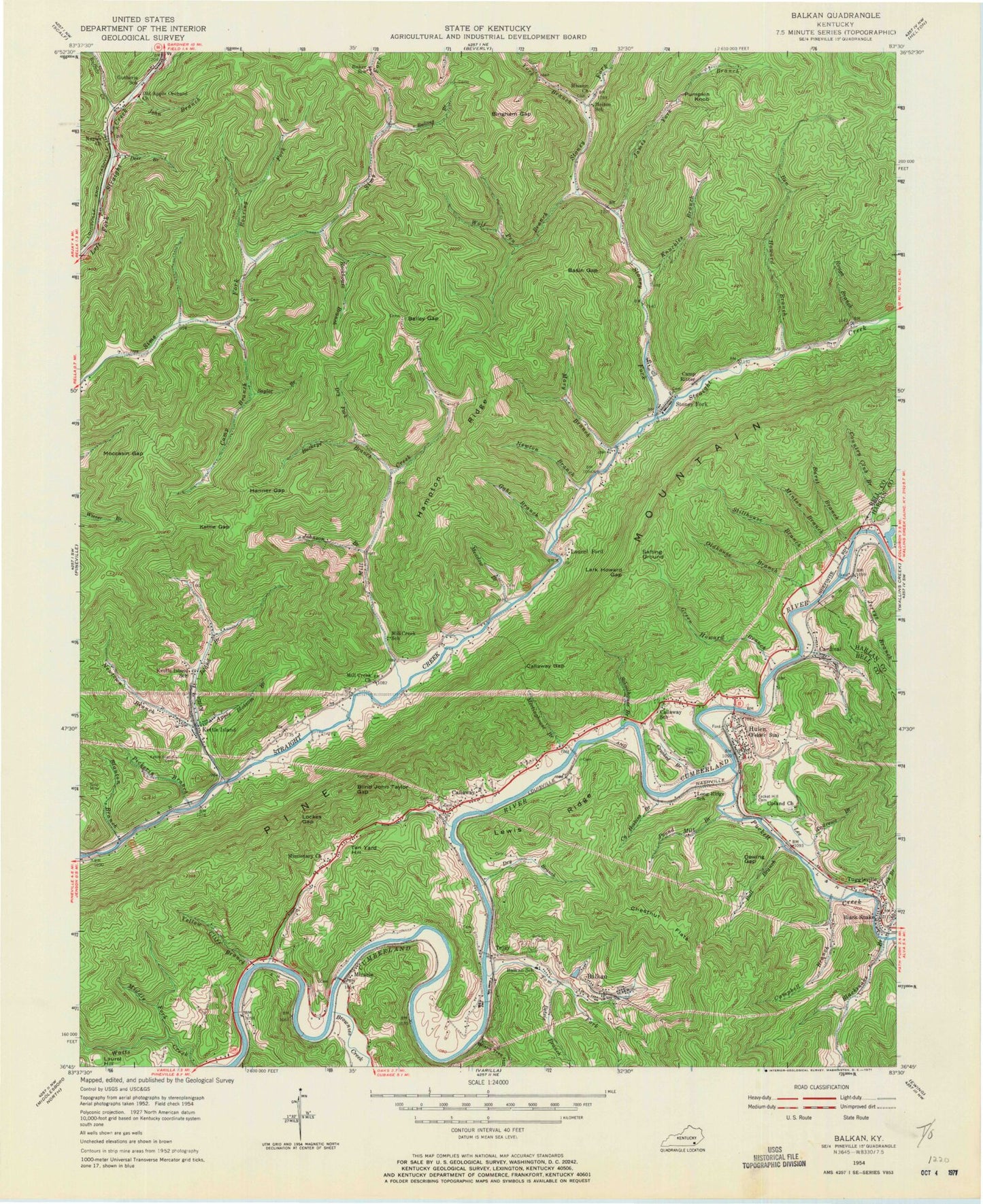
Classic USGS Balkan Kentucky 7.5'x7.5' Topo Map
Couldn't load pickup availability
Historical USGS topographic quad map of Balkan in the state of Kentucky. Map scale is 1:24000. Print size is approximately 24" x 27"
This quadrangle is in the following counties: Bell, Harlan.
The map contains contour lines, roads, rivers, towns, and lakes. Printed on high-quality waterproof paper with UV fade-resistant inks, and shipped rolled.
Contains the following named places: Apple Blossom Branch, Bailey Gap, Balkan, Balkan Cemetery, Balkan Road Station(historical), Basin Gap, Bell County Volunteer Fire Department Calloway Station, Bell County Volunteer Fire Department Right Fork Station, Ben Howard Branch, Betsie Branch, Bingham Gap, Black Snake, Blackmont, Blackmont Census Designated Place, Blackmont School, Blackmount Railroad Station (historical), Blacksnake Branch, Blacksnake Post Office (historical), Blanton Branch, Blind John Taylor Gap, Board Tree Hollow, Brownies Creek, Buckeye Branch, Buffalo Creek, Bull Branch, Bullins Branch, Burst Branch, Callaway, Callaway Gap, Calvary Church, Camp Branch, Camp Ritter, Campbell Branch, Cardinal, Chestnut Flats, Country Club Branch, Crooked Branch, Cy Hoskins Branch, Deer Branch, Dewing Gap, Dry Branch, Dry Fork, Gabe Branch, Green Howard Branch, Hall Cemetery, Hampton Ridge, Hanner Gap, Hata Railroad Station (historical), Hulen Post Office, James York Branch, Jaybel, Jerrys Branch, John Branch, Johnson Branch, Kerrick Railroad Station (historical), Kettle Gap, Kettle Island, Kettle Island Branch, Kettle Island Cemetery, Kettle Island Coal Camp (historical), Kettle Island Railroad Station (historical), Knuckles Branch, Kotha Railroad Station (historical), Lark Howard Gap, Laurel Ford, Lee Andrews Branch, Lewis Ridge, Lick Branch, Lockes Gap, Luce Railroad Station (historical), Mary Branch, McFarland Branch, Meadow Branch, Meetinghouse Branch, Middle Fork Watts Creek, Mill Creek, Mill Creek Baptist Church, Minton Branch, Miracle, Miracle Railroad Station (historical), Missionary Church, Moccasin Gap, Napier Church, Newton Branch, Newtown Branch, Oldhouse Branch, Pickerin Branch, Pickering Railroad Station (historical), Pound Mill Branch, Puckett Creek, Pumpkin Knob, Right Fork School Center, Roaring Fork, Rockhouse Branch, Rough Branch, Salting Ground, Sanborn Railroad Station (historical), Saylor Branch, Schoolhouse Branch, Stillhouse Branch, Stoney Fork, Stoney Fork, Stoney Fork Mission Church, Stoney Fork Post Office, Tacket Hill Cemetery, Tan Yard Hill, Tee Jay Railroad Station (historical), Tejay, Tom Fork, Tuggleville, Upland Church, Wayne Railroad Station (historical), Wessell Railroad Station (historical), Whipple Church, Whipple Railroad Station (historical), Wolf Pen Branch, Yellow Cliff Branch, York Branch