MyTopo
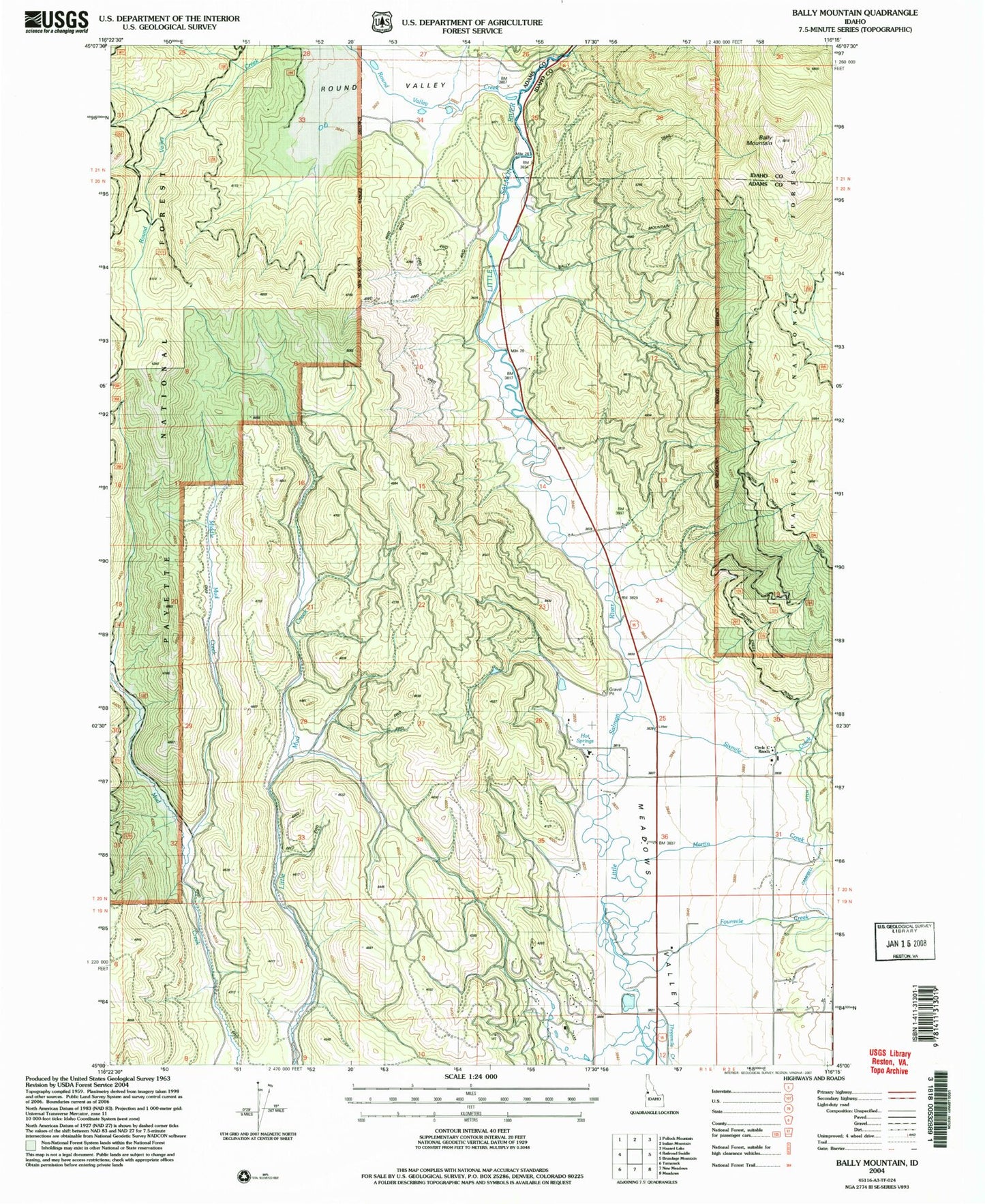
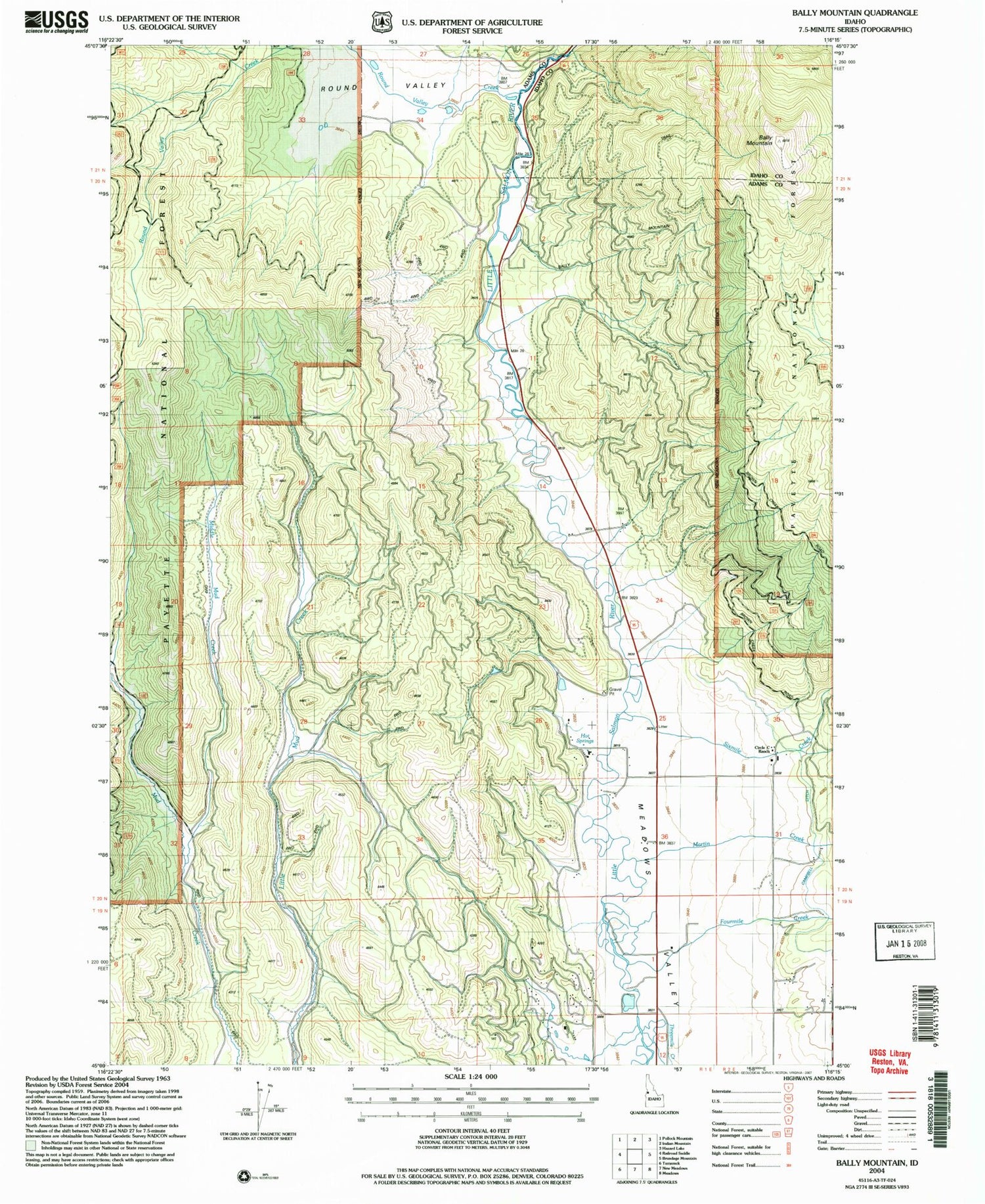
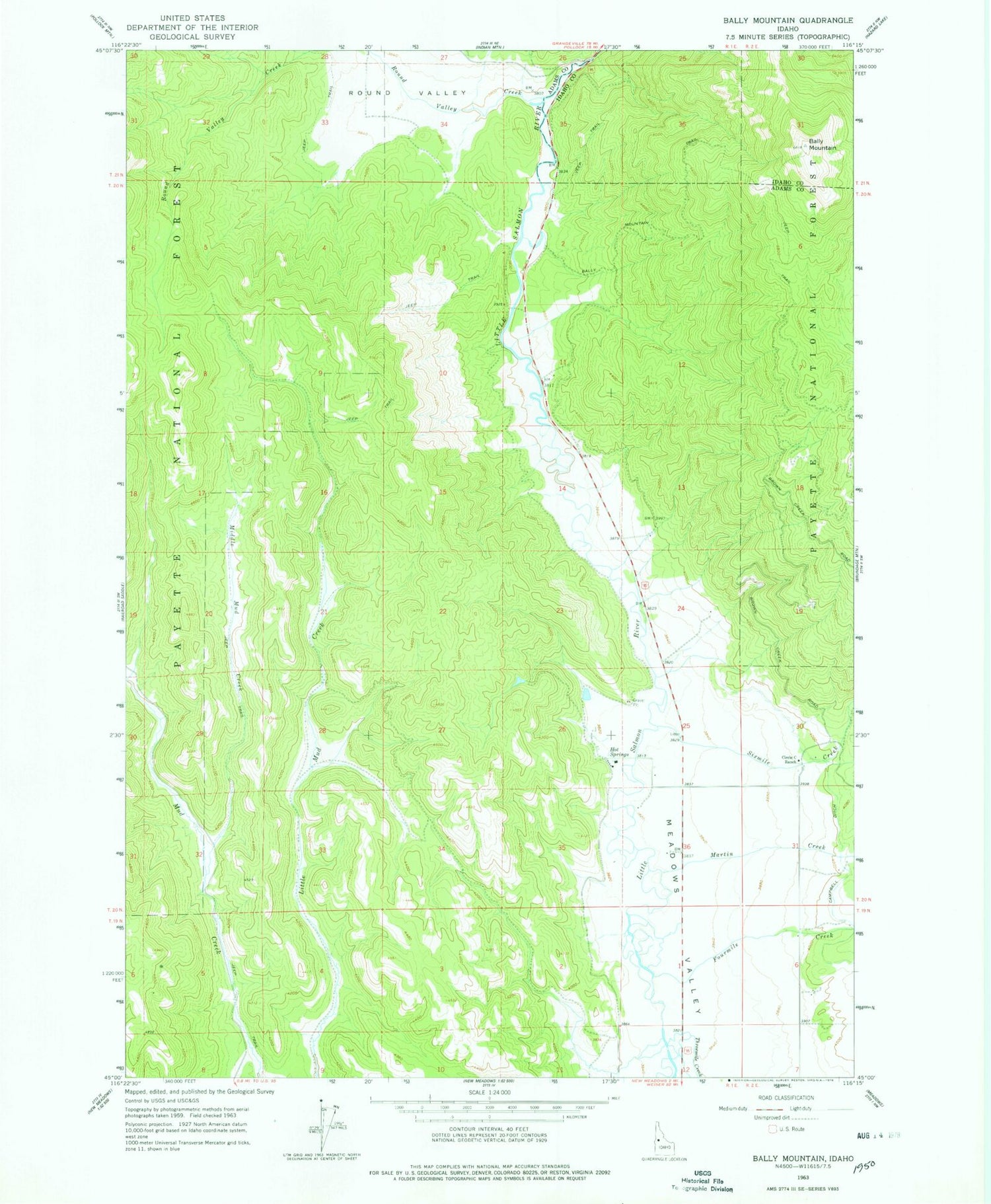
Classic USGS Bally Mountain Idaho 7.5'x7.5' Topo Map
Regular price
$16.95
Regular price
Sale price
$16.95
Unit price
per
Couldn't load pickup availability
Historical USGS topographic quad map of Bally Mountain in the state of Idaho. Map scale may vary for some years, but is generally around 1:24,000. Print size is approximately 24" x 27"
This quadrangle is in the following counties: Adams, Idaho.
The map contains contour lines, roads, rivers, towns, and lakes. Printed on high-quality waterproof paper with UV fade-resistant inks, and shipped rolled.
Contains the following named places: Bally Mountain, Circle C Ranch, Fourmile Creek, Hot Springs, Martin Creek, Meadows Valley, Middle Mud Creek, New Meadows Division, Round Valley, Round Valley Creek, Sixmile Creek, Threemile Creek, ZIP Code: 83654