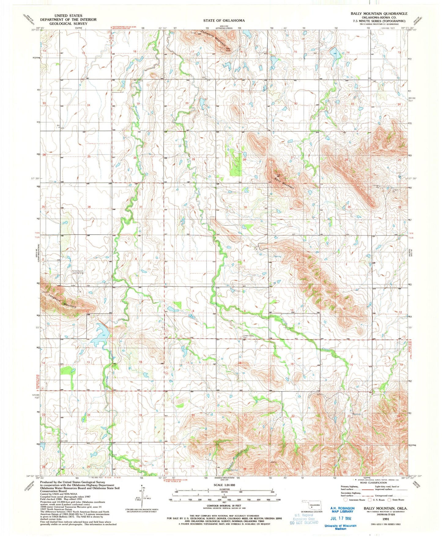
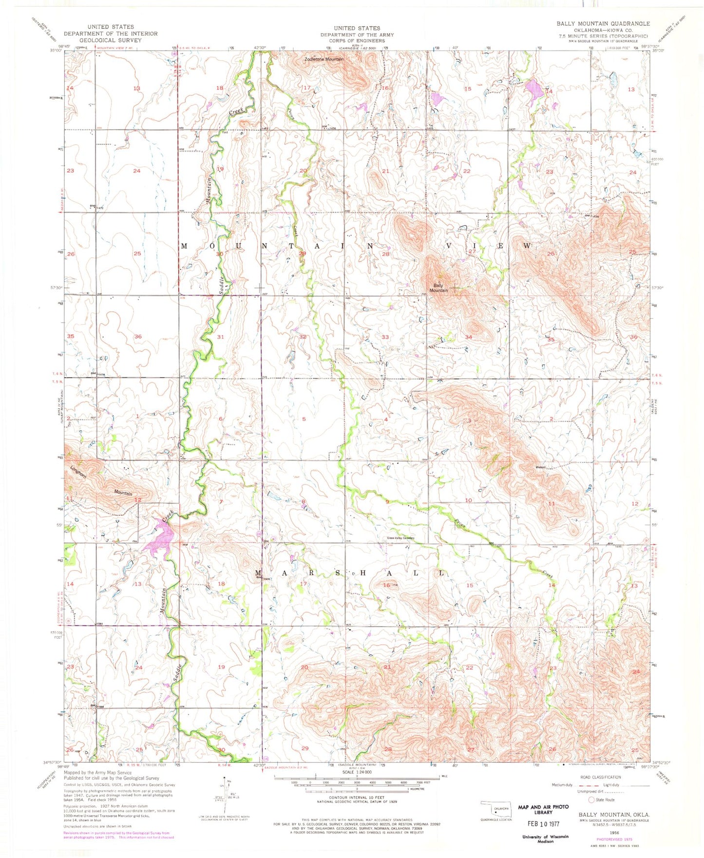
MyTopo
Classic USGS Bally Mountain Oklahoma 7.5'x7.5' Topo Map
Couldn't load pickup availability
Historical USGS topographic quad map of Bally Mountain in the state of Oklahoma. Map scale may vary for some years, but is generally around 1:24,000. Print size is approximately 24" x 27"
This quadrangle is in the following counties: Kiowa.
The map contains contour lines, roads, rivers, towns, and lakes. Printed on high-quality waterproof paper with UV fade-resistant inks, and shipped rolled.
Contains the following named places: Bally Mountain, Ferrell Ranch Airport, Green Valley Cemetery, Longhorn Mountain, Saddle Mountain Site 10 Dam, Saddle Mountain Site 10 Reservoir, Saddle Mountain Site 11 Dam, Saddle Mountain Site 11 Reservoir, Saddle Mountain Site 4 Dam, Saddle Mountain Site 4 Reservoir, Saddle Mountain Site 5 Dam, Saddle Mountain Site 5 Reservoir, Saddle Mountain Site 6 Dam, Saddle Mountain Site 6 Reservoir, South Clinton Laterals Site L15 Reservoir, Township of Marshall, Zodletone Mountain