MyTopo
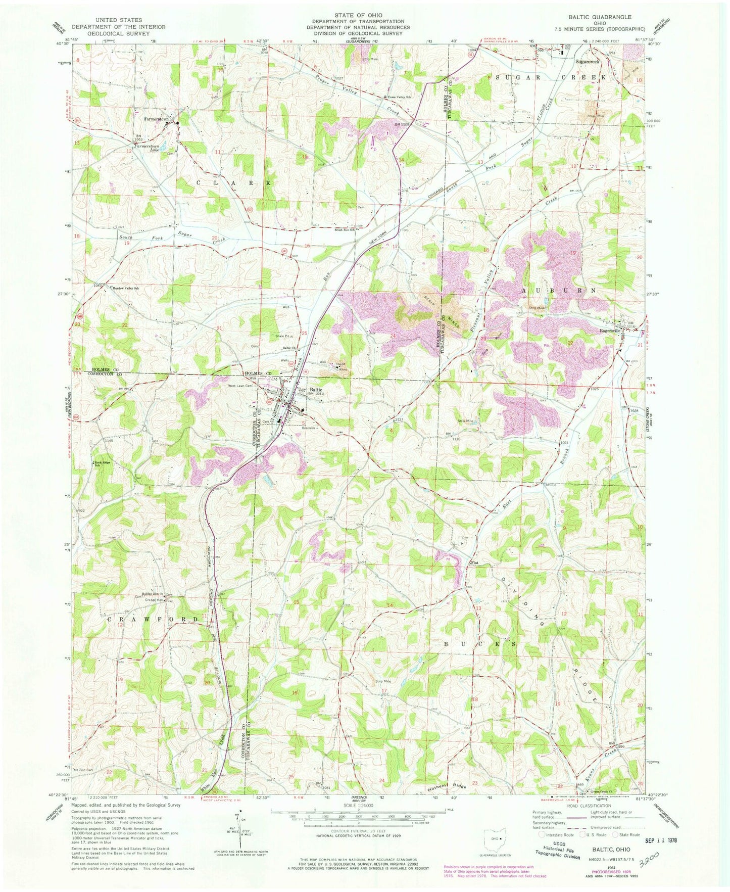
Classic USGS Baltic Ohio 7.5'x7.5' Topo Map
Couldn't load pickup availability
Historical USGS topographic quad map of Baltic in the state of Ohio. Map scale may vary for some years, but is generally around 1:24,000. Print size is approximately 24" x 27"
This quadrangle is in the following counties: Coshocton, Holmes, Tuscarawas.
The map contains contour lines, roads, rivers, towns, and lakes. Printed on high-quality waterproof paper with UV fade-resistant inks, and shipped rolled.
Contains the following named places: Andreas School, Baltic, Baltic Cemetery, Baltic Church, Baltic Elementary School, Baltic Fire and Rescue Department, Baltic Park Place, Baltic Post Office, Berger Cemetery, Brush Run, Brush Run School, Cattail Creek, Dividing Ridge, Evans Creek Church, Evans Creek Lutheran Cemetery, Evans Creek School, Farmerstown, Farmerstown Cemetery, Farmerstown Lake, Farmerstown Post Office, Fiat, Fiat Cemetery, Fiat Post Office, Fisher Cemetery, Haas School, Halifax Cemetery, Halifax School, Halifax Zion Church, Harshman School, Holly, Holly Post Office, Hostetler Cemetery, Lower Cemetery, Meadow Valley School, Mount Zion Cemetery, Oak Valley School, Pleasant Hill School, Pleasant Valley School, Ragersville, Ragersville Cemetery, Ragersville Elementary School, Rock Ridge School, Saint John Lutheran Church, Salem Church, School Number 9, Selton Cemetery, Townquarter School, Township of Bucks, Township of Clark, Troyer School, Troyer Valley Creek, Union Valley School, Village of Baltic, West Lawn Cemetery, Zion United Church of Christ, ZIP Code: 43804