MyTopo
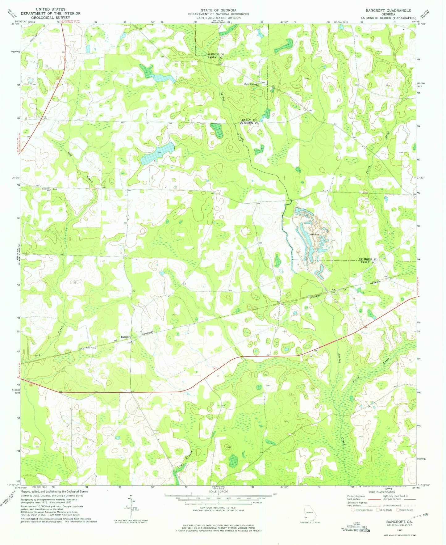
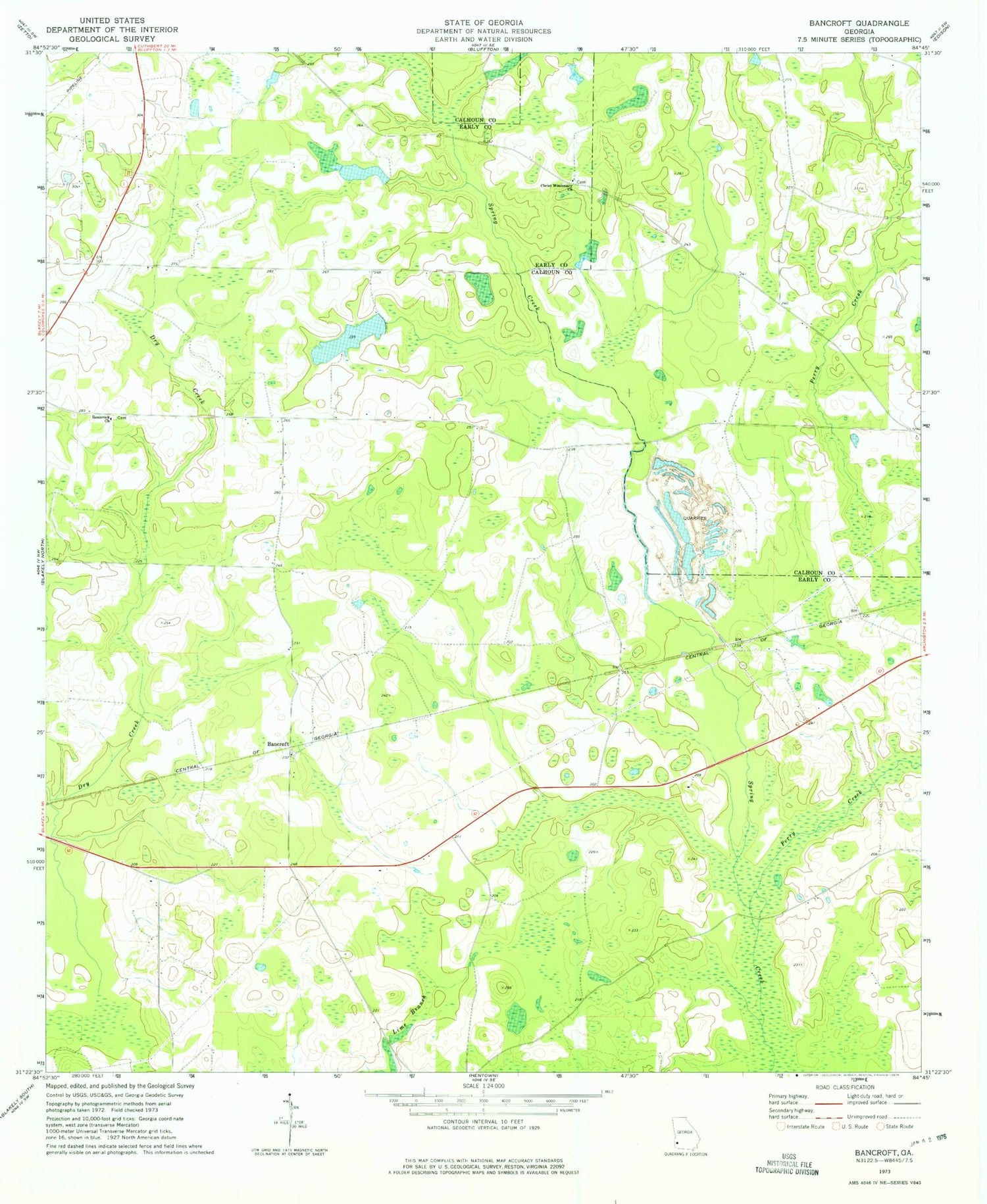
Classic USGS Bancroft Georgia 7.5'x7.5' Topo Map
Couldn't load pickup availability
Historical USGS topographic quad map of Bancroft in the state of Georgia. Map scale is 1:24000. Print size is approximately 24" x 27"
This quadrangle is in the following counties: Calhoun, Early.
The map contains contour lines, roads, rivers, towns, and lakes. Printed on high-quality waterproof paper with UV fade-resistant inks, and shipped rolled.
Contains the following named places: Arms of Faith Missionary Baptist Church, Arms of Faith Missionary Baptist Church Cemetery, Bancroft, Christ Missionary Baptist Church Cemetery, Christ Missionary Church, Dixie Cemetery, Hattaways Gin (historical), Kolomoki Plantation Lake, Kolomoki Plantation Lake Dam, Lee Branch, Matt Gilbert Cemetery, Mulligan Branch, Number Five Branch, Number Seven Branch, Perry Creek, Ralph Balkcom Dam, Rosinvick Church, Rosinvick Freewill Baptist Church Cemetery, Spring Creek School (historical)