MyTopo
Classic USGS Bancroft Louisiana 7.5'x7.5' Topo Map
Couldn't load pickup availability
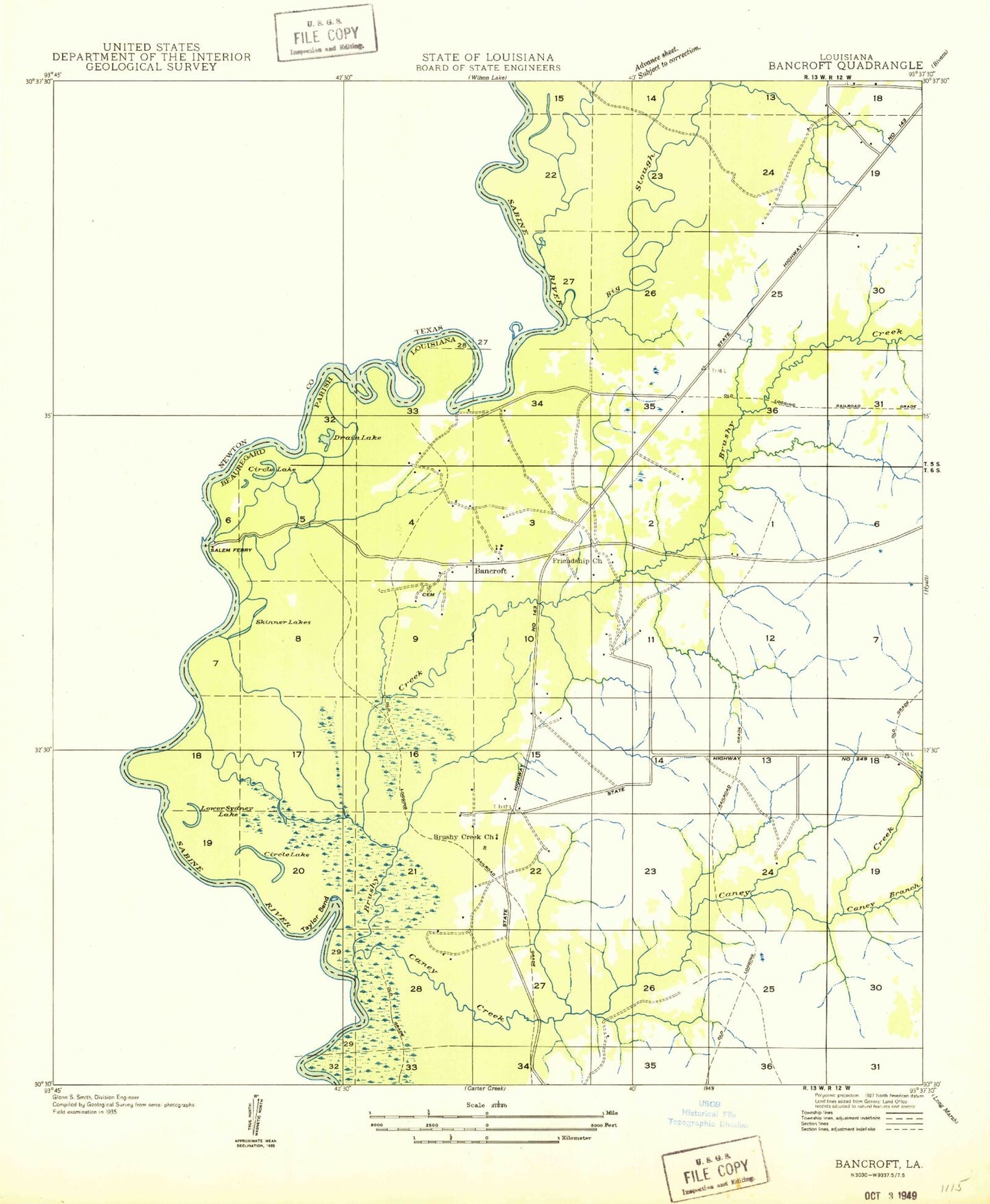
Historical USGS topographic quad map of Bancroft in the states of Louisiana, Texas. Typical map scale is 1:24,000, but may vary for certain years, if available. Print size: 24" x 27"
This quadrangle is in the following counties: Beauregard, Newton.
The map contains contour lines, roads, rivers, towns, and lakes. Printed on high-quality waterproof paper with UV fade-resistant inks, and shipped rolled.
Contains the following named places: Bancroft, Big Slough, Brushy Creek, Bugger Branch, Caney Branch, Caney Creek, Cool Slough, Duck Roost Lake, North Bancroft Oil Field, Rattlesnake Slough, Spikes Cemetery, Bee Slough, Bird Branch, Friendship Church, Long Branch, Taylor Bend, Brushy Creek School (historical), Skinner Lakes Oil Field, Salem Ferry (historical), Bancroft School (historical), Bancroft Oil Field, Brushy Creek Missionary Baptist Church, Drain Lake, Duck Lake, Long Lake, Lower Circle Lake, Skinner Lake, Sydney Lake, Upper Circle Lake, Morning Star Church of God in Christ, Big Cow Creek, Big Slough, Biloxi School, Bose Lake, Donahoe Creek, Fredonia Church, Howell Lake, Pecan Lake, Pine Lake, Sime Lake, Simms Branch, Snider Bend, Whitmans Ferry (historical)