MyTopo
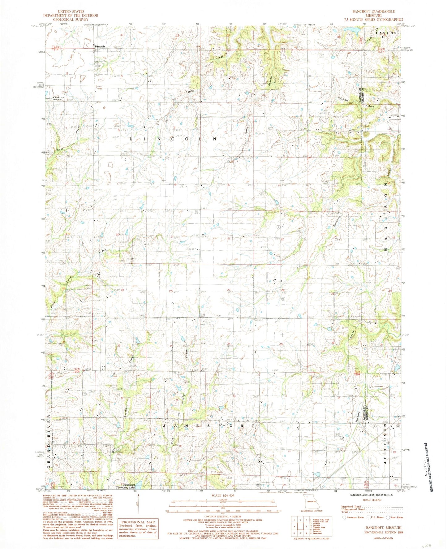
Classic USGS Bancroft Missouri 7.5'x7.5' Topo Map
Couldn't load pickup availability
Historical USGS topographic quad map of Bancroft in the state of Missouri. Map scale may vary for some years, but is generally around 1:24,000. Print size is approximately 24" x 27"
This quadrangle is in the following counties: Daviess, Grundy.
The map contains contour lines, roads, rivers, towns, and lakes. Printed on high-quality waterproof paper with UV fade-resistant inks, and shipped rolled.
Contains the following named places: Antioch Cemetery, Antioch Church, Ashbrook Chapel, Bancroft, Billy Herrin Lake, Boyd School, Charity School, Gates Lake Dam, Griffin School, Liberty School, McCarty Lake Dam, Mount Pleasant School, Pilot Grove Number 1 Church, Pilot Grove Number 2 Cemetery, Pilot Grove Number Two Church, Pilot Grove School, Pleasant Grove School, Prairie Center School, Red School, Township of Jamesport, Township of Lincoln, Wayne Moore Lake, Wilson Hollow