
MyTopo
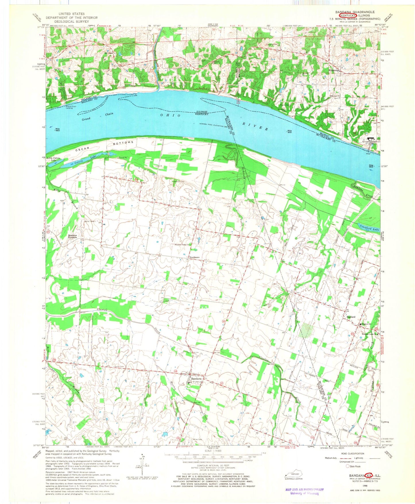
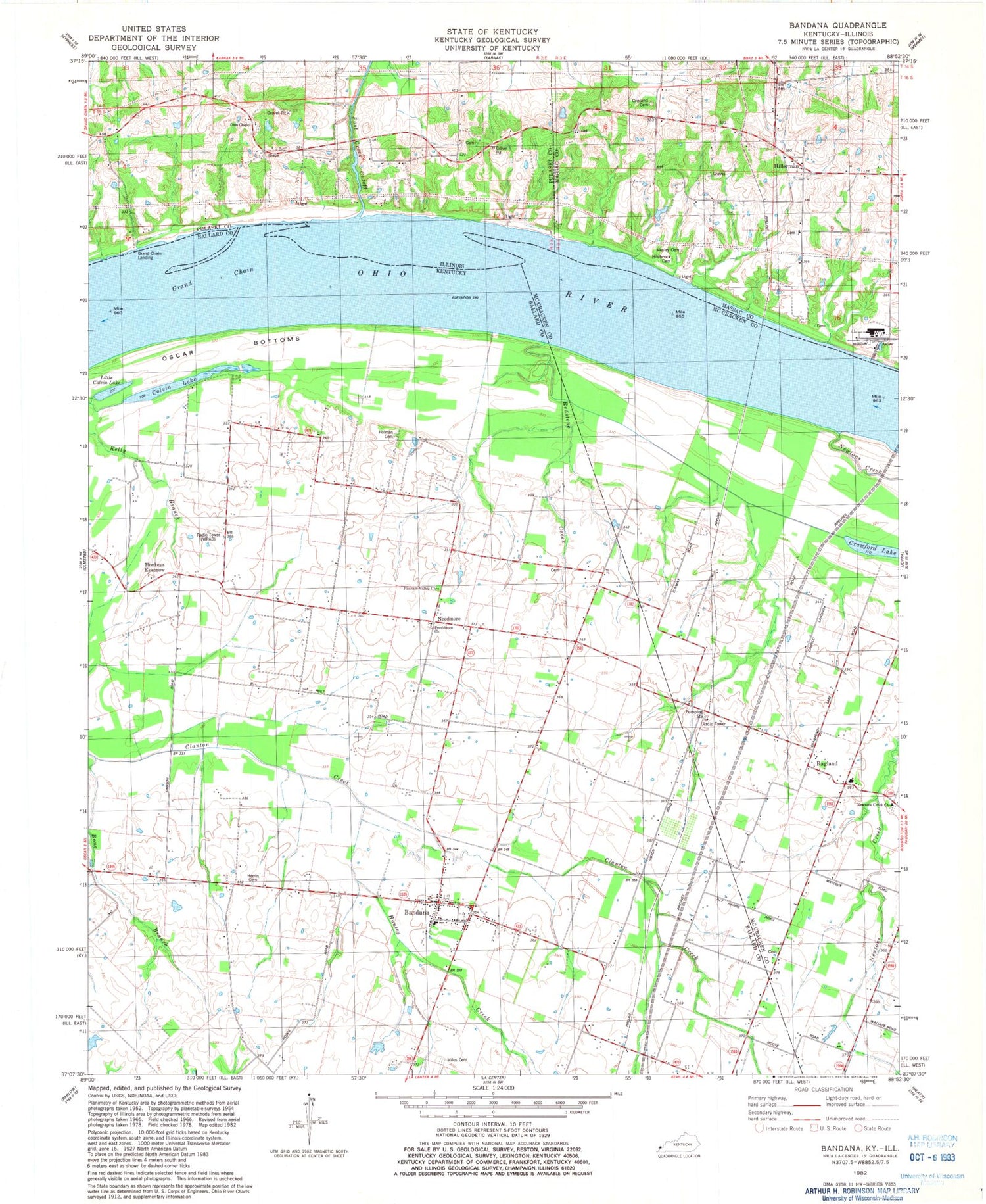
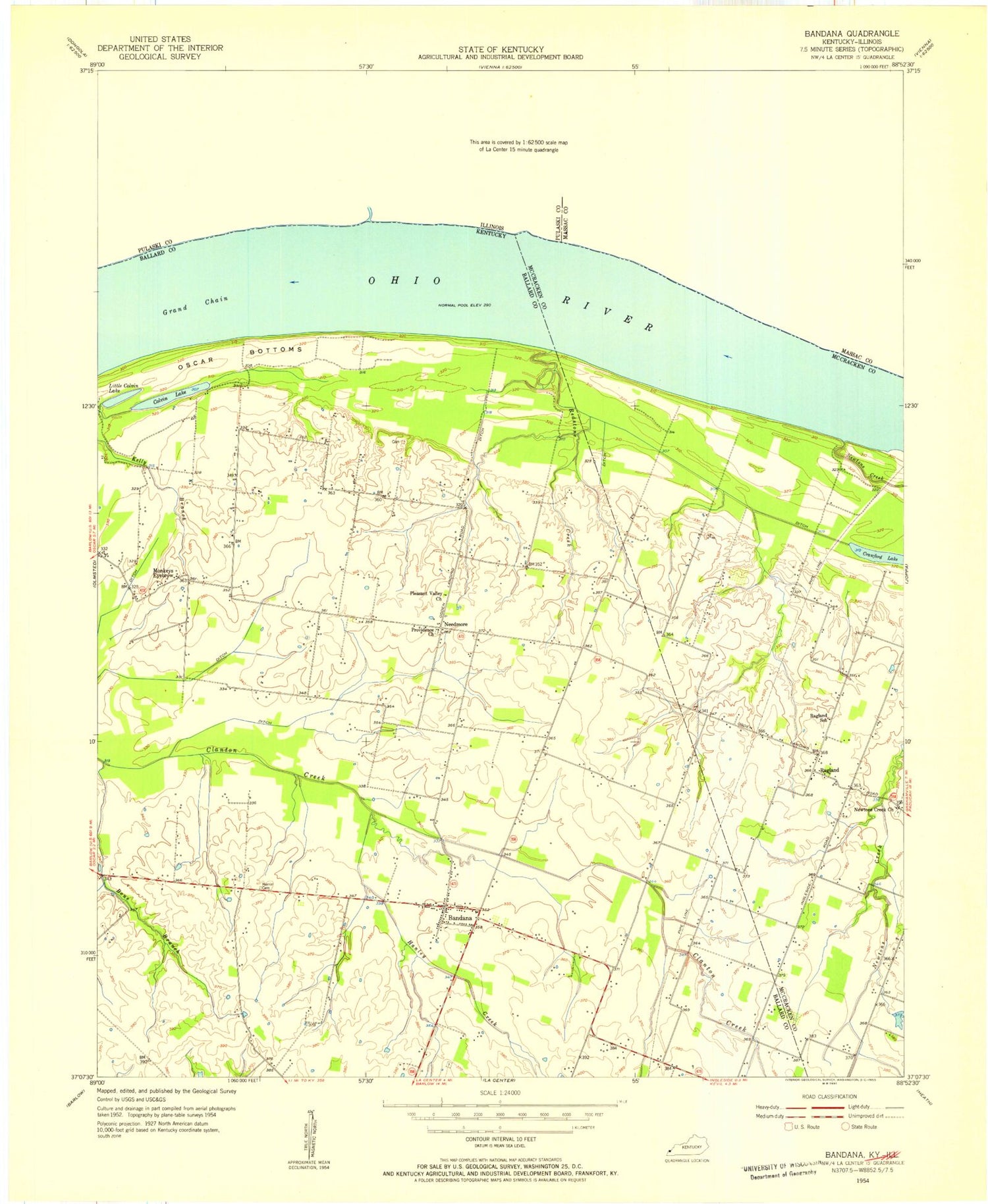
Classic USGS Bandana Kentucky 7.5'x7.5' Topo Map
Couldn't load pickup availability
Historical USGS topographic quad map of Bandana in the states of Kentucky, Illinois. Map scale may vary for some years, but is generally around 1:24,000. Print size is approximately 24" x 27"
This quadrangle is in the following counties: Ballard, Massac, McCracken, Pulaski.
The map contains contour lines, roads, rivers, towns, and lakes. Printed on high-quality waterproof paper with UV fade-resistant inks, and shipped rolled.
Contains the following named places: Bandana, Bandana Census Designated Place, Bandana Post Office, Bandana Volunteer Fire Department, Beelers Hill, Bone Branch, Colvin Lake, Copland Cemetery, Crawford Lake, Grand Chain, Grand Chain Landing, Hanley Creek, Herrin Cemetery, Hillerman, Hillerman Church, Hillerman Rock, Hitchcock Cemetery, Holman Cemetery, Lee, Little Colvin Lake, Miles Cemetery, Monkeys Eyebrow, Mosley Cemetery, Needmore, Newtons Creek, Newtons Creek Cemetery, Newtons Creek Church, Ohio Chapel, Ohio Chapel Cemetery, Pleasant Valley Church, Post Creek Cutoff, Providence Cemetery, Ragland, Ragland School, Redstone Creek, Round Pond School, WDKA-TV (Paducah), WPSD-TV (Paducah), ZIP Codes: 42022, 62941