MyTopo
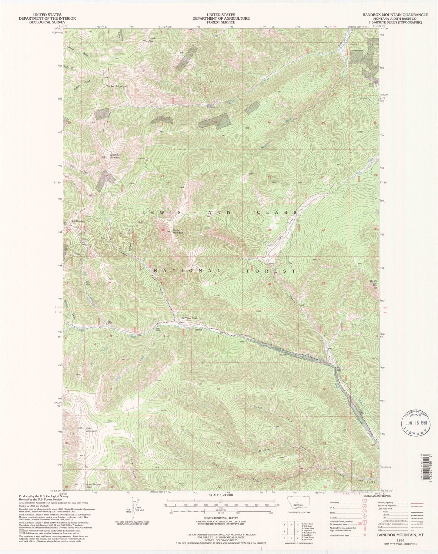
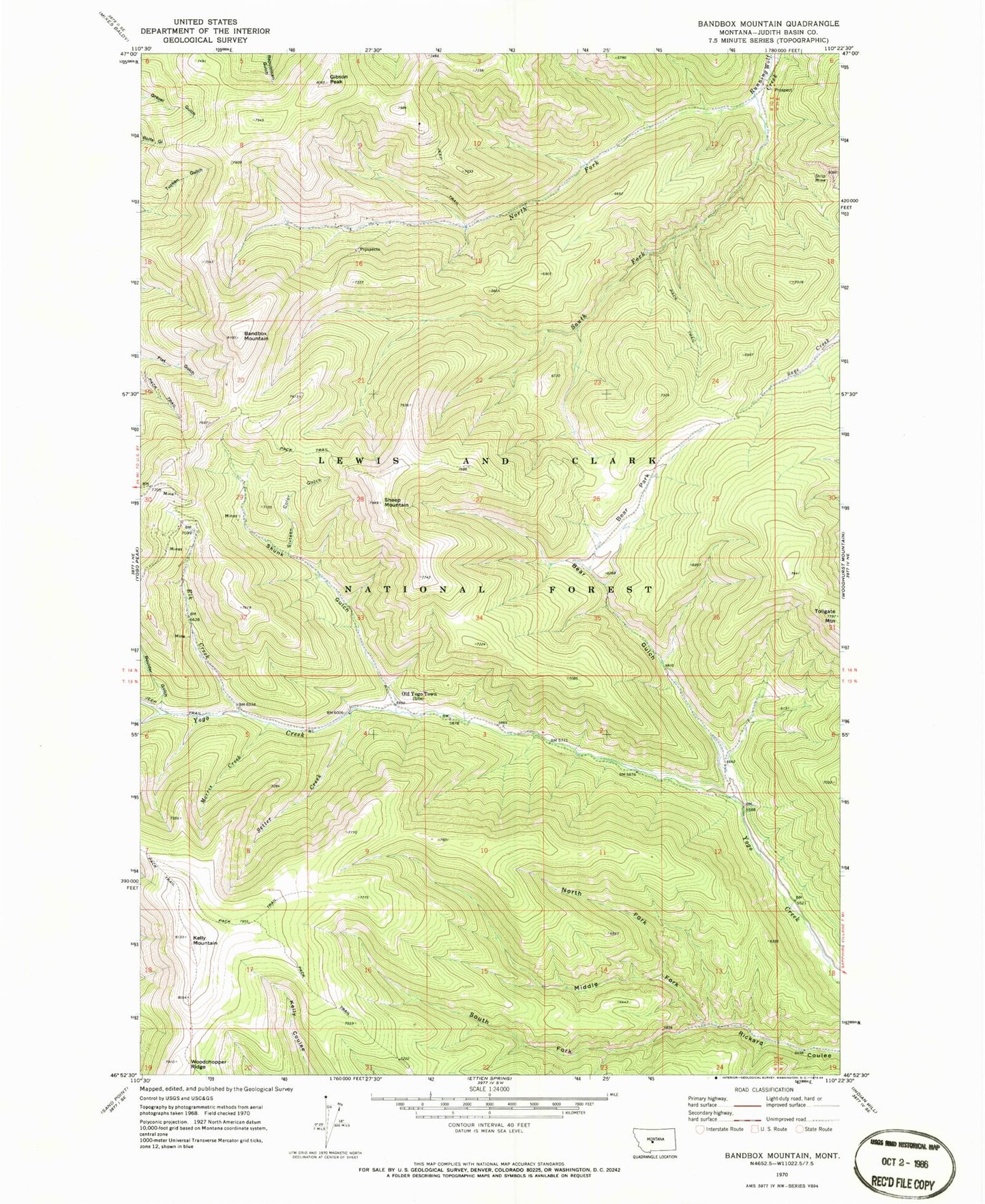
Classic USGS Bandbox Mountain Montana 7.5'x7.5' Topo Map
Couldn't load pickup availability
Historical USGS topographic quad map of Bandbox Mountain in the state of Montana. Typical map scale is 1:24,000, but may vary for certain years, if available. Print size: 24" x 27"
This quadrangle is in the following counties: Judith Basin.
The map contains contour lines, roads, rivers, towns, and lakes. Printed on high-quality waterproof paper with UV fade-resistant inks, and shipped rolled.
Contains the following named places: Bandbox Mountain, Bear Gulch, Bear Park, Boulder Gulch, Elk Creek, Gibson Peak, Kelly Mountain, Middle Fork Rickard Coulee, Morris Creek, North Fork Rickard Coulee, North Fork Running Wolf Creek, Old Yogo Town, Setter Creek, Sheep Mountain, Sixteen Color Gulch, Skunk Gulch, South Fork Rickard Coulee, South Fork Running Wolf Creek, Tollgate Mountain, Woodchopper Ridge, Tucken Mountain, Elk Saddle, Gold Bug Mine, NW SW Section 32 Mine, Running Wolf Deposit Mine, SW NW Section 10 Mine, NW NE Section 16 Mine, NE NW Section 16 Mine, SE NW Section 16 Mine, SW NW Section 15 Mine, NE NE Section 12 Mine, NW NW Section 14 Mine, Skunk Gulch Placer Mine, Old Yogo Townsite Mine, SW SE Section 33 Mine, SE NE Section 30 Mine, SW SE Section 29 Mine, NE NE Section 31 Mine, Yogo Post Office (historical), Kalatta Post Office (historical), Hoover Post Office (historical), Hoover (historical), Cameron (historical)