MyTopo
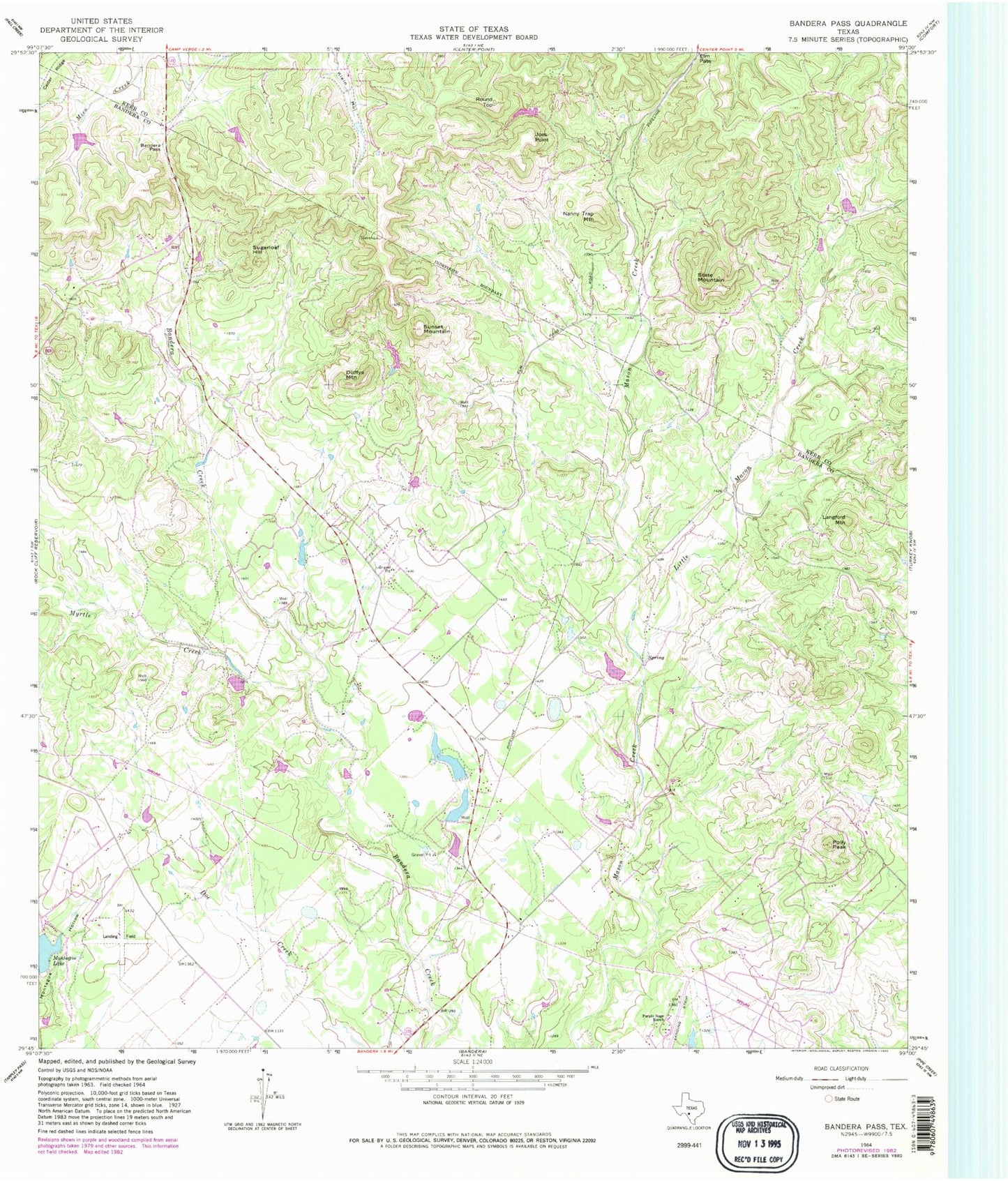
Classic USGS Bandera Pass Texas 7.5'x7.5' Topo Map
Couldn't load pickup availability
Historical USGS topographic quad map of Bandera Pass in the state of Texas. Map scale is 1:24000. Print size is approximately 24" x 27"
This quadrangle is in the following counties: Bandera, Kerr.
The map contains contour lines, roads, rivers, towns, and lakes. Printed on high-quality waterproof paper with UV fade-resistant inks, and shipped rolled.
Contains the following named places: Bains Private Airport, Bandera County Sheriff's Office, Bandera Pass, Duffys Mountain, Eagles Roost Airport (historical), Elm Pass, Elm Pass Volunteer Fire Department, English Hollow, H and K Lake, H and K Lake Dam, Joes Point, KHLC-FM (Bandera), KHLC-FM (Bandera), Langford Mountain, Little Mason Creek, Montague Lake, Morgan Lake, Morgan Lake Dam, Mosher Big Lake, Mosher Big Lake Dam, Mosher Little Lake, Mosher Little Lake Dam, Myrtle Creek, Nanny Trap Mountain, Polly Peak, Purple Sage Ranch, Purple Sage Ranch Airfield (historical), Round Top, State Mountain, Sugarloaf Hill, Sunset Mountain