MyTopo
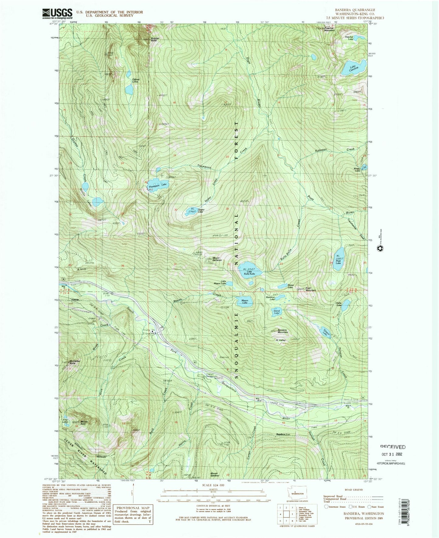
Classic USGS Bandera Washington 7.5'x7.5' Topo Map
Couldn't load pickup availability
Historical USGS topographic quad map of Bandera in the state of Washington. Typical map scale is 1:24,000, but may vary for certain years, if available. Print size: 24" x 27"
This quadrangle is in the following counties: King.
The map contains contour lines, roads, rivers, towns, and lakes. Printed on high-quality waterproof paper with UV fade-resistant inks, and shipped rolled.
Contains the following named places: Alice Creek, Alice Lakes, Bandera, Bandera Mountain, Blazer Lake, Camp Joy, Lake Caroline, Carter Creek, Mount Defiance, Garcia, Gifford Lakes, Granite Lakes, Hansen Creek, Harris Creek, Hatchet Lake, Island Lake, Kaleetan Creek, Mount Kent, Kulla Kulla Creek, Lake Kulla Kulla, Little Mason Lake, Mason Creek, Mason Lake, McClellan Butte, Mount Defiance Trail, Olallie Lake, Pratt Lake, Pratt Lake Trail, Pratt Mountain, Preacher Mountain, Rainbow Lake, Rock Creek, Russian Butte, Spider Creek, Spider Lake, Talapus Creek, Talapus Lake, Thompson Creek, Thompson Lake, Tuscohatchie Creek, Windy Lake, Wood Creek, North Bend Ranger District, Little Kulla Lake, Little Pratt Lake, Island Lakes, Mount Roosevelt Lake, Bandera State Airport, Snoqualmie National Forest Division (historical), Ira Spring Trail, Pratt Wild and Scenic River