MyTopo
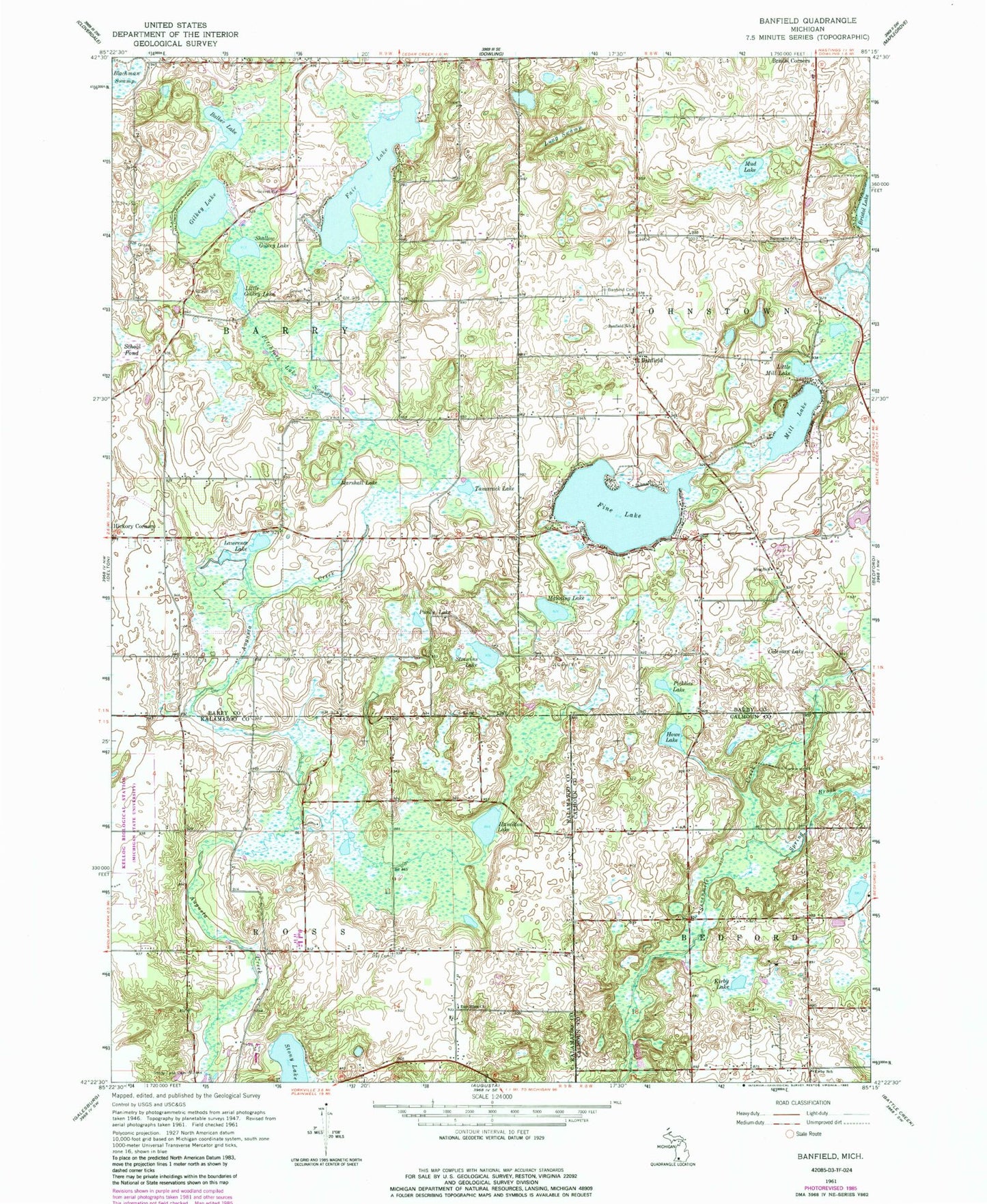
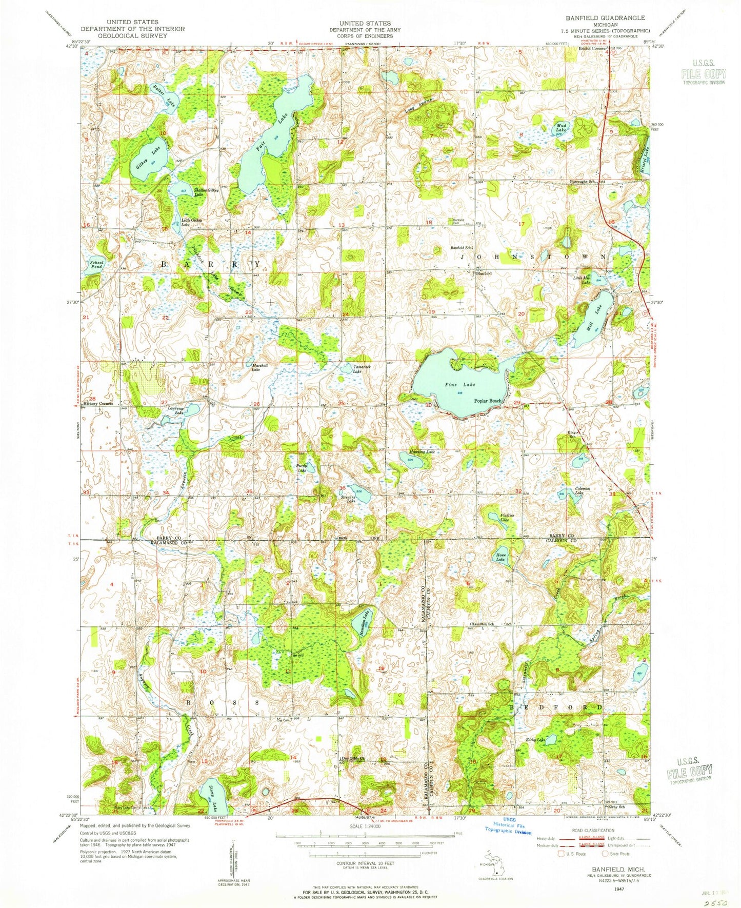
Classic USGS Banfield Michigan 7.5'x7.5' Topo Map
Couldn't load pickup availability
Historical USGS topographic quad map of Banfield in the state of Michigan. Map scale may vary for some years, but is generally around 1:24,000. Print size is approximately 24" x 27"
This quadrangle is in the following counties: Barry, Calhoun, Kalamazoo.
The map contains contour lines, roads, rivers, towns, and lakes. Printed on high-quality waterproof paper with UV fade-resistant inks, and shipped rolled.
Contains the following named places: Banfield, Banfield Cemetery, Banfield Post Office, Banfield School, Bulkey Lake, Burroughs School, Coleman Lake, Day Bible Church, Day Cemetery, East Hickory Corners Cemetery, Fair Lake, Fine Lake, Gaskill Post Office, Gilkey Lake, Hamilton Cemetery, Hamilton Lake, Howe Lake, Johnstown Post Office, King School, Kirby Lake, Kirby School, Lawrence Lake, Little Gilkey Lake, Little Mill Lake, Long Swamp, Manning Lake, Maple Hills Golf Course, Marshall Lake, Mill Lake, Mud Lake, Pickliss Lake, Pitchfork Lake Swamp, Purdy Lake, Ross Center Cemetery, School Pond, Seventh-Day Adventist Church, Shallow Gilkey Lake, Spring Brook, Stony Lake, Strewins Lake, Tamarack Lake, Township of Barry, Township of Ross