MyTopo
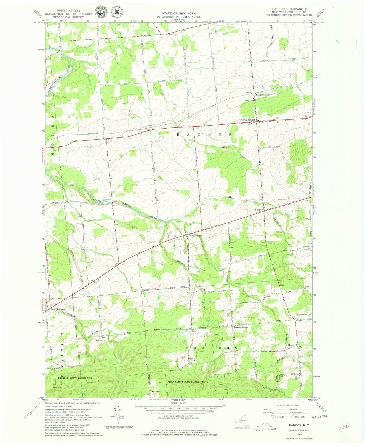
Classic USGS Bangor New York 7.5'x7.5' Topo Map
Couldn't load pickup availability
Historical USGS topographic quad map of Bangor in the state of New York. Map scale may vary for some years, but is generally around 1:24,000. Print size is approximately 24" x 27"
This quadrangle is in the following counties: Franklin.
The map contains contour lines, roads, rivers, towns, and lakes. Printed on high-quality waterproof paper with UV fade-resistant inks, and shipped rolled.
Contains the following named places: Bangor, Bangor Baptist Chapel, Bangor Cemetery, Bangor Fire Department, Bangor Station, Brandon Cemetery, Brandon Center, Develin Brook, Develin Cemetery, East Branch Little Salmon River, East Dickinson, Malone Quarry, North Bangor, North Bangor Cemetery, North Bangor Post Office, North Bangor Seventh Day Adventist Church, Plumb Hill Farm, Saint Augustine Cemetery, School Number 11, School Number 2, School Number 3, School Number 4, School Number 5, School Number 6, School Number 7, School Number 9, Skerry, Southworth Cemetery, Town of Bangor, West Bangor, ZIP Code: 12966