MyTopo
Classic USGS Bangs Mountain Washington 7.5'x7.5' Topo Map
Couldn't load pickup availability
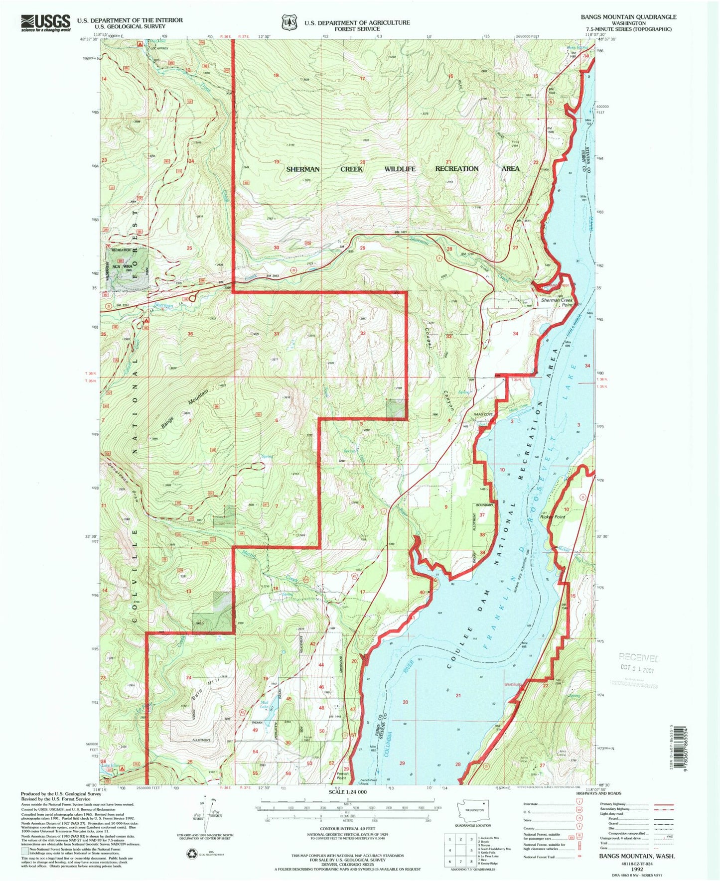
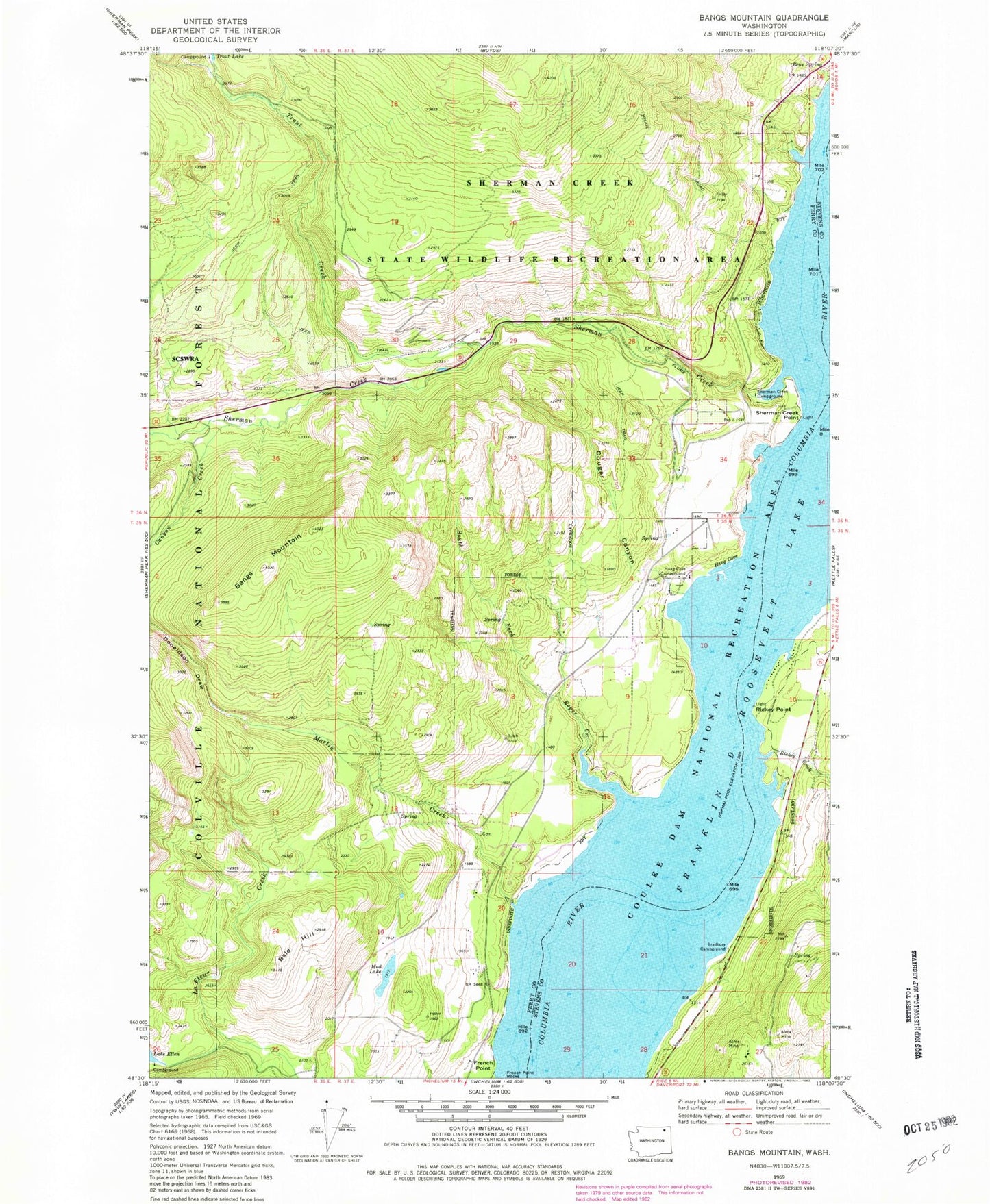
Historical USGS topographic quad map of Bangs Mountain in the state of Washington. Map scale may vary for some years, but is generally around 1:24,000. Print size is approximately 24" x 27"
This quadrangle is in the following counties: Ferry, Stevens.
The map contains contour lines, roads, rivers, towns, and lakes. Printed on high-quality waterproof paper with UV fade-resistant inks, and shipped rolled.
Contains the following named places: Acme Mine, Alma Mine, Bald Hill, Bangs Mountain, Bangs Mountain Vista, Barney's Junction Census Designated Place, Bens Spring, Beulah, Bradbury Campground, Canyon Creek, Canyon Creek Campground, Cougar Canyon, Donaldson Draw, French Point, French Point Rocks, Haag Cove, Haag Cove Campground, Joint Protection Ferry County Fire District 3 - Stevens County Fire District 8 Haag Cove Storage, Joint Protection Ferry County Fire District 3 - Stevens County Fire District 8 Station 5 Tipton, Lake Ellen Campground, Martin Creek, Mud Lake, Rickey Canyon, Rickey Creek, Rickey Point, Rickey Rapids, Roper Creek, Sherman Creek, Sherman Creek Campground, Sherman Creek Game Range, Sherman Creek Point, Sherman Creek State Wildlife Recreation Area, South Fork Roper Creek, Trout Creek, Trout Lake Campground