
MyTopo
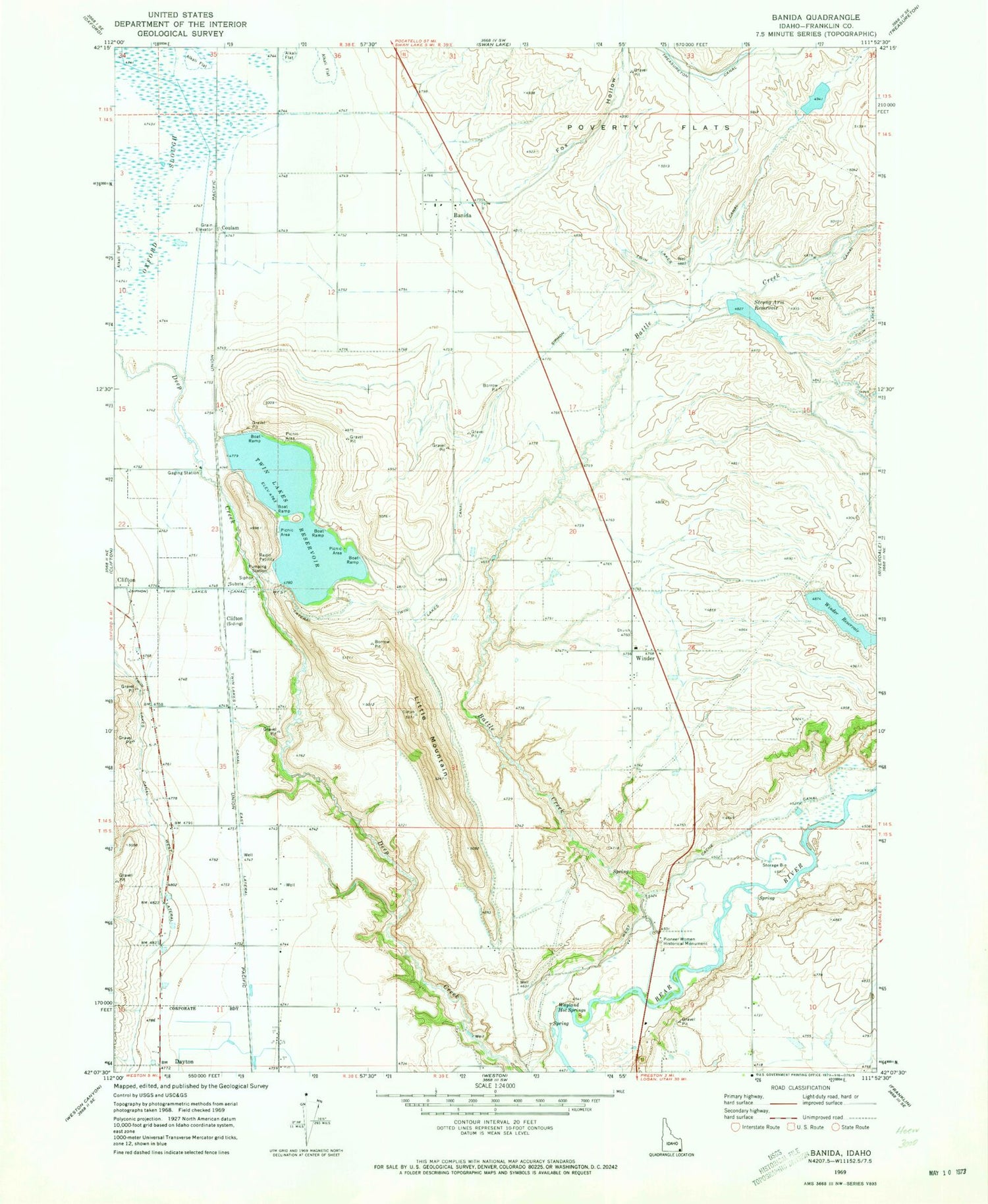
Classic USGS Banida Idaho 7.5'x7.5' Topo Map
Couldn't load pickup availability
Historical USGS topographic quad map of Banida in the state of Idaho. Map scale may vary for some years, but is generally around 1:24,000. Print size is approximately 24" x 27"
This quadrangle is in the following counties: Franklin.
The map contains contour lines, roads, rivers, towns, and lakes. Printed on high-quality waterproof paper with UV fade-resistant inks, and shipped rolled.
Contains the following named places: Banida, Battle Creek, Beers Spur, Casperson Dam, Coulam, Dayton Siding, Fox Hollow, Little Mountain, Oxford Slough, Pioneer Women Historical Monument, Poverty Flats, Strong Arm Reservoir, Strongarm Reservoir Number Two Dam, Twin Lakes Access Area, Twin Lakes Canal East Lateral, Twin Lakes Northwest Dam, Twin Lakes Reservoir, Twin Lakes Southwest Dam, Wayland Hot Springs, Winder, Winder Dam, Winder Reservoir, ZIP Code: 83232


