MyTopo
Classic USGS Banks Mississippi 7.5'x7.5' Topo Map
Couldn't load pickup availability
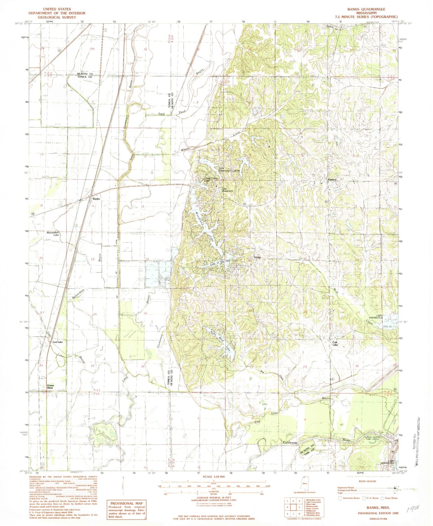
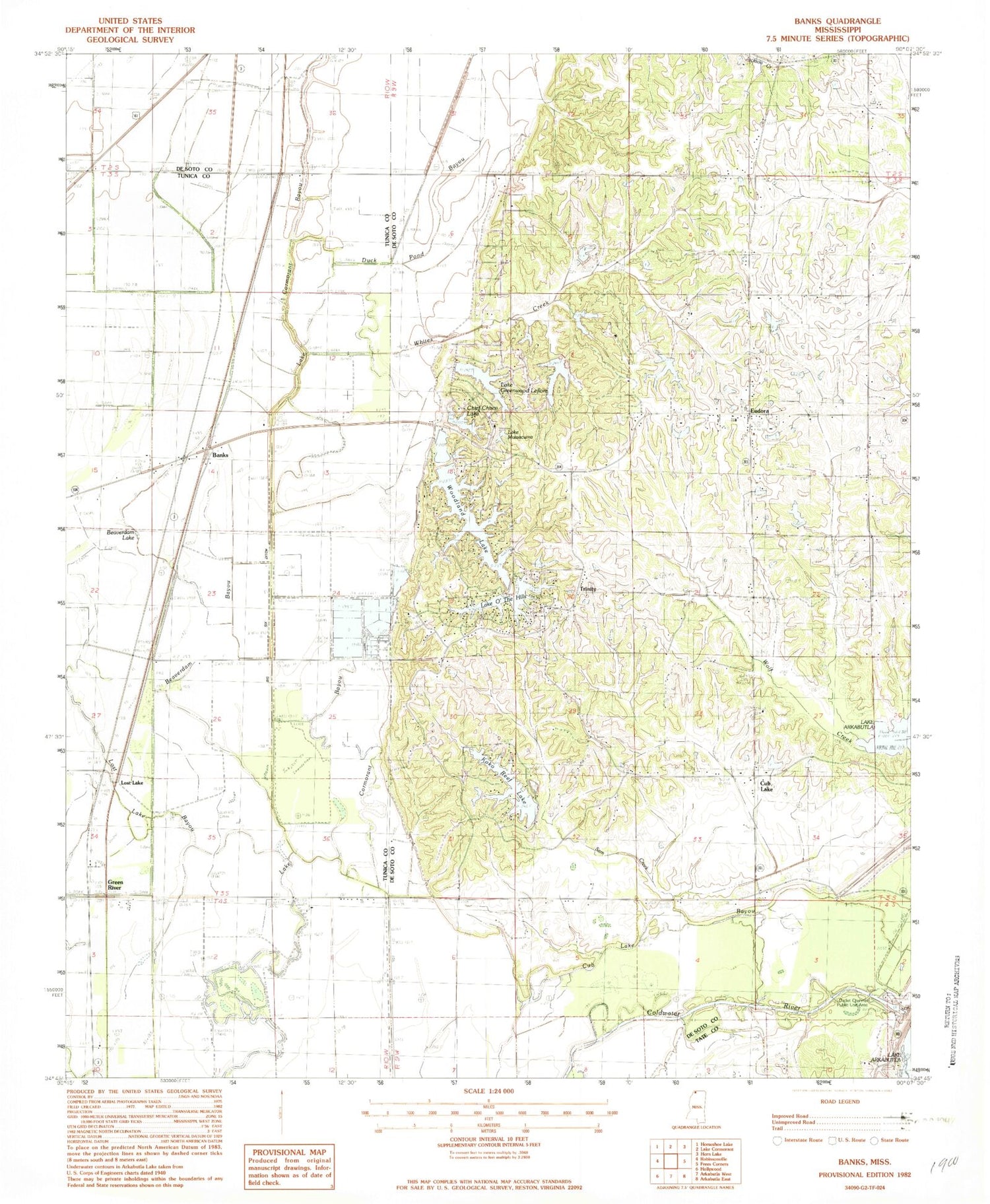
Historical USGS topographic quad map of Banks in the state of Mississippi. Typical map scale is 1:24,000, but may vary for certain years, if available. Print size: 24" x 27"
This quadrangle is in the following counties: DeSoto, Tate, Tunica.
The map contains contour lines, roads, rivers, towns, and lakes. Printed on high-quality waterproof paper with UV fade-resistant inks, and shipped rolled.
Contains the following named places: Banks, Beaverdam Bayou, Beaverdam Lake, Neeley Chapel, Pratt Bridge, Saint Lukes Church, Battle Ewing Catfish Ponds Dam, Outlet Channel Public Use Area, Bennetts Landing (historical), Big Six Ditch, Green River, Bullock School, Camp Currier, Cub Lake, Duck Pond Bayou, Eudora, Good Hope Church, Lakeside Church, Pleasant Grove School, Sam Creek, Trinity, Union Hill Church, Whites Creek, Wilson Store, Hugh Dancy Lake Dam, Chief Chisca Lake Dam, Lake O' the Hills Dam, Woodland Lake Dam, Delta Crest Subdivision Lake Dam, J A Earnheart Pond Dam, Harry Madision Pond Dam, W T Hendricks Pond Dam, R O Dees Pond Dam, Chickasaw Council Boy Scout Lake Dam, Chief Chisca Lake, Eudora Baptist Church, Lake Greenwood Leflore, Koko Reef Lake, Lake Mussacuma, Lake O' the Hills, Pleasant Grove Church, Trinity Church, Woodland Lake, Bullards Chapel Christian Methodist Episcopal Church, Lost Lake, Marienette, Eudora Presbyterian Church, Eudora Fire Department, Eudora Census Designated Place