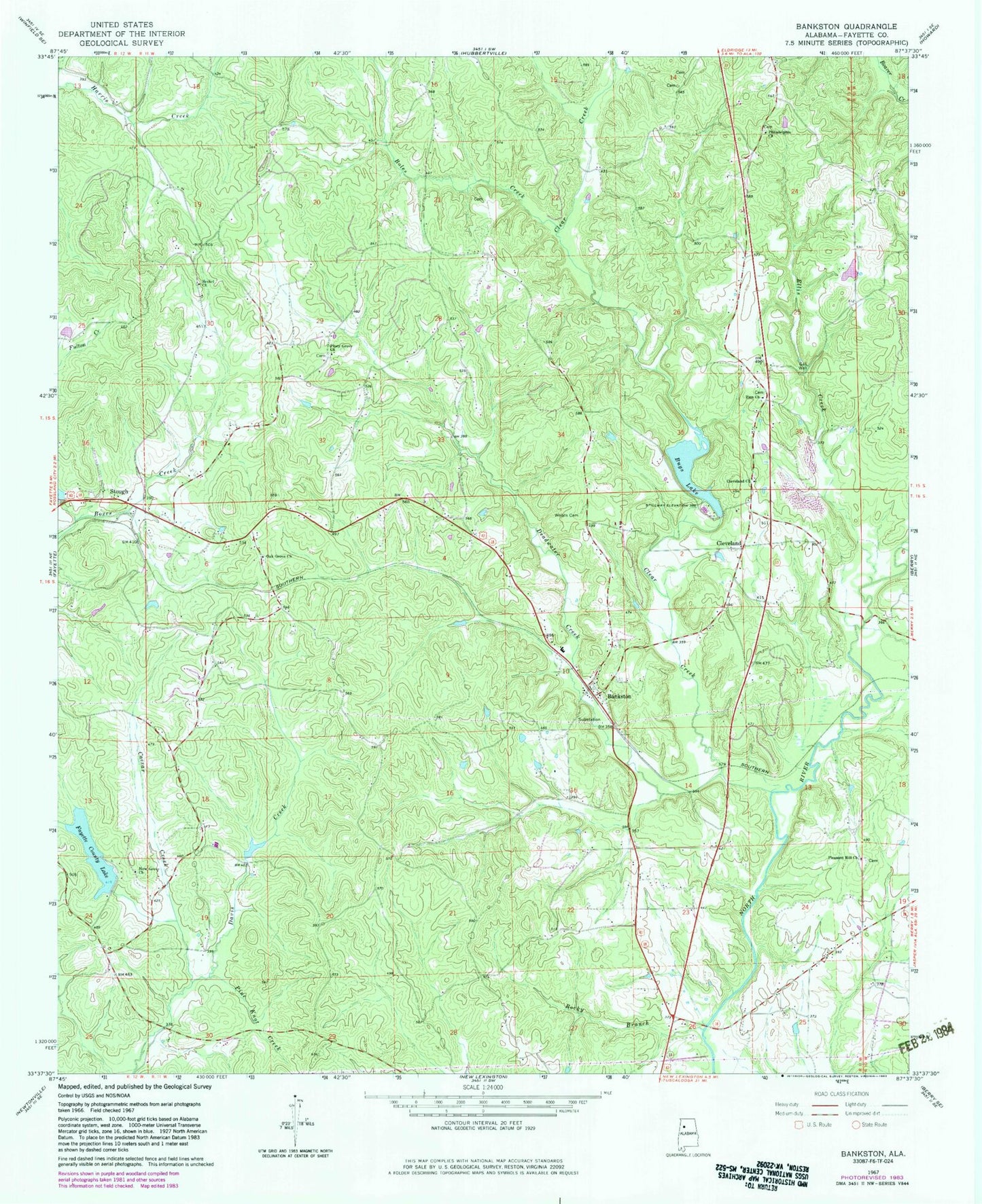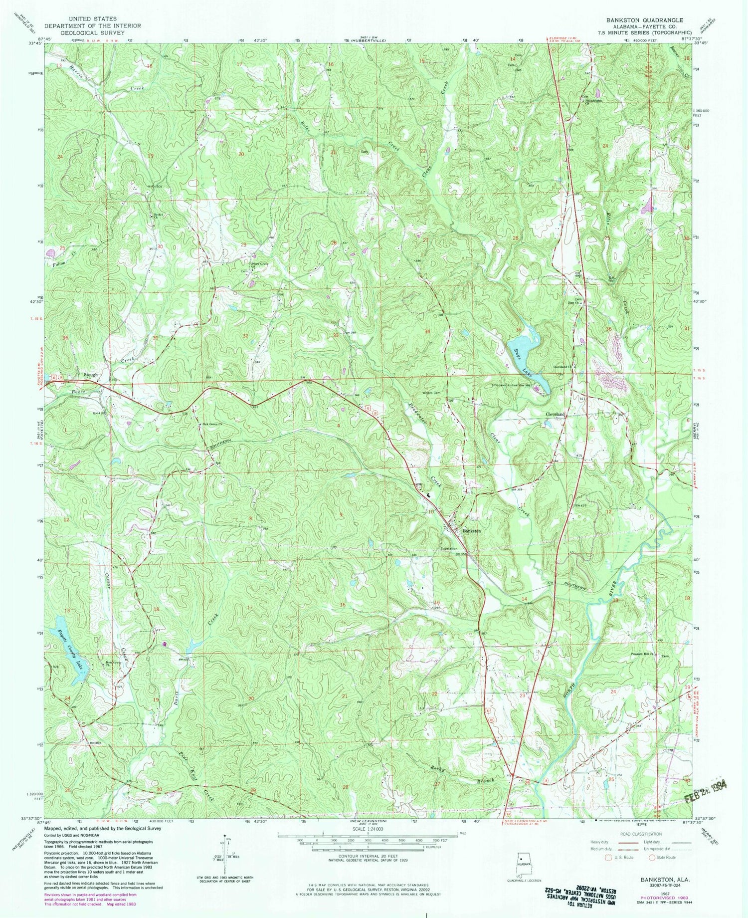
MyTopo
Classic USGS Bankston Alabama 7.5'x7.5' Topo Map
Couldn't load pickup availability
Historical USGS topographic quad map of Bankston in the state of Alabama. Map scale may vary for some years, but is generally around 1:24,000. Print size is approximately 24" x 27"
This quadrangle is in the following counties: Fayette.
The map contains contour lines, roads, rivers, towns, and lakes. Printed on high-quality waterproof paper with UV fade-resistant inks, and shipped rolled.
Contains the following named places: Baker Creek, Bankston, Bankston - Stough Volunteer Fire Department, Bankston Baptist Church, Bankston Cemetery, Bankston Church of Christ, Bankston Gas Field, Bankston Junior High School, Bankston Post Office, Berry Junction Gas Field, Bethel Cemetery, Bethel Church, Bethel School, Boles Creek, Bugs Lake, Bugs Lake Dam, Caesar Creek, Clear Creek, Cleveland, Cleveland Cemetery, Cleveland Church of Christ, Deadwater Creek, Ellis Creek, Fayette County, Fayette County Lake, Fayette County Public Lake Dam, Hartline Church, Liberty Church, Little Piney Creek, Mars Hill School, New Grove Church, New River Post Office, Oak Grove Cemetery, Oak Grove Methodist Church, Oak Grove School, Original Church, Philadelphia Baptist Church, Philadelphia Cemetery, Phillips Memorial Cemetery, Pine Knot Creek, Piney Grove Cemetery, Piney Grove Church, Pleasant Hill Cemetery, Pleasant Hill Church, Rock Hill School, Rocky Branch, Sheffield Post Office, Simmons School, Stough, Woods Cemetery, Zion Cemetery, Zion Church, ZIP Code: 35542