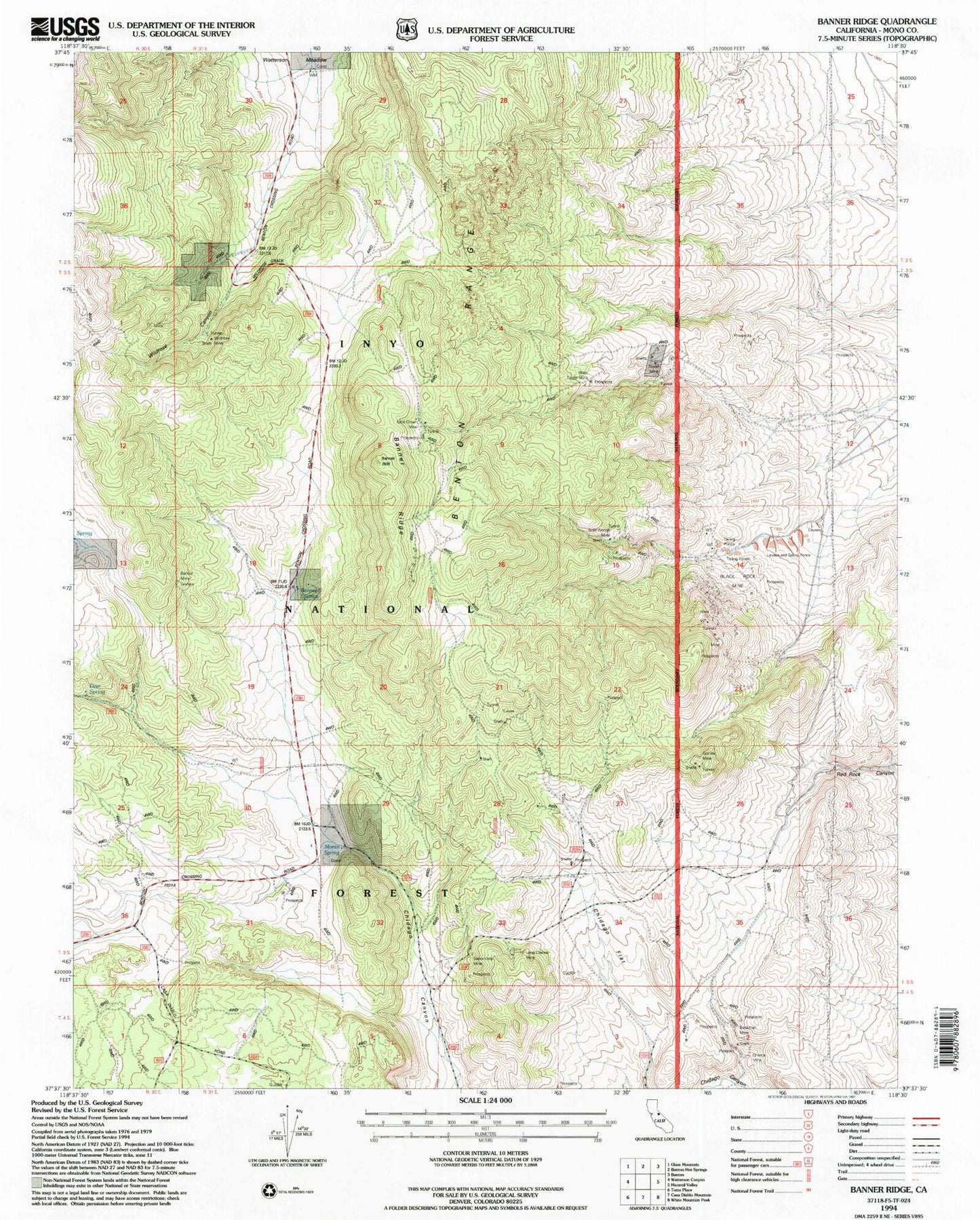
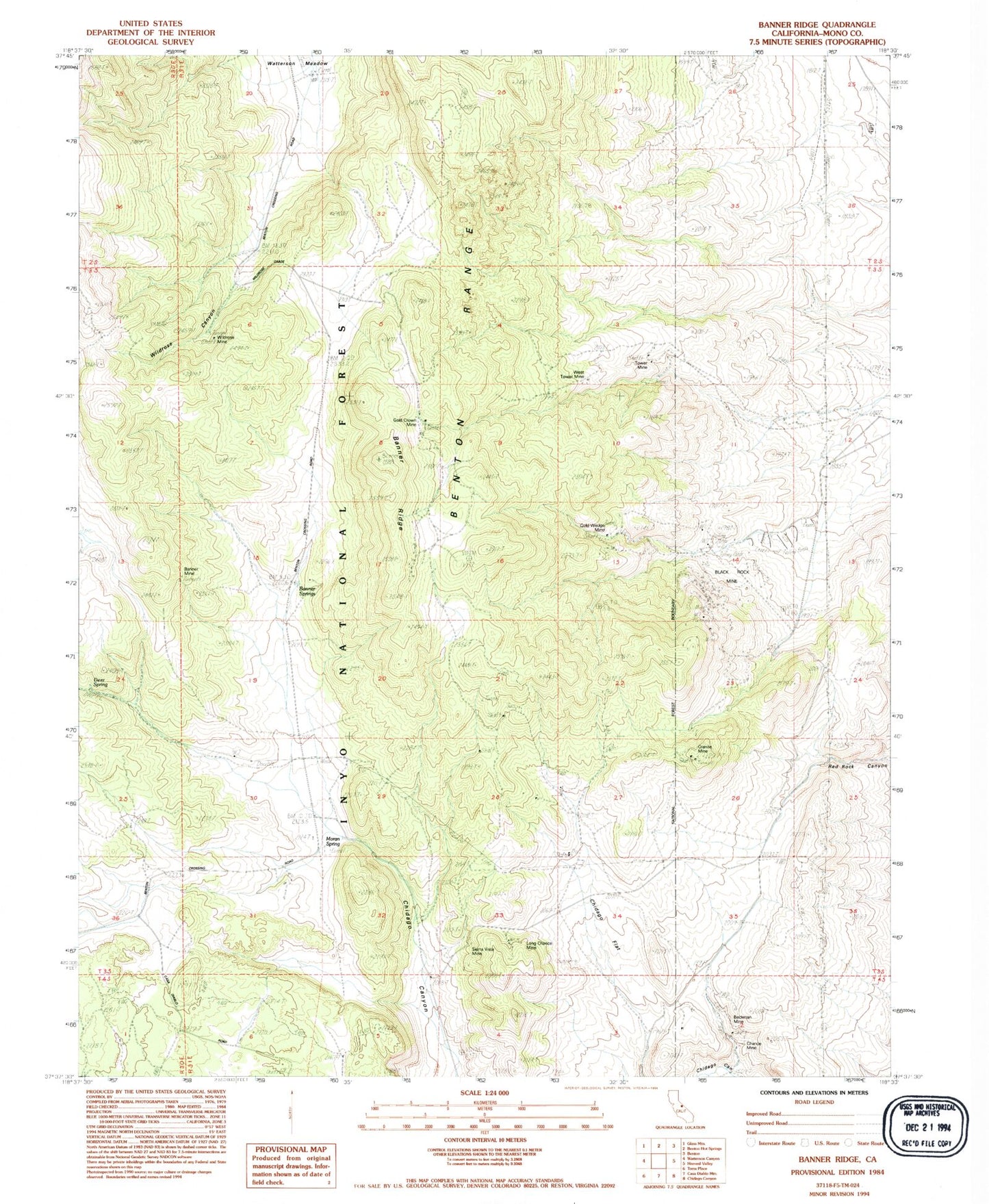
MyTopo
Classic USGS Banner Ridge California 7.5'x7.5' Topo Map
Couldn't load pickup availability
Historical USGS topographic quad map of Banner Ridge in the state of California. Map scale may vary for some years, but is generally around 1:24,000. Print size is approximately 24" x 27"
This quadrangle is in the following counties: Mono.
The map contains contour lines, roads, rivers, towns, and lakes. Printed on high-quality waterproof paper with UV fade-resistant inks, and shipped rolled.
Contains the following named places: Banner Mine, Banner Ridge, Banner Springs, Beckman Mine, Benton Range, Black Rock Mine, Chance Mine, Chidago Flat, Deer Spring, Gold Crown Mine, Gold Wedge Mine, Granite Mine, Kings Mill, Lone Star Mine, Long Chance Mine, Moran Spring, Sierra Vista Mine, Tower Mine, West Tower Mine, Wildrose Canyon, Wildrose Mine