MyTopo
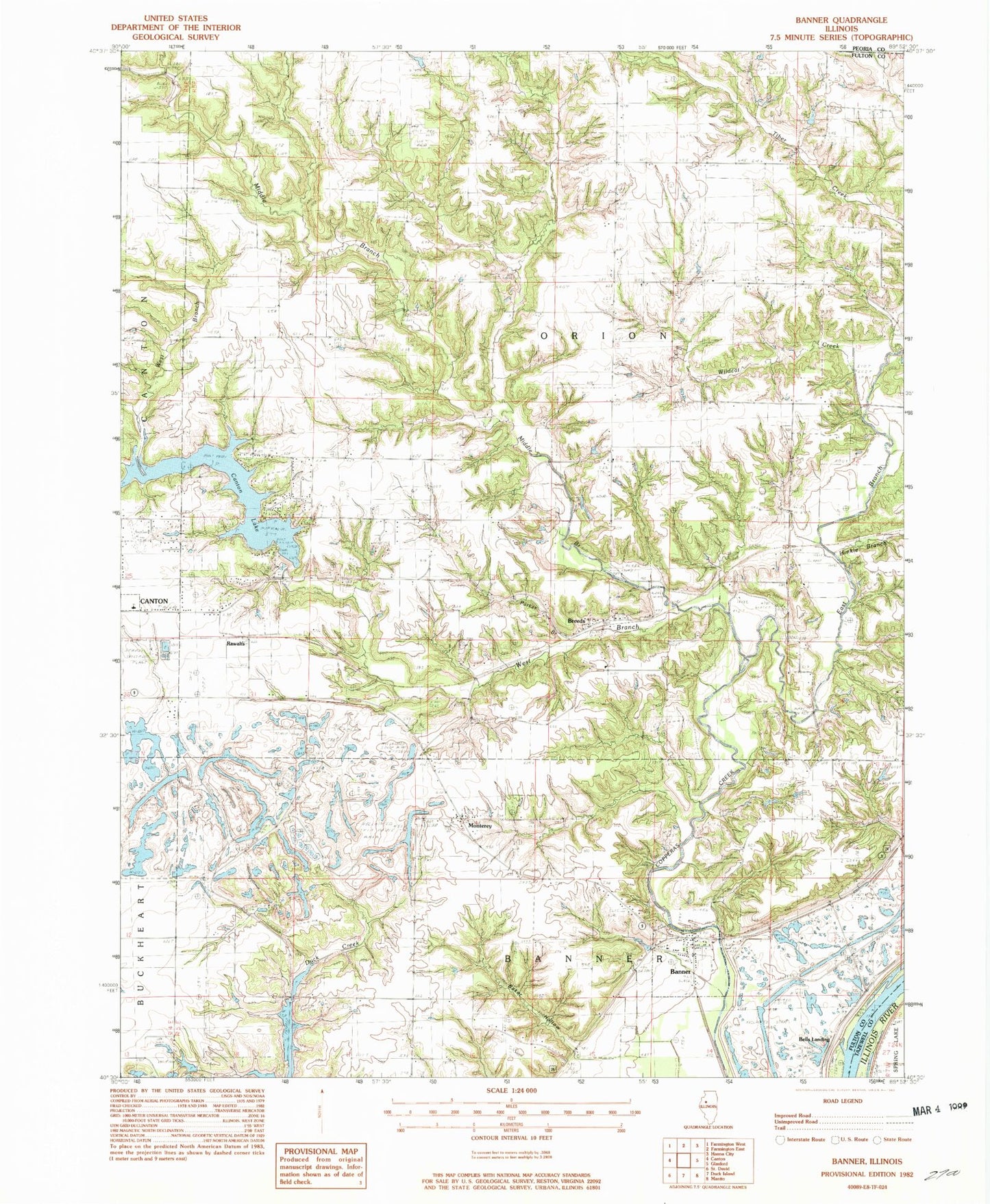
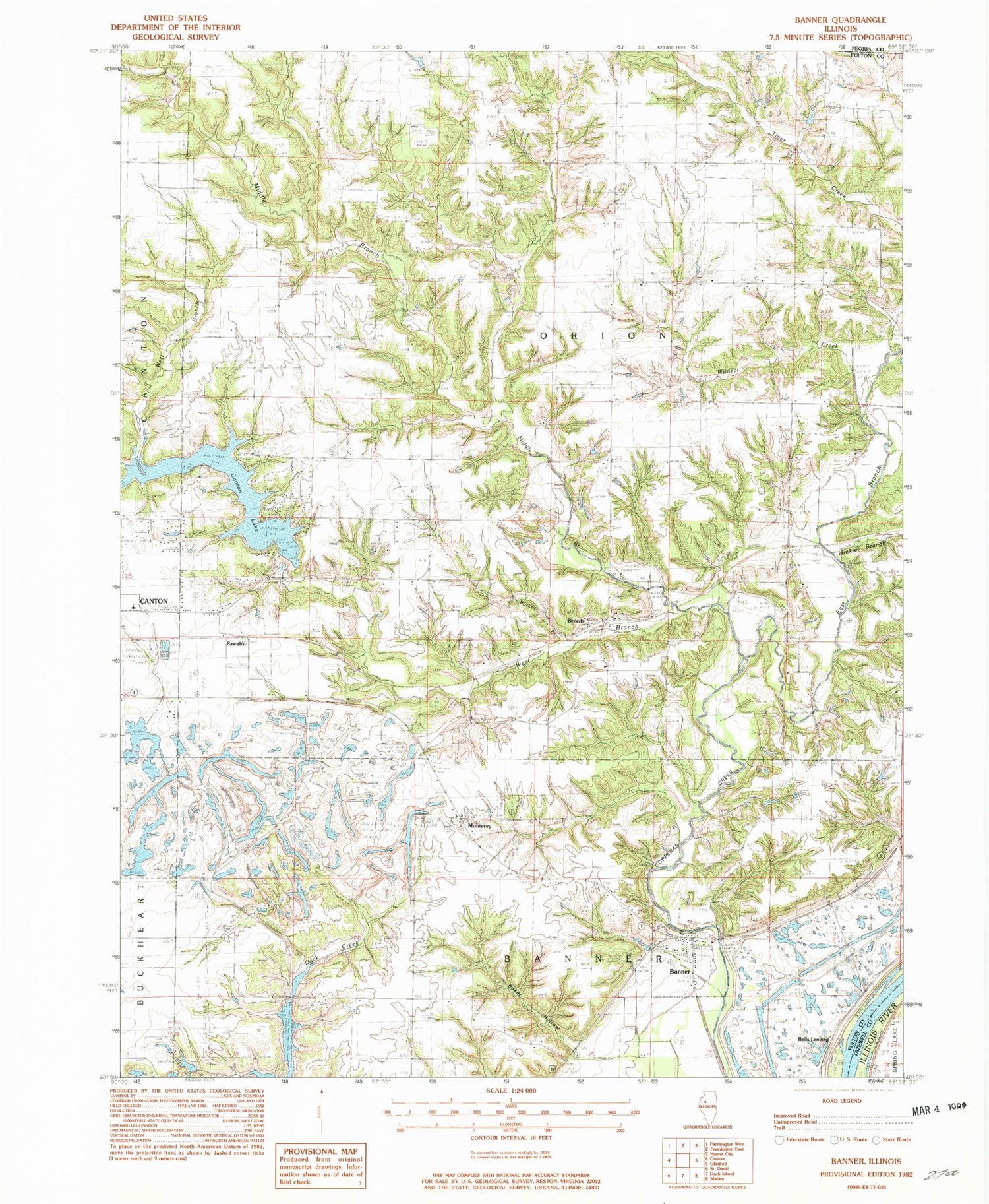
Classic USGS Banner Illinois 7.5'x7.5' Topo Map
Couldn't load pickup availability
Historical USGS topographic quad map of Banner in the state of Illinois. Map scale may vary for some years, but is generally around 1:24,000. Print size is approximately 24" x 27"
This quadrangle is in the following counties: Fulton, Peoria, Tazewell.
The map contains contour lines, roads, rivers, towns, and lakes. Printed on high-quality waterproof paper with UV fade-resistant inks, and shipped rolled.
Contains the following named places: Baker Hollow, Banner, Banner Cemetery, Banner School, Baxter Mine, Bells Landing, Bethel Cemetery, Bethel Chapel, Birds Corners School, Breeds, Breeds Cemetery, Breeds School, Burhans School, Bybee Cemetery, Canton City Lake, Canton City Lake Dam, Canton Lake, Douglas School, Duffield School, East Branch Copperas Creek, Enterprise School, First Church of the Nazarene, Ford School, Franklin School, G and L Mine, Green Valley School, Hinkle Branch, King Hill School, King Island, Kings Hill Cemetery, Little Brick School, Middle Branch Copperas Creek, Monterey, Monterey School, Orendorff Cemetery, Orion School, Parker Branch, Rawalts, Red School, Red Schoolhouse Cemetery, Sandler Spur, Tiber Creek, Township of Orion, Village of Banner, WBOD-FM (Canton), West Branch Copperas Creek, White Chapel, Wildcat Creek, Wolf School, Wolfe Cemetery