MyTopo
Classic USGS Banner Mississippi 7.5'x7.5' Topo Map
Couldn't load pickup availability
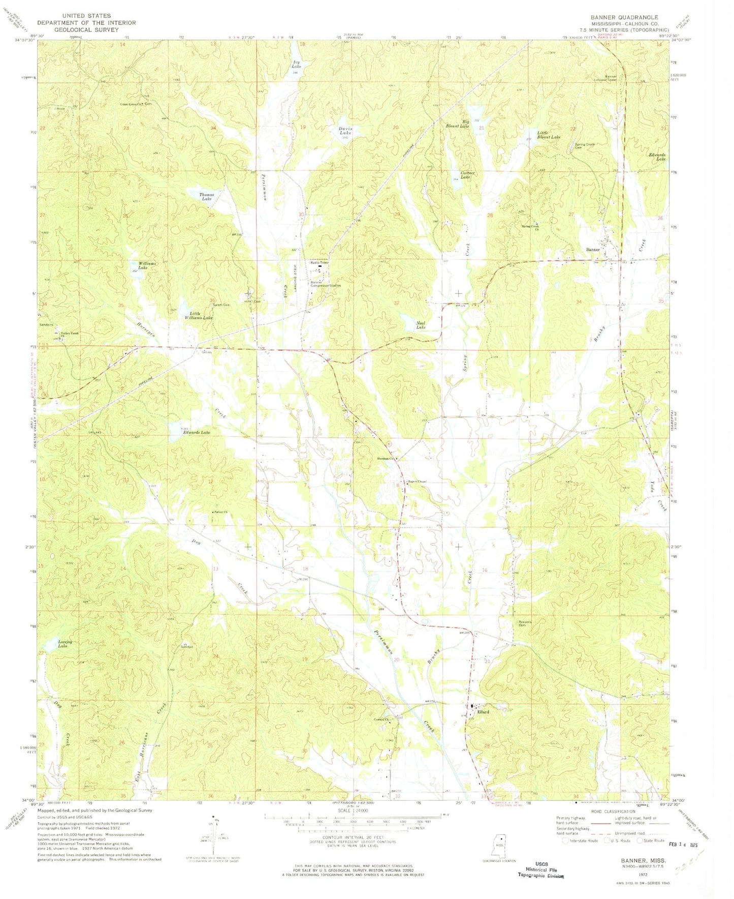
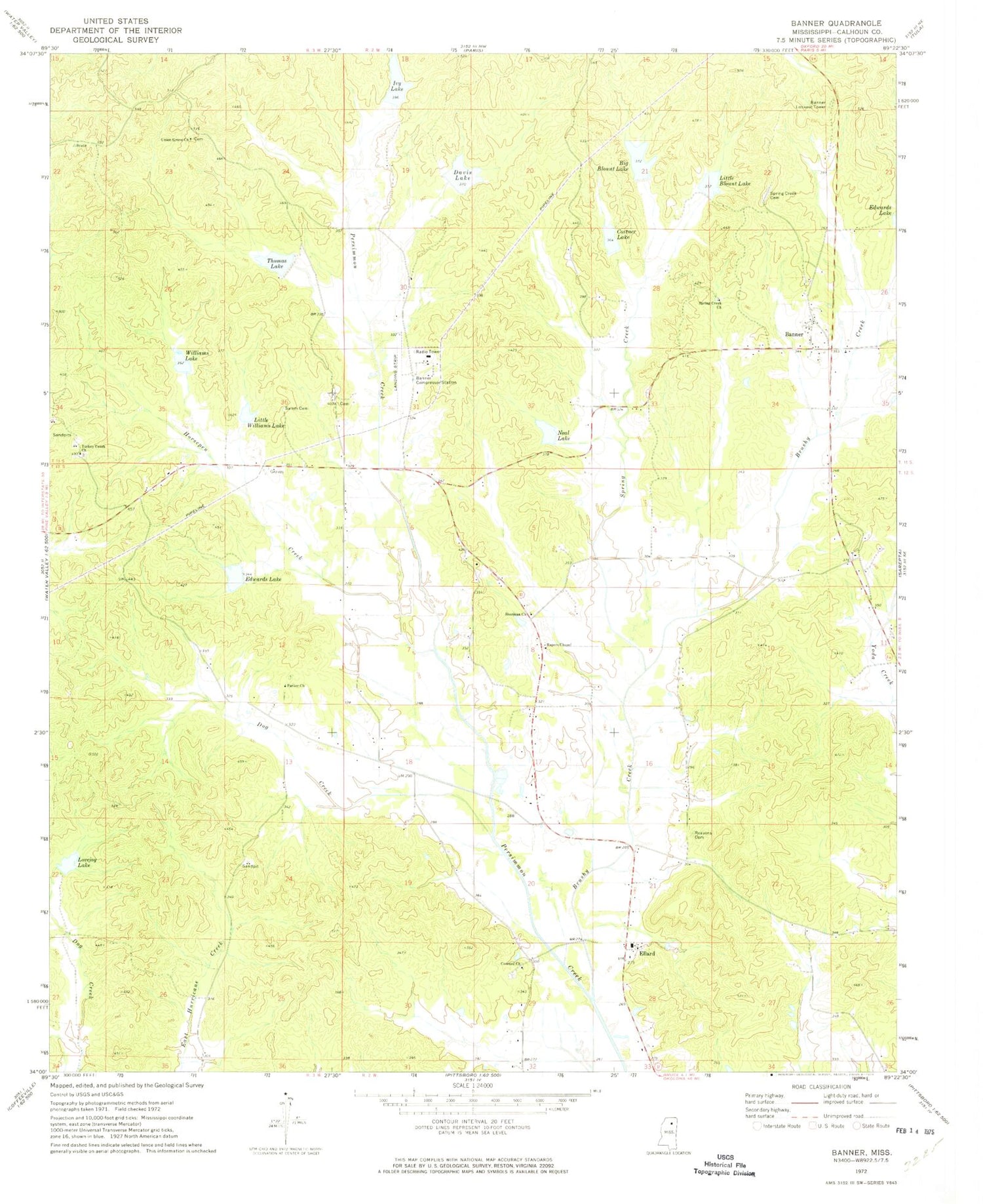
Historical USGS topographic quad map of Banner in the state of Mississippi. Map scale may vary for some years, but is generally around 1:24,000. Print size is approximately 24" x 27"
This quadrangle is in the following counties: Calhoun.
The map contains contour lines, roads, rivers, towns, and lakes. Printed on high-quality waterproof paper with UV fade-resistant inks, and shipped rolled.
Contains the following named places: Banner, Banner Baptist Church, Banner Compressor Station, Banner Lookout Tower, Banner Volunteer Fire Department, Big Blount Lake, Brushy Creek, Concord, Concord Cemetery, Concord Church, Costner Lake, Davis Lake, Dog Creek, Edwards Lake, Ellard, Horsepen Creek, Ivy Lake, Lamars Box, Little Blount Lake, Little Williams Lake, Lovejoy Lake, Money, Neal Lake, Persimmon Creek Structure Y-21-10 Dam, Persimmon Creek Structure Y-21-2 Dam, Persimmon Creek Structure Y-21-3 Dam, Persimmon Creek Structure Y-21-30 Dam, Persimmon Creek Structure Y-21-32 Dam, Persimmon Creek Structure Y-21-4 Dam, Persimmon Creek Structure Y-21-5 Dam, Persimmon Creek Structure Y-21-50 Dam, Persimmon Creek Structure Y-21-51 Dam, Persimmon Creek Structure Y-21-7 Dam, Persimmon Creek Structure Y-21-8 Dam, Rapers Chapel, Reasons Cemetery, Salem Church, Sherman Church, Spring Creek, Spring Creek Cemetery, Spring Creek Church, Supervisor District 3, Thomas Lake, Trusty, Turkey Creek Cemetery, Turkey Creek Church, Union Grove Cemetery, Union Grove Church, Williams Lake, ZIP Code: 38915