MyTopo
Classic USGS Banner Wyoming 7.5'x7.5' Topo Map
Couldn't load pickup availability
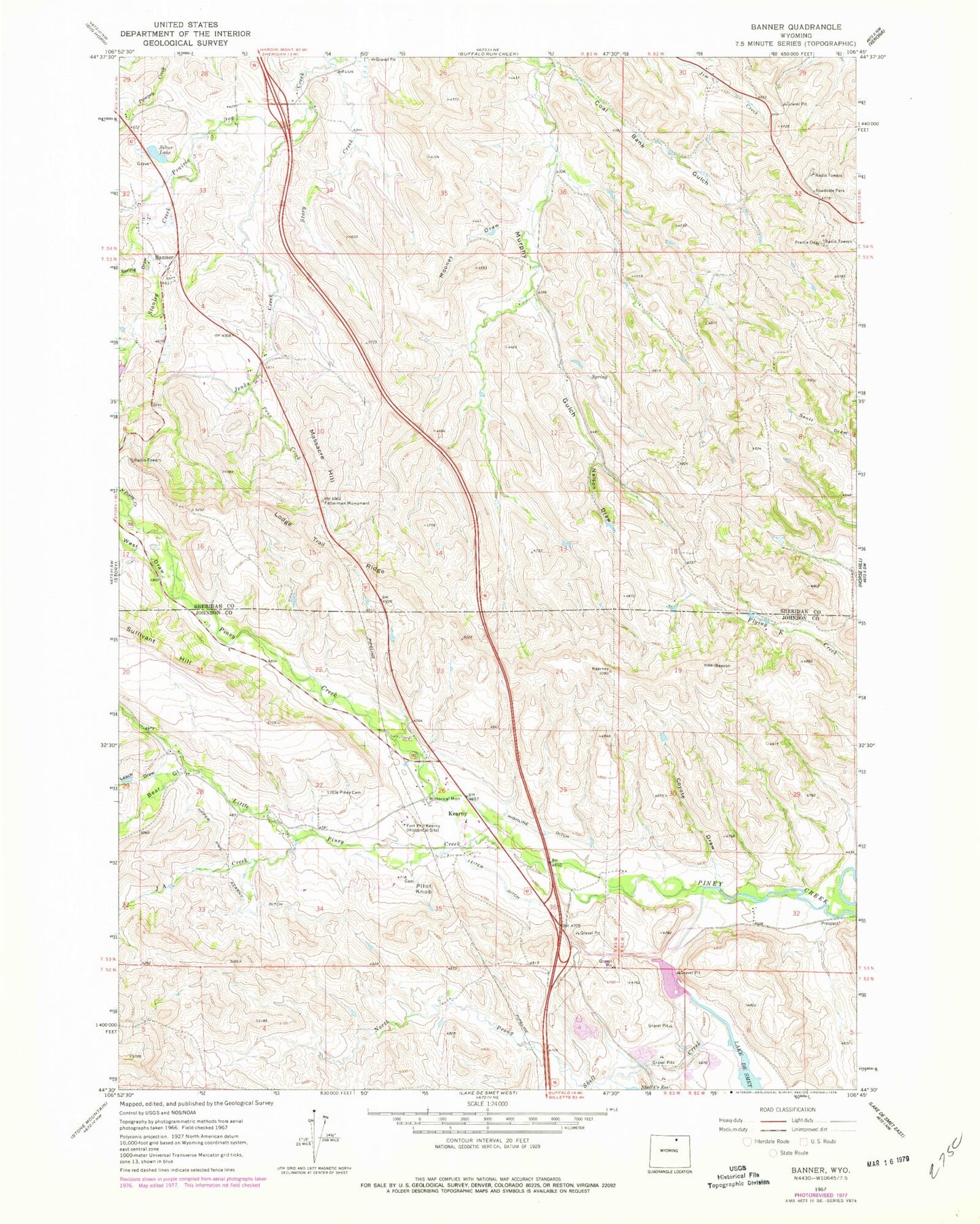
Historical USGS topographic quad map of Banner in the state of Wyoming. Typical map scale is 1:24,000, but may vary for certain years, if available. Print size: 24" x 27"
This quadrangle is in the following counties: Johnson, Sheridan.
The map contains contour lines, roads, rivers, towns, and lakes. Printed on high-quality waterproof paper with UV fade-resistant inks, and shipped rolled.
Contains the following named places: Coal Bank Gulch, Coyote Draw, Fetterman Monument, Fort Phil Kearny Historical Site (historical), Highline Ditch, Jenks Creek, Leiter Ditch, Quiet Rest Cemetery, Lodge Trail Ridge, Massacre Hill, Mooney Draw, Nelson Draw, North Prong Shell Creek, Peno Creek, Pilot Knob, Shell Creek, Silver Lake, Spring Draw, Story Creek, Upper Phil Kearny Ditch, Banner, Kearny, Bear Gulch, J A Creek, Leach Draw, Little Piney Creek, North Piney Creek, Orr Gulch, South Piney Creek, Stanley Creek, Sullivant Hill, West Draw, Spring Draw, Lake Desmet Dam, Lake Desmet, Reynolds Piney Creek Diversion Dam, Reynolds Piney Creek Diversion Dam, Hearney Pit Mine